MyTopo
Cold Spring Arizona US Topo Map
Couldn't load pickup availability
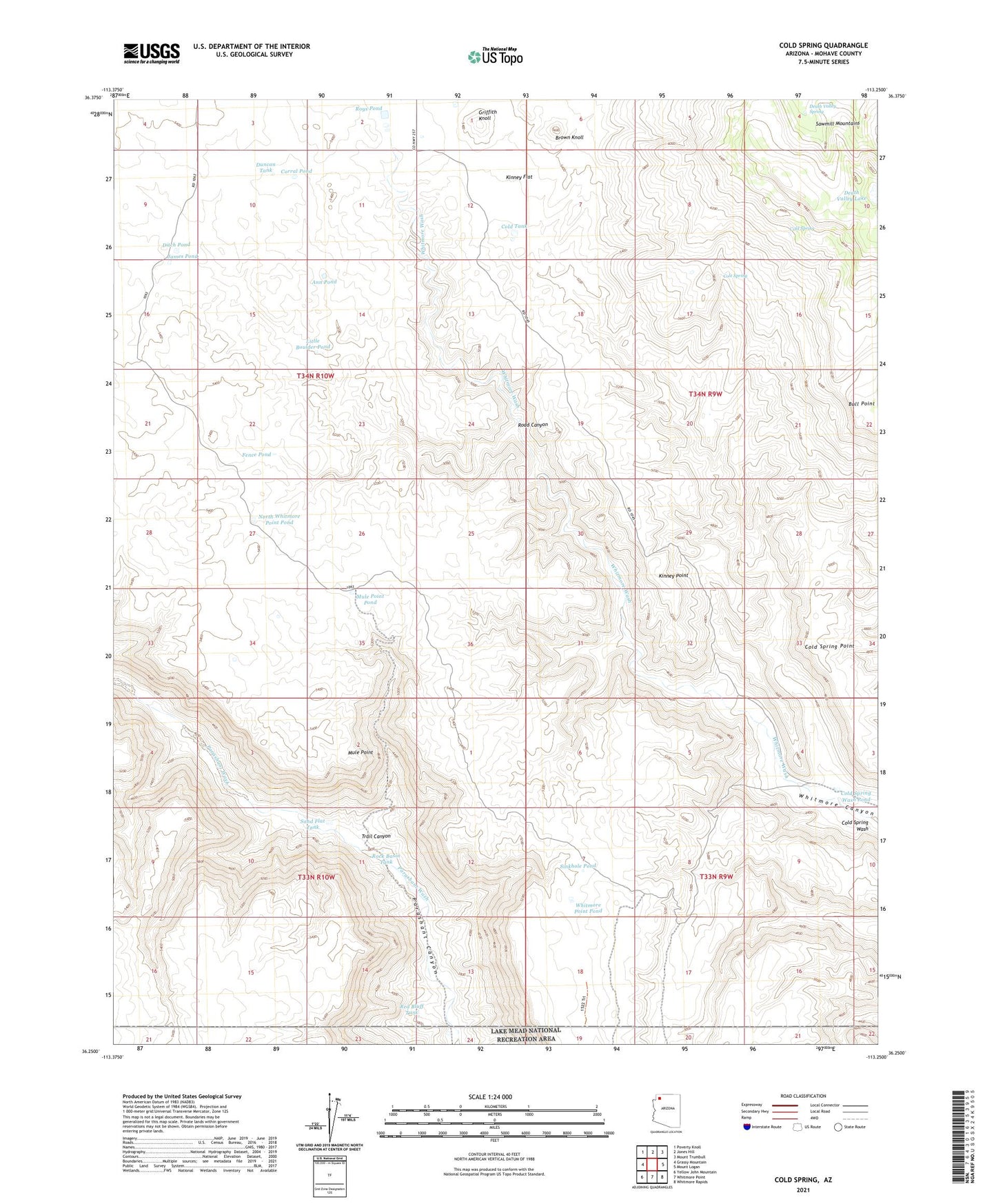
2021 topographic map quadrangle Cold Spring in the state of Arizona. Scale: 1:24000. Based on the newly updated USGS 7.5' US Topo map series, this map is in the following counties: Mohave. The map contains contour data, water features, and other items you are used to seeing on USGS maps, but also has updated roads and other features. This is the next generation of topographic maps. Printed on high-quality waterproof paper with UV fade-resistant inks.
Quads adjacent to this one:
West: Grassy Mountain
Northwest: Poverty Knoll
North: Jones Hill
Northeast: Mount Trumbull
East: Mount Logan
Southeast: Whitmore Rapids
South: Whitmore Point
Southwest: Yellow John Mountain
This map covers the same area as the classic USGS quad with code o36113c3.
Contains the following named places: Ann Pond, Brown Knoll, Cold Spring, Cold Spring Point, Cold Spring Wash, Cold Spring Wash Pond, Cold Tank, Cole Spring, Corral Pond, Death Valley Lake, Death Valley Spring, Ditch Pond, Duncan Tank, Fence Pond, Griffith Knoll, James Pond, Kinney Flat, Kinney Point, Little Boulder Pond, Mule Point, Mule Point Pond, North Whitmore Point Pond, Red Bluff Tank, Road Canyon, Rock Basin Tank, Roys Pond, Sand Flat Tank, Sinkhole Pond, Trail Canyon, Whitmore Point Pond