MyTopo
Poverty Knoll Arizona US Topo Map
Couldn't load pickup availability
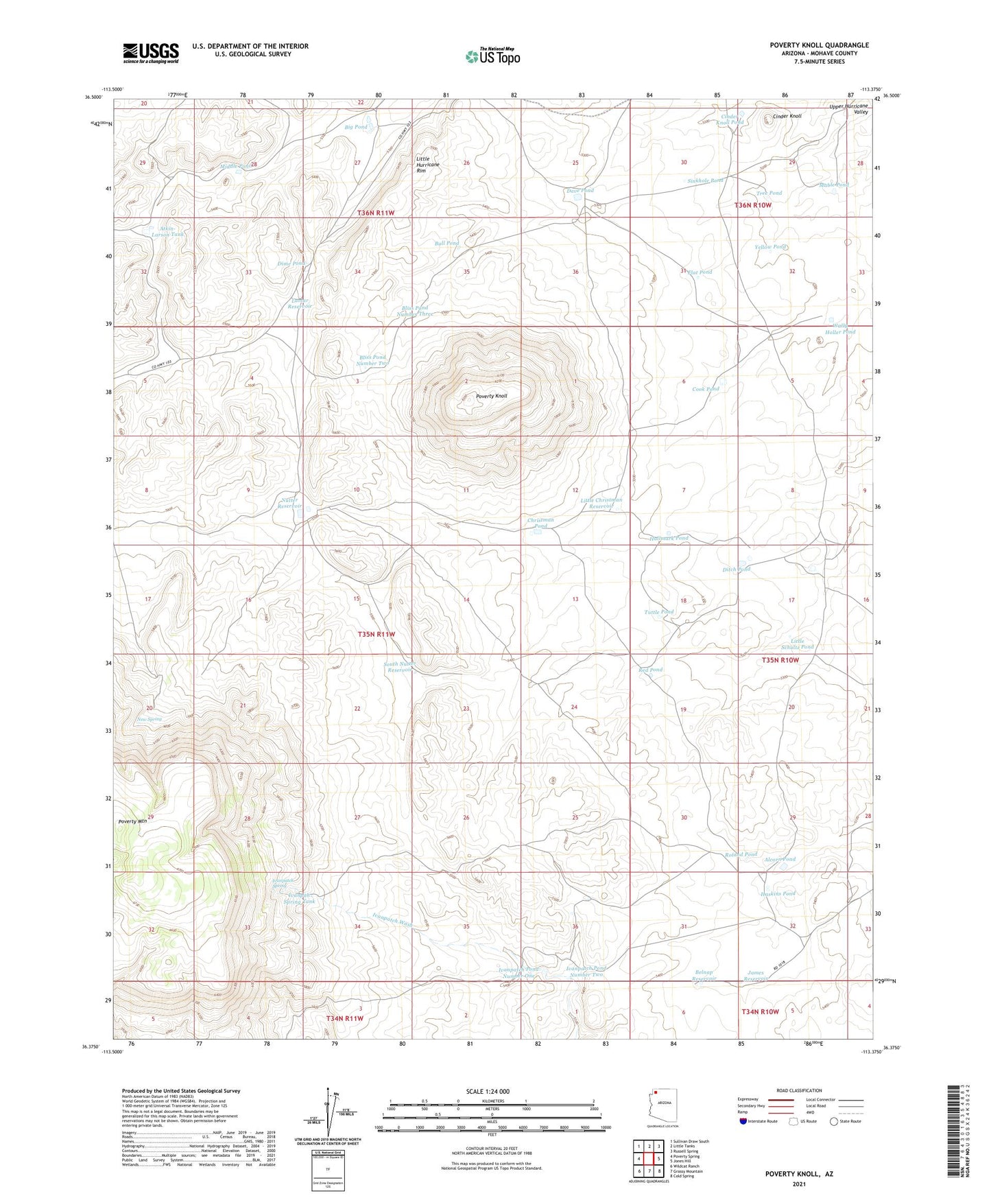
2021 topographic map quadrangle Poverty Knoll in the state of Arizona. Scale: 1:24000. Based on the newly updated USGS 7.5' US Topo map series, this map is in the following counties: Mohave. The map contains contour data, water features, and other items you are used to seeing on USGS maps, but also has updated roads and other features. This is the next generation of topographic maps. Printed on high-quality waterproof paper with UV fade-resistant inks.
Quads adjacent to this one:
West: Poverty Spring
Northwest: Sullivan Draw South
North: Little Tanks
Northeast: Russell Spring
East: Jones Hill
Southeast: Cold Spring
South: Grassy Mountain
Southwest: Wildcat Ranch
This map covers the same area as the classic USGS quad with code o36113d4.
Contains the following named places: Alcorn Pond, Atkin-Larson Tank, Belnap Reservoir, Big Pond, Bliss Pond Number Three, Bliss Pond Number Two, Bull Pond, Christman Detention Dam, Christman Pond, Cinder Knoll, Cinder Knoll Pond, Cook Pond, Dave Pond, Dime Pond, Ditch Pond, End Trough, Flat Pond, Hallmark Pond, Haskins Pond, Ivanpah Spring Tank, Ivanpatch Pond Number One, Ivanpatch Pond Number Two, Ivanpatch Spring, James Reservoir, Jones Pond, Lamar Reservoir, Little Christman Reservoir, Little Hurricane Rim, Little Schultz Pond, Mable Pond, Middle Pond, New Spring, Nutter Reservoir, Poverty Knoll, Poverty Mountain, Red Pond, Roland Pond, Sinkhole Pond, South Nutter Reservoir, Tree Pond, Tuttle Pond, Wally Holler Pond, Yellow Pond