MyTopo
Grassy Mountain Arizona US Topo Map
Couldn't load pickup availability
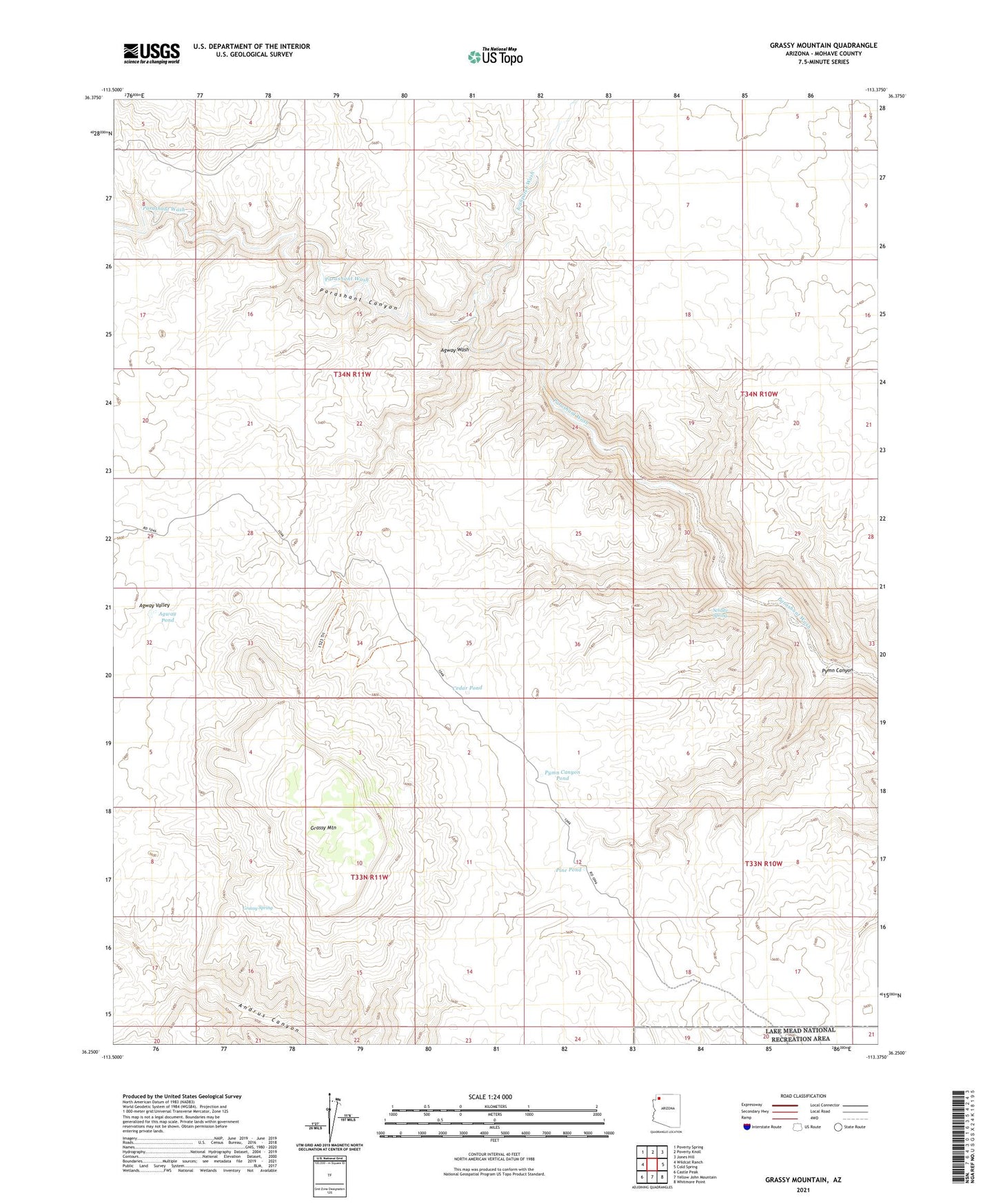
2021 topographic map quadrangle Grassy Mountain in the state of Arizona. Scale: 1:24000. Based on the newly updated USGS 7.5' US Topo map series, this map is in the following counties: Mohave. The map contains contour data, water features, and other items you are used to seeing on USGS maps, but also has updated roads and other features. This is the next generation of topographic maps. Printed on high-quality waterproof paper with UV fade-resistant inks.
Quads adjacent to this one:
West: Wildcat Ranch
Northwest: Poverty Spring
North: Poverty Knoll
Northeast: Jones Hill
East: Cold Spring
Southeast: Whitmore Point
South: Yellow John Mountain
Southwest: Castle Peak
This map covers the same area as the classic USGS quad with code o36113c4.
Contains the following named places: Agway Pond, Agway Valley, Agway Wash, Cedar Pocket Reservoir, Cedar Pond, Grassy Mountain, Grassy Spring, Ivanpatch Wash, Pine Pond, Pymn Canyon, Pymn Canyon Pond, Schultz Spring, ZIP Code: 86432