MyTopo
Jones Hill Arizona US Topo Map
Couldn't load pickup availability
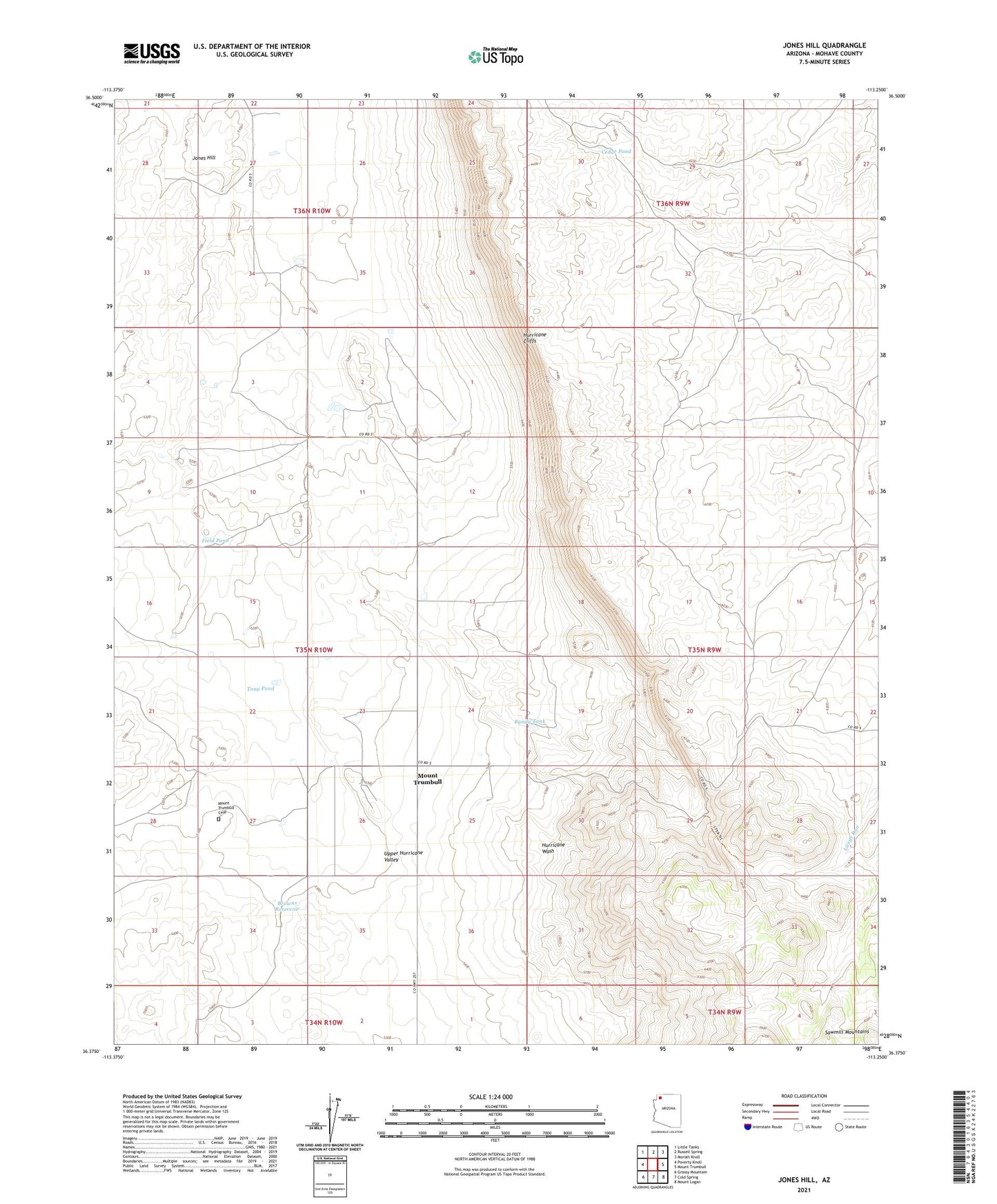
2021 topographic map quadrangle Jones Hill in the state of Arizona. Scale: 1:24000. Based on the newly updated USGS 7.5' US Topo map series, this map is in the following counties: Mohave. The map contains contour data, water features, and other items you are used to seeing on USGS maps, but also has updated roads and other features. This is the next generation of topographic maps. Printed on high-quality waterproof paper with UV fade-resistant inks.
Quads adjacent to this one:
West: Poverty Knoll
Northwest: Little Tanks
North: Russell Spring
Northeast: Moriah Knoll
East: Mount Trumbull
Southeast: Mount Logan
South: Cold Spring
Southwest: Grassy Mountain
This map covers the same area as the classic USGS quad with code o36113d3.
Contains the following named places: Browns Reservoir, Bundy Tank, Cedar Pond, Field Pond, Jones Hill, Mount Trumbull, Mount Trumbull Cemetery, Tony Pond, Zumwait Detention Dam