MyTopo
Doubtful Canyon Arizona US Topo Map
Couldn't load pickup availability
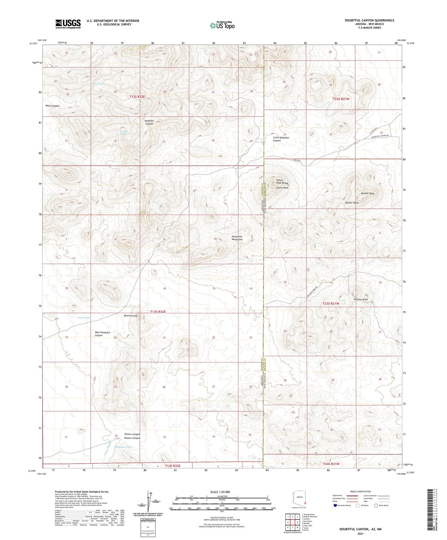
2021 topographic map quadrangle Doubtful Canyon in the states of Arizona, New Mexico. Scale: 1:24000. Based on the newly updated USGS 7.5' US Topo map series, this map is in the following counties: Cochise, Hidalgo. The map contains contour data, water features, and other items you are used to seeing on USGS maps, but also has updated roads and other features. This is the next generation of topographic maps. Printed on high-quality waterproof paper with UV fade-resistant inks.
Quads adjacent to this one:
West: San Simon
Northwest: Orange Butte
North: Engine Mountain
Northeast: Summit
East: Mondel
Southeast: Steins
South: Vanar
Southwest: Vanar NW
Contains the following named places: Black Face, Braidfoot Ranch, Buckhorn Prospect, Canteen Spring, Dean Tank, Doubtful Canyon, Elore Mine, Eloro Mine, Giddings Grave, Guess Ranch, Little Doubtful Canyon, Mayflower Prospect, McKenzie Tank, Merrimac Prospect, National Mine, Peloncillo Mountains Wilderness, Powers Canyon, Roostercomb, Rustler Peak, Steins Peak, Steins Peak Range, Steins Peak Station, Volcano Mine, Ward Canyon, Ward Spring, West Doubtful Canyon, Wheeler Place