MyTopo
Vanar Arizona US Topo Map
Couldn't load pickup availability
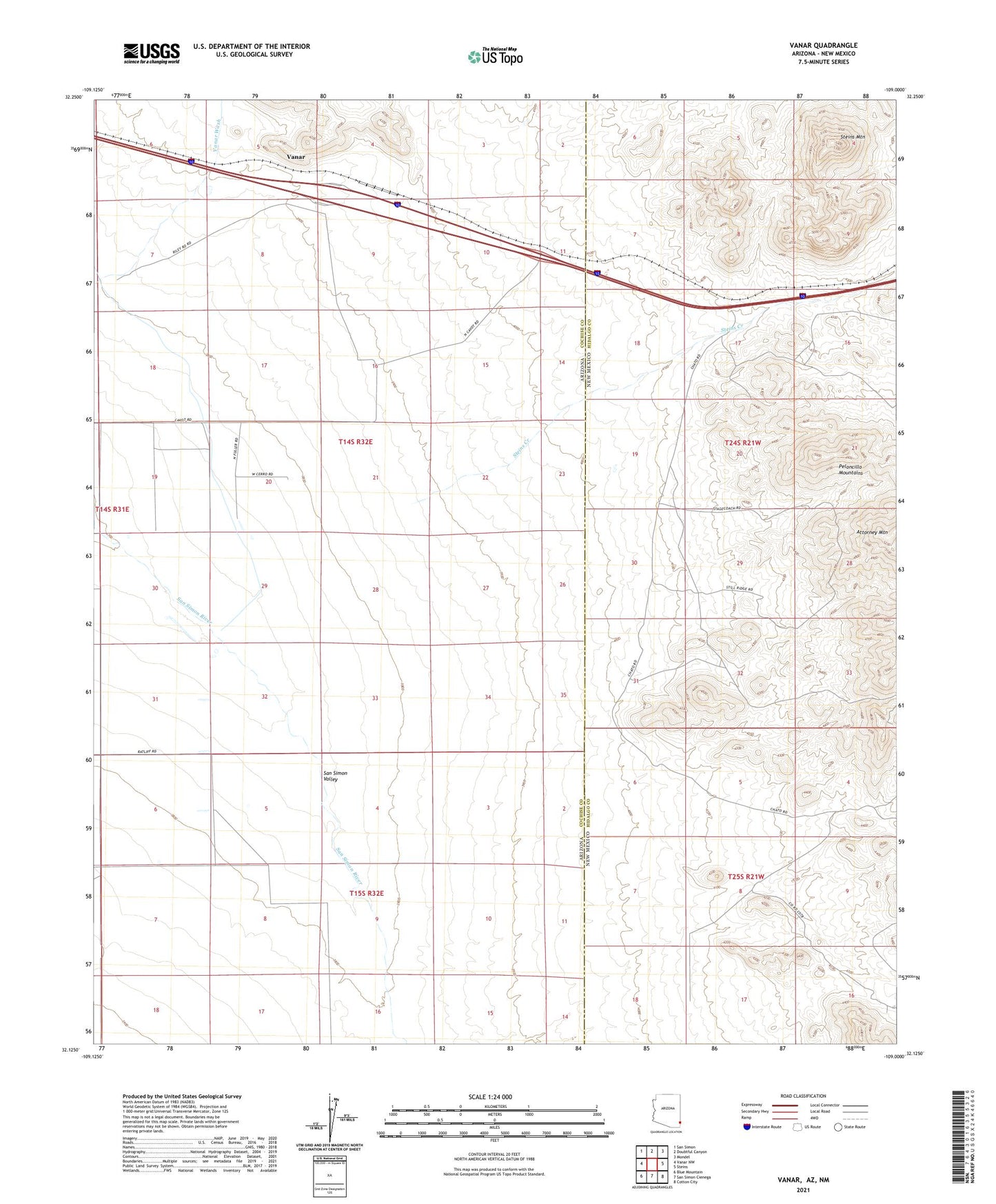
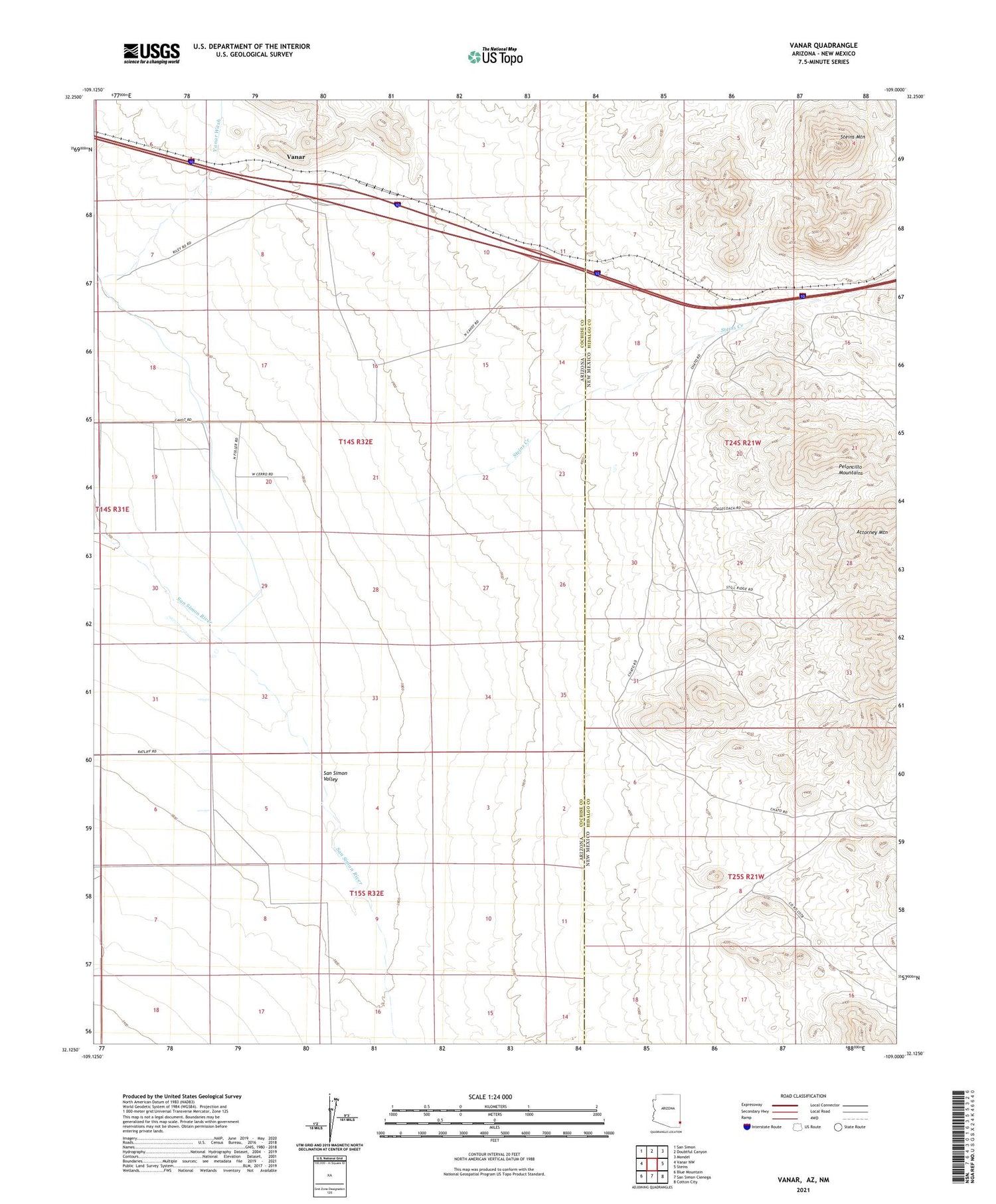
2021 topographic map quadrangle Vanar in the states of Arizona, New Mexico. Scale: 1:24000. Based on the newly updated USGS 7.5' US Topo map series, this map is in the following counties: Cochise, Hidalgo. The map contains contour data, water features, and other items you are used to seeing on USGS maps, but also has updated roads and other features. This is the next generation of topographic maps. Printed on high-quality waterproof paper with UV fade-resistant inks.
Quads adjacent to this one:
West: Vanar NW
Northwest: San Simon
North: Doubtful Canyon
Northeast: Mondel
East: Steins
Southeast: Cotton City
South: San Simon Cienega
Southwest: Blue Mountain
Contains the following named places: Attorney Mountain, Barnes Ranch, Dewey Prospect, Hattie Lee Mine, Horseshoe Prospect, Ironclad Prospect, Little Lucile Mine, Mineral Mountain Mine, Peloncillo Mountains, San Simon River, Steins Creek, Steins Mountain, Sweet Mine, Vanar, Vanar Railroad Station, Wood Canyon