MyTopo
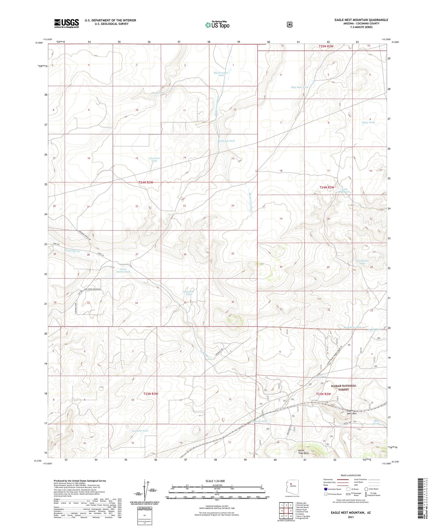
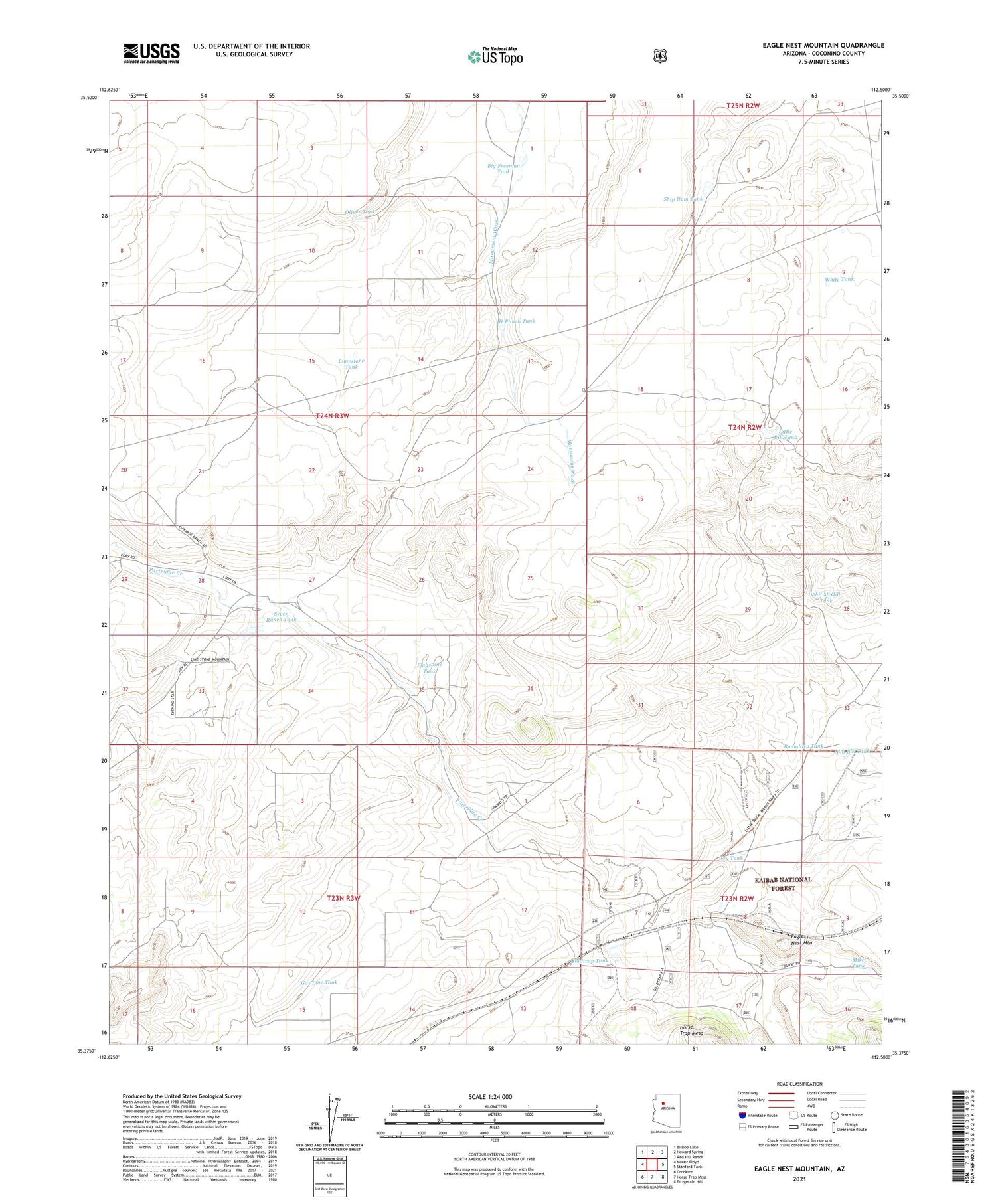
Eagle Nest Mountain Arizona US Topo Map
Couldn't load pickup availability
Also explore the Eagle Nest Mountain Forest Service Topo of this same quad for updated USFS data
2021 topographic map quadrangle Eagle Nest Mountain in the state of Arizona. Scale: 1:24000. Based on the newly updated USGS 7.5' US Topo map series, this map is in the following counties: Coconino. The map contains contour data, water features, and other items you are used to seeing on USGS maps, but also has updated roads and other features. This is the next generation of topographic maps. Printed on high-quality waterproof paper with UV fade-resistant inks.
Quads adjacent to this one:
West: Mount Floyd
Northwest: Bishop Lake
North: Howard Spring
Northeast: Red Hill Ranch
East: Stanford Tank
Southeast: Fitzgerald Hill
South: Horse Trap Mesa
Southwest: Crookton
This map covers the same area as the classic USGS quad with code o35112d5.
Contains the following named places: Big Bill Tank, Big Freeman Tank, Boundary Tank, Chunin Tank, Eagle Nest Mountain, Eagle Nest Railroad Station, Flagstone Tank, Gas Line Tank, Goldtrap Ranch, Goldtrap Tank, H Ranch Tank, Horse Tank, Joy Tank, Limestone Tank, Little Bill Tank, Mike Tank, Oliver Tank, Phil McGill Tank, Railroad Tank, Russell Quarry, Russell Tank, Seven Ranch Tank, Ship Dam Tank, Strawberry Tank, White Tank