
MyTopo
Fortified Peak Arizona US Topo Map
Couldn't load pickup availability
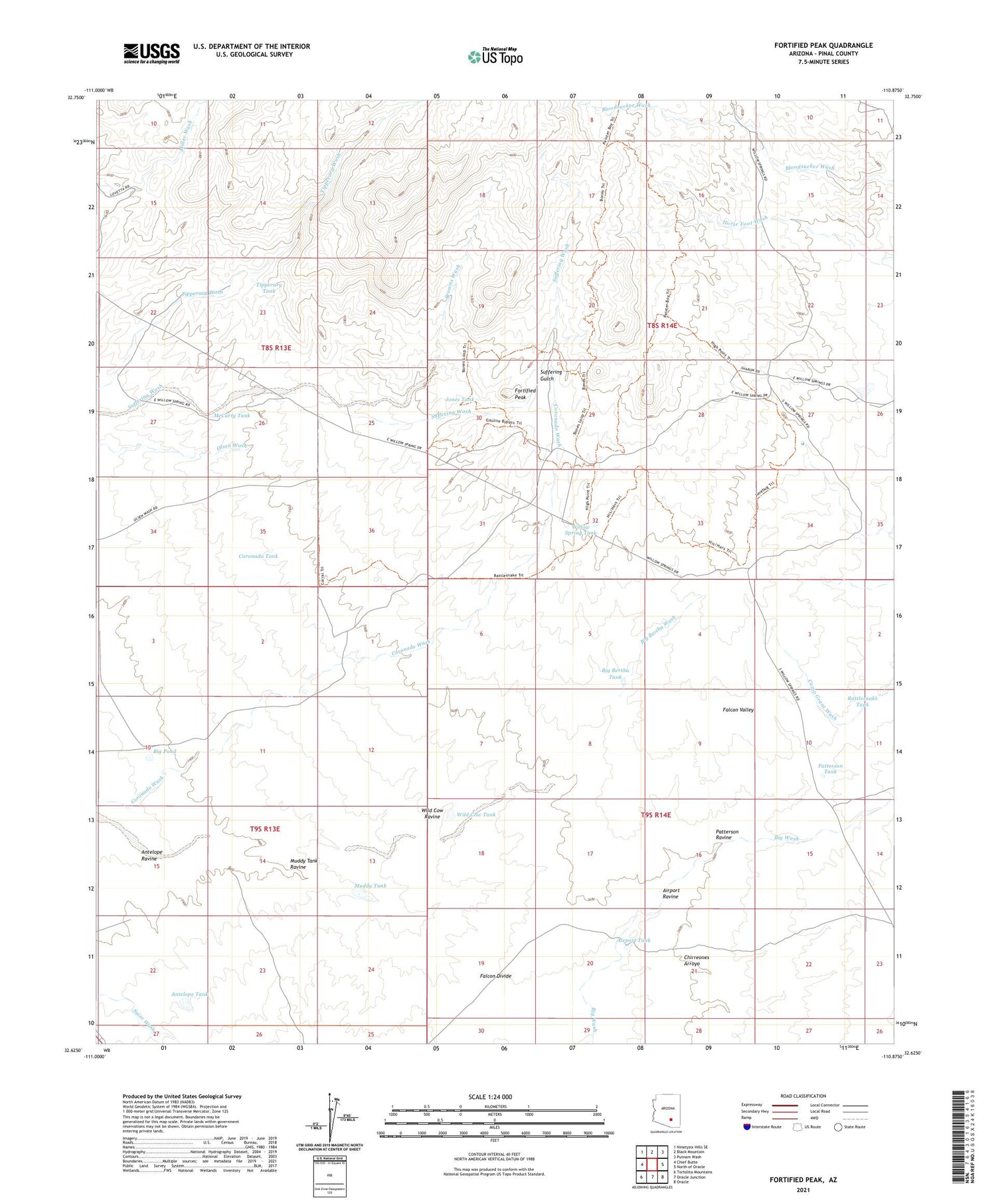
2021 topographic map quadrangle Fortified Peak in the state of Arizona. Scale: 1:24000. Based on the newly updated USGS 7.5' US Topo map series, this map is in the following counties: Pinal. The map contains contour data, water features, and other items you are used to seeing on USGS maps, but also has updated roads and other features. This is the next generation of topographic maps. Printed on high-quality waterproof paper with UV fade-resistant inks.
Quads adjacent to this one:
West: Chief Butte
Northwest: Ninetysix Hills SE
North: Black Mountain
Northeast: Putnam Wash
East: North of Oracle
Southeast: Oracle
South: Oracle Junction
Southwest: Tortolita Mountains
This map covers the same area as the classic USGS quad with code o32110f8.
Contains the following named places: Airport Ravine, Airport Tank, Antelope Ravine, Antelope Tank, Ardmore Mine, Big Bertha Tank, Big Bertha Wash, Big Pond, Browns Wash, Browns Well, Chirreones Arroyo, Coronado Tank, Coronado Well, Fortified Peak, Horse Foot Ranch, Hot Boy Mine, James Well, Jones Tank, Jones Well, Last Chance Tank, McCarty Tank, Muddy Tank, Muddy Tank Ravine, Patterson Ravine, Patterson Tank, Rattlesnake Tank, Rock House, Suffering Gulch, Sunnyside Ranch, The Big House, Tipperary Tank, Tipperary Well, Wild Cow Ravine, Wild Cow Tank, Willow Spring Tank


