
MyTopo
Chief Butte Arizona US Topo Map
Couldn't load pickup availability
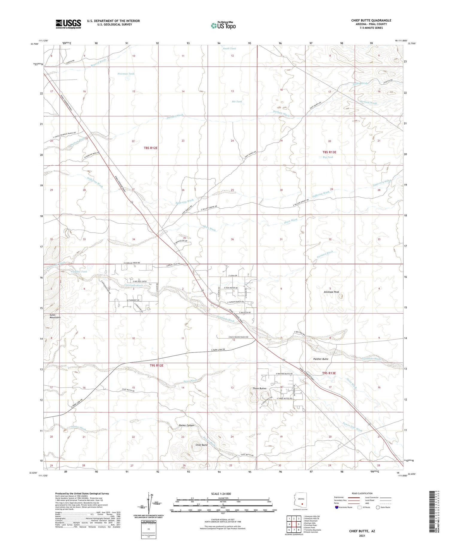
2021 topographic map quadrangle Chief Butte in the state of Arizona. Scale: 1:24000. Based on the newly updated USGS 7.5' US Topo map series, this map is in the following counties: Pinal. The map contains contour data, water features, and other items you are used to seeing on USGS maps, but also has updated roads and other features. This is the next generation of topographic maps. Printed on high-quality waterproof paper with UV fade-resistant inks.
Quads adjacent to this one:
West: Durham Hills
Northwest: Ninetysix Hills SW
North: Ninetysix Hills SE
Northeast: Black Mountain
East: Fortified Peak
Southeast: Oracle Junction
South: Tortolita Mountains
Southwest: Desert Peak
This map covers the same area as the classic USGS quad with code o32111f1.
Contains the following named places: Antelope Peak, Big Mine, Big Tank, Cadillac Tank, Chief Butte, Forman Ranch, Forman Wash, Freeman Tank, Hit Tank, Lopez Wells, Miller Wash, Mine Well, North Well, Olsen Wash, Panther Butte, Parker Canyon, Power Line Wash, Sampson Well, Slash Well, South Tank, Suizo Mountains, Sutton Well, Three Buttes, Tipperary Wash


