
MyTopo
Oracle Junction Arizona US Topo Map
Couldn't load pickup availability
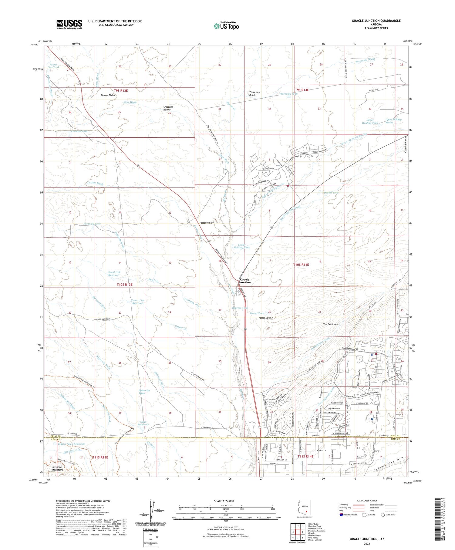
2021 topographic map quadrangle Oracle Junction in the state of Arizona. Scale: 1:24000. Based on the newly updated USGS 7.5' US Topo map series, this map is in the following counties: Pinal, Pima. The map contains contour data, water features, and other items you are used to seeing on USGS maps, but also has updated roads and other features. This is the next generation of topographic maps. Printed on high-quality waterproof paper with UV fade-resistant inks.
Quads adjacent to this one:
West: Tortolita Mountains
Northwest: Chief Butte
North: Fortified Peak
Northeast: North of Oracle
East: Oracle
Southeast: Mount Lemmon
South: Oro Valley
Southwest: Ruelas Canyon
This map covers the same area as the classic USGS quad with code o32110e8.
Contains the following named places: Black Tank Well, Bowl Creek, Carpas Wash, Catalina, Catalina Ravine, Catalina Well, Chalk Reservoir, Chirreon Wash, Copper Creek, Crescent Ravine, Crescent Tank, Cruz Wash, Deep Well, Double Tank, Falcon Divide, Falcon Valley, Falcon Valley Ranch, Faraway Tank, Faraway Wash, Fox Ravine, Golder Ranch Fire District Station 373, Golder Ranch Fire District Station 378, Indian Town Reservoir, Indian Well Wash, Lower Holding Tank, Lower Sahuarita Dam, Martin Ranch Airstrip, Mountain View Country Club, Nelson Ranch, Oracle Junction, Oracle Substation, Page-Trowbridge Experimental Ranch, Pinal County Parkway Rest Area, Pinal County Sheriff's Office Saddlebrooke Region B, Power Line Reservoir, Power Line Tank, Rail N Ranch, Rainbows End Wash, Represo Tank, Sierra Tucson Residential Treatment Hospital, Small Hill Reservoir, Tascal Ravine, Tascal Tank, The Cordones, Threeway Gulch, Threeway Tank, Threeway Wash, Twentynine Wash, Upper Holding Ravine, Upper Holding Tank, Upper Sahuarita Dam, Walnut Well, Well Twentynine, Well Twentyseven, ZIP Code: 85739


