MyTopo
Havasu Falls Arizona US Topo Map
Couldn't load pickup availability
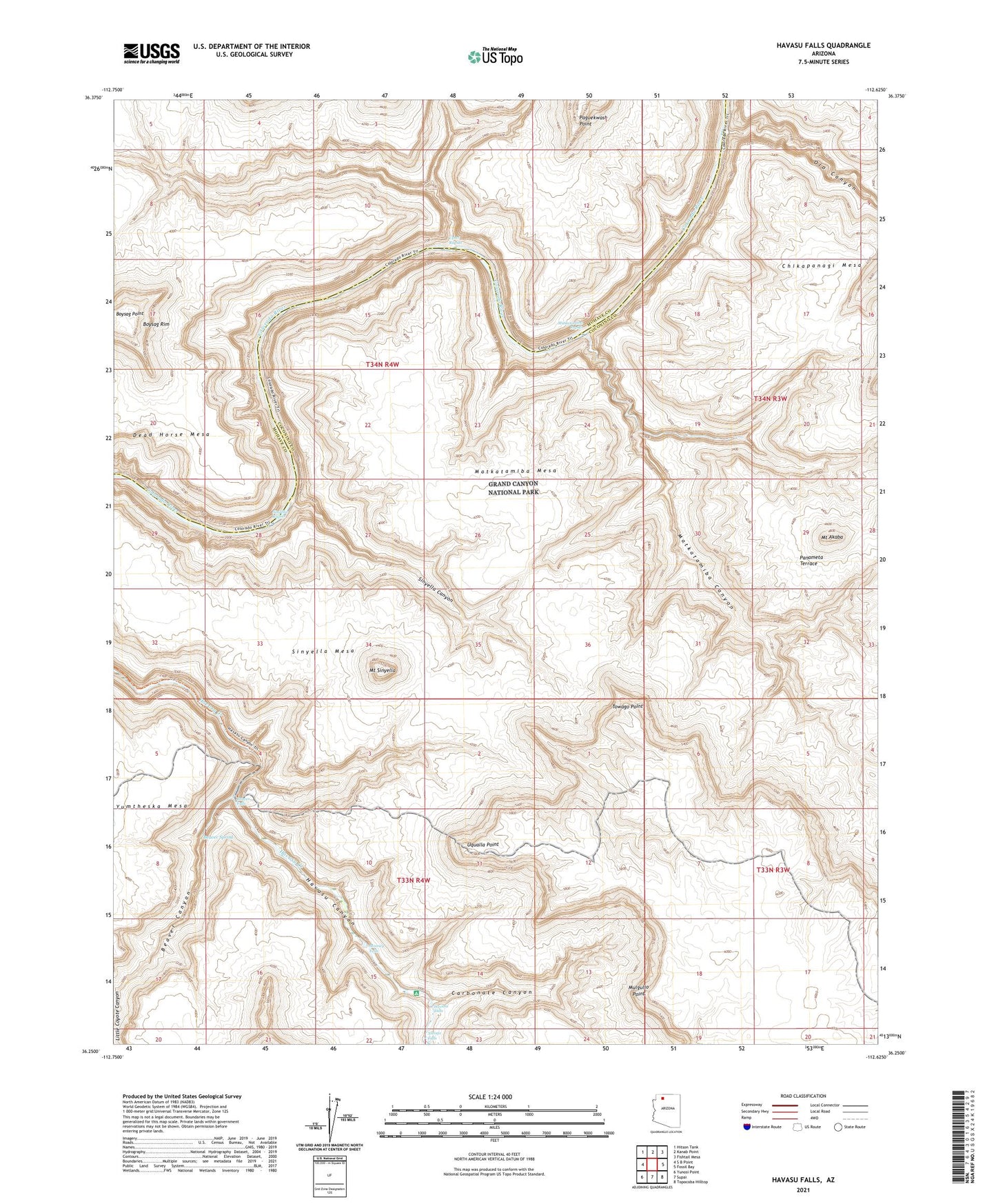
2021 topographic map quadrangle Havasu Falls in the state of Arizona. Scale: 1:24000. Based on the newly updated USGS 7.5' US Topo map series, this map is in the following counties: Coconino, Mohave. The map contains contour data, water features, and other items you are used to seeing on USGS maps, but also has updated roads and other features. This is the next generation of topographic maps. Printed on high-quality waterproof paper with UV fade-resistant inks.
Quads adjacent to this one:
West: S B Point
Northwest: Hitson Tank
North: Kanab Point
Northeast: Fishtail Mesa
East: Fossil Bay
Southeast: Topocoba Hilltop
South: Supai
Southwest: Yunosi Point
This map covers the same area as the classic USGS quad with code o36112c6.
Contains the following named places: Beaver Canyon, Beaver Falls, Beaver Spring, Boysag Point, Boysag Rim, Carbonate Canyon, Chikapanagi Mesa, Dead Horse Mesa, Havasu Falls, Matkatamiba Canyon, Matkatamiba Mesa, Matkatamiba Rapids, Mooney Falls, Mount Akaba, Mount Sinyella, Mulgullo Point, Navajo Falls, Olo Canyon, Panameta Terrace, Sinyella Canyon, Sinyella Mesa, Sinyella Rapids, Towago Point, Upset Rapids, Uqualla Point