MyTopo
Fossil Bay Arizona US Topo Map
Couldn't load pickup availability
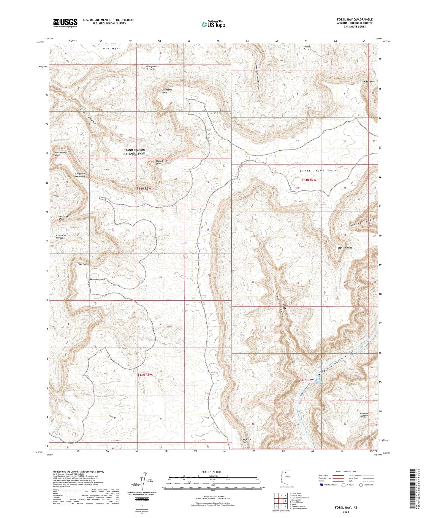
2021 topographic map quadrangle Fossil Bay in the state of Arizona. Scale: 1:24000. Based on the newly updated USGS 7.5' US Topo map series, this map is in the following counties: Coconino. The map contains contour data, water features, and other items you are used to seeing on USGS maps, but also has updated roads and other features. This is the next generation of topographic maps. Printed on high-quality waterproof paper with UV fade-resistant inks.
Quads adjacent to this one:
West: Havasu Falls
Northwest: Kanab Point
North: Fishtail Mesa
Northeast: Tapeats Amphitheater
East: Powell Plateau
Southeast: Explorers Monument
South: Topocoba Hilltop
Southwest: Supai
This map covers the same area as the classic USGS quad with code o36112c5.
Contains the following named places: Bear Headland, Chikapanagi Point, Enfilade Point, Fossil Bay, Fossil Canyon, Fossil Rapids, Gatagama Point, Gatagama Terrace, Grand Canyon National Game Preserve, Hamidreek Point, Kangaroo Headland, Panameta Point, Paya Point, Stanton Point, Tahuta Point