MyTopo
Topocoba Hilltop Arizona US Topo Map
Couldn't load pickup availability
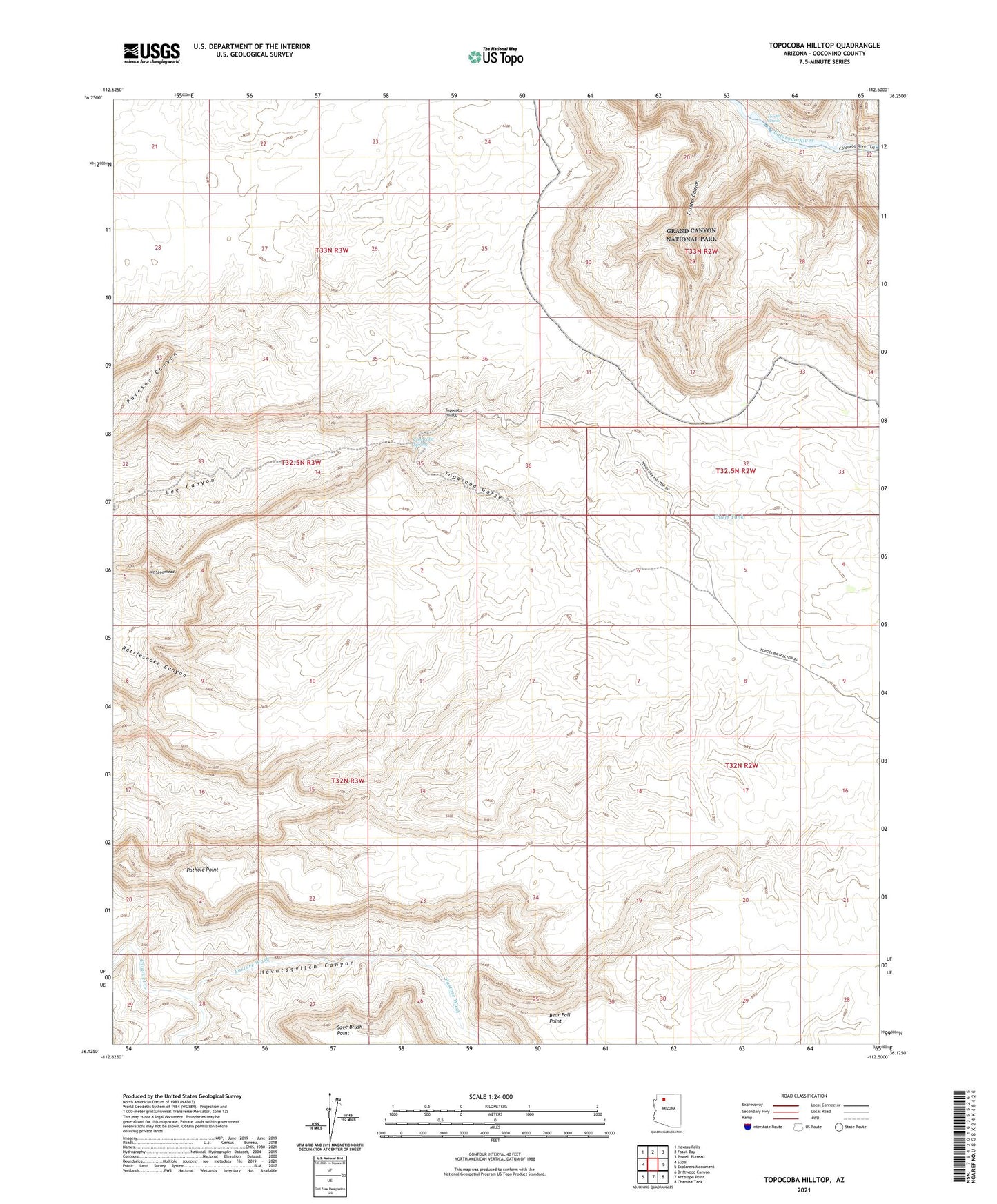
2021 topographic map quadrangle Topocoba Hilltop in the state of Arizona. Scale: 1:24000. Based on the newly updated USGS 7.5' US Topo map series, this map is in the following counties: Coconino. The map contains contour data, water features, and other items you are used to seeing on USGS maps, but also has updated roads and other features. This is the next generation of topographic maps. Printed on high-quality waterproof paper with UV fade-resistant inks.
Quads adjacent to this one:
West: Supai
Northwest: Havasu Falls
North: Fossil Bay
Northeast: Powell Plateau
East: Explorers Monument
Southeast: Chamisa Tank
South: Antelope Point
Southwest: Driftwood Canyon
This map covers the same area as the classic USGS quad with code o36112b5.
Contains the following named places: Bear Fall Point, Chiefs Tank, Forster Canyon, Forster Rapids, Havasupai Division, Havasupai Reservation, Havatagvitch Canyon, Hundred and Twentytwo Mile Creek, Mount Spoonhead, Pasture Wash, Pothole Point, Sage Brush Point, Topacoba Gorge, Topocoba Hilltop, Topocoba Spring, Topocoba Trail