MyTopo
Supai Arizona US Topo Map
Couldn't load pickup availability
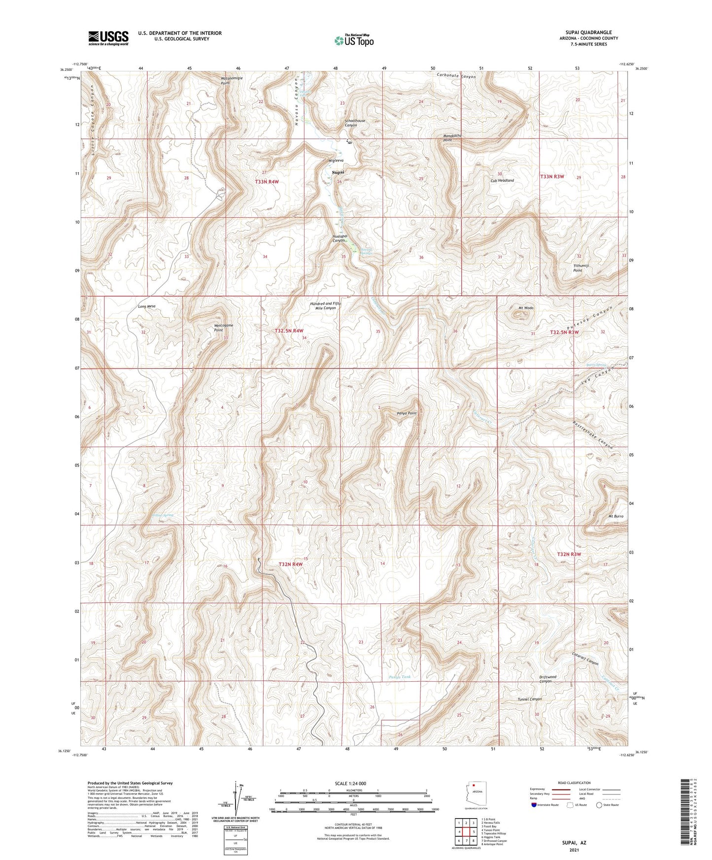
2021 topographic map quadrangle Supai in the state of Arizona. Scale: 1:24000. Based on the newly updated USGS 7.5' US Topo map series, this map is in the following counties: Coconino. The map contains contour data, water features, and other items you are used to seeing on USGS maps, but also has updated roads and other features. This is the next generation of topographic maps. Printed on high-quality waterproof paper with UV fade-resistant inks.
Quads adjacent to this one:
West: Yunosi Point
Northwest: S B Point
North: Havasu Falls
Northeast: Fossil Bay
East: Topocoba Hilltop
Southeast: Antelope Point
South: Driftwood Canyon
Southwest: Higgins Tank
This map covers the same area as the classic USGS quad with code o36112b6.
Contains the following named places: Burro Spring, Cataract Canyon, Cataract Creek, Cub Headland, Driftwood Canyon, Fiftyfoot Falls, Havasu Springs, Havasupai Elementary School, Havasupai Trail Thirty, Hualapai Canyon, Hualapai Hilltop, Hundred and Fifty Mile Canyon, Lee Canyon, Long Mesa, Manakacha Point, Mount Burro, Mount Wodo, Panya Point, Panya Tank, Putesoy Canyon, Rattlesnake Canyon, Schoolhouse Canyon, Supai, Supai Census Designated Place, Supai Post Office, Tithumiji Point, Tunnel Canyon, Watahomigie Point, Wescogame Point, Wigleeva, Willow Spring