MyTopo
Hawley Lake West Arizona US Topo Map
Couldn't load pickup availability
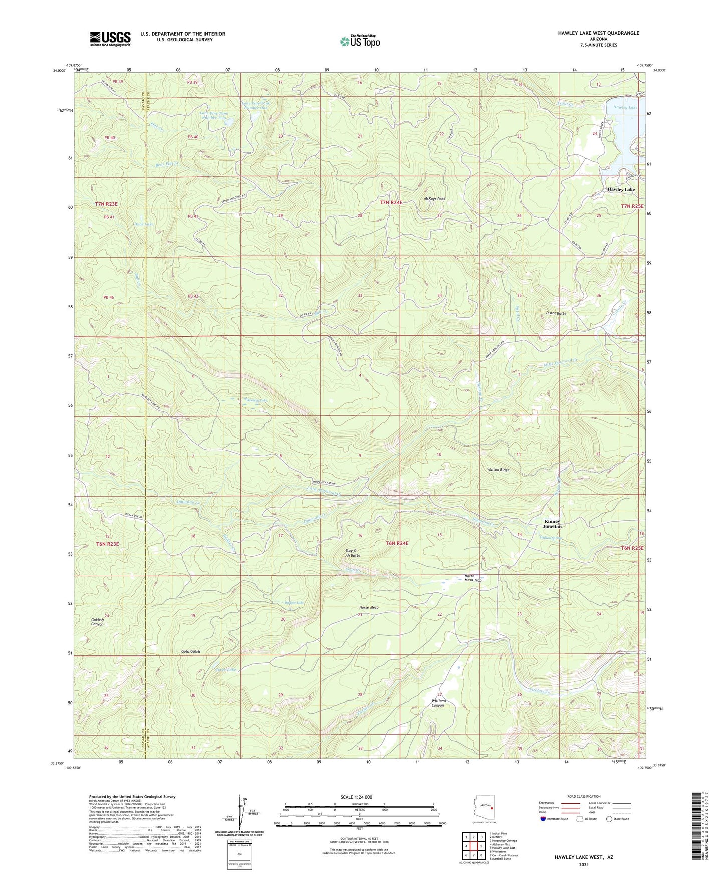
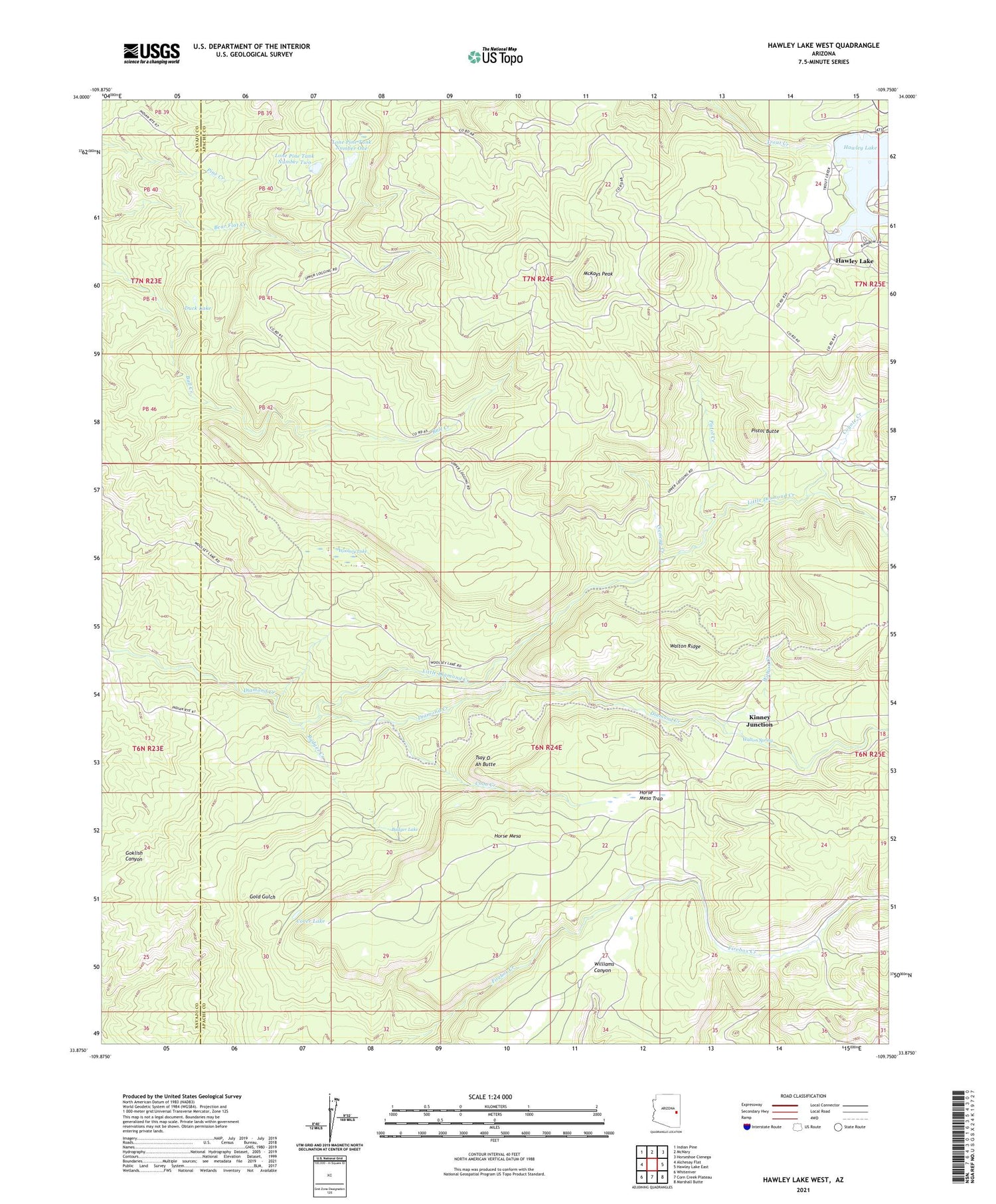
2021 topographic map quadrangle Hawley Lake West in the state of Arizona. Scale: 1:24000. Based on the newly updated USGS 7.5' US Topo map series, this map is in the following counties: Apache, Navajo. The map contains contour data, water features, and other items you are used to seeing on USGS maps, but also has updated roads and other features. This is the next generation of topographic maps. Printed on high-quality waterproof paper with UV fade-resistant inks.
Quads adjacent to this one:
West: Alchesay Flat
Northwest: Indian Pine
North: McNary
Northeast: Horseshoe Cienega
East: Hawley Lake East
Southeast: Marshall Butte
South: Corn Creek Plateau
Southwest: Whiteriver
This map covers the same area as the classic USGS quad with code o33109h7.
Contains the following named places: Badger Creek, Badger Lake, Christmas Tree Dam, Cienega Creek, Coon Creek, Cover Lake, Coyote Creek, Davis Dam, Diamond Creek Campsite Number Three, Duck Lake, Hawley Lake, Hawley Lake Campground Area, Hawley Lake Post Office, Horse Mesa, Horse Mesa Trap, Kinney Junction, Kinney Lookout, Little Diamond Creek, Lone Pine Tank Number One, Lone Pine Tank Number Two, McKays Peak, Pistol Butte, Pistol Creek, Tsay O Ah Butte, Walton Creek, Walton Ridge, Walton Spring, Woolsey Lake