MyTopo
Whiteriver Arizona US Topo Map
Couldn't load pickup availability
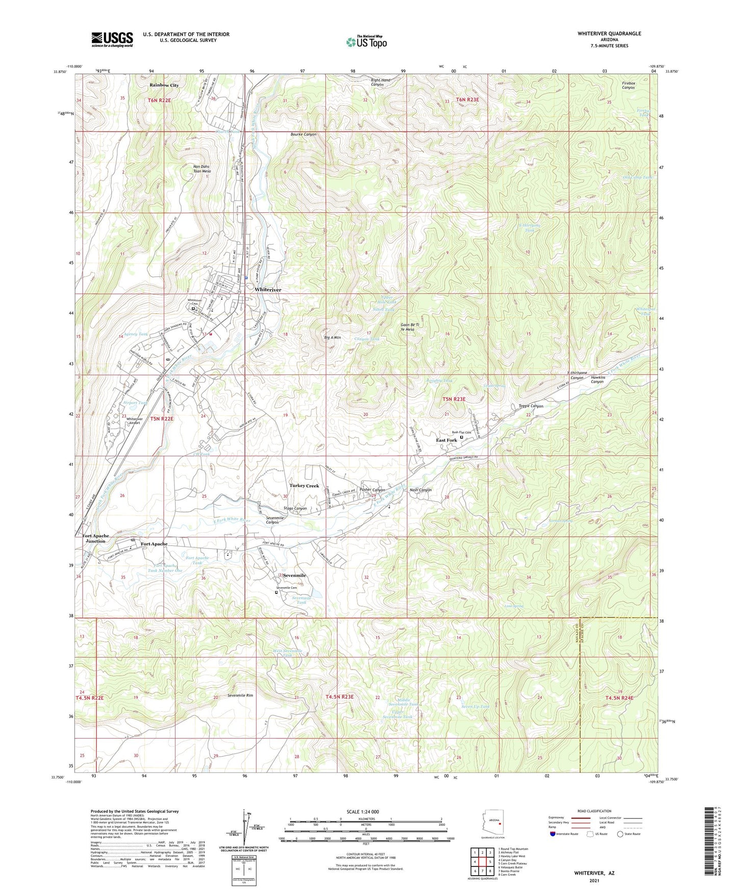
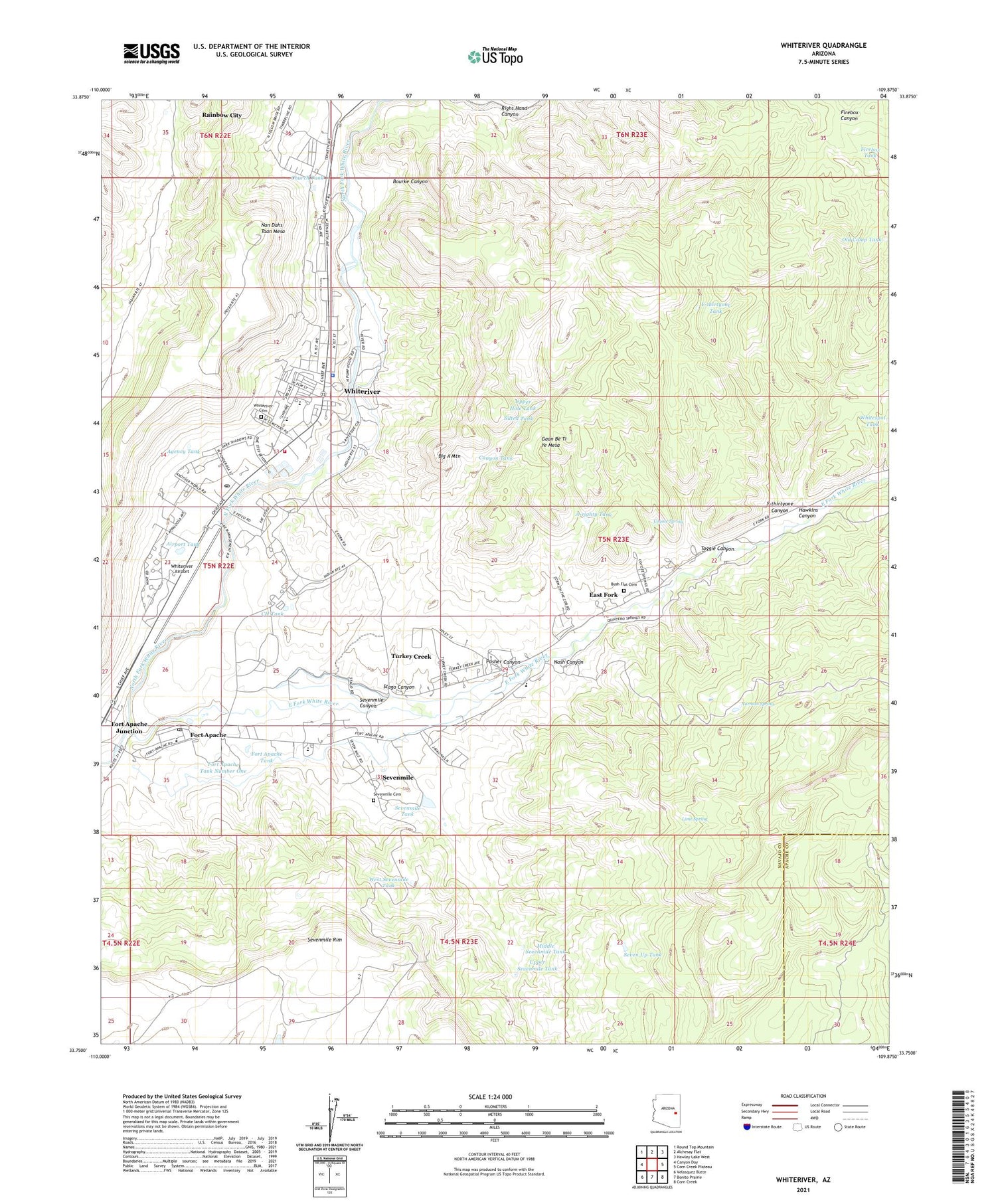
2021 topographic map quadrangle Whiteriver in the state of Arizona. Scale: 1:24000. Based on the newly updated USGS 7.5' US Topo map series, this map is in the following counties: Navajo, Apache. The map contains contour data, water features, and other items you are used to seeing on USGS maps, but also has updated roads and other features. This is the next generation of topographic maps. Printed on high-quality waterproof paper with UV fade-resistant inks.
Quads adjacent to this one:
West: Canyon Day
Northwest: Round Top Mountain
North: Alchesay Flat
Northeast: Hawley Lake West
East: Corn Creek Plateau
Southeast: Corn Creek
South: Bonito Prairie
Southwest: Velasquez Butte
This map covers the same area as the classic USGS quad with code o33109g8.
Contains the following named places: A-eighty Tank, Agency Tank, Airport Tank, Alchesay High School, Big A Mountain, Bourke Canyon, Bush Flat Cemetery, Canyon Tank, CH Tank, Church Tank, Coyote Spring, East Fork, East Fork Census Designated Place, East Fork Community Center, East Fork Lutheran School, East Fork White River, Firebox Tank, Fort Apache, Fort Apache Census Designated Place, Fort Apache Post Office, Fort Apache Tank, Fort Apache Tank Number One, Gaan Be Ti Ye Mesa, Hawkins Canyon, John F Kennedy Day School, KNNB-FM (Whiteriver), Lime Spring, Middle Sevenmile Tank, Nan Dahs Taan Mesa, Nash Canyon, Norman Spring, North Fork White River, Old Camp Tank, Pusher Canyon, Rainbow City Census Designated Place, Right Hand Canyon, Saint Francis Church, Seven Mile Census Designated Place, Seven Mile Elementary School, Seven Up Tank, Sevenmile, Sevenmile Canyon, Sevenmile Cemetery, Sevenmile Rim, Sevenmile Tank, Sevenmile Tank Dam, Silted Tank, Stago Canyon, Theodore Roosevelt School, Toggie Canyon, Turkey Creek Census Designated Place, Upper Hole Tank, Upper Sevenmile Tank, West Sevenmile Tank, White Mountain Apache Police Department, White Mountain Apache Tribal Fire and Rescue Department Station 810 Whiteriver, Whiteriver, Whiteriver Airport, Whiteriver Cemetery, Whiteriver Census Designated Place, Whiteriver City Hall, Whiteriver Elementary School, Whiteriver Fire Station, Whiteriver Lutheran Church, Whiteriver Post Office, Whiteriver Public Library, Y-thirtyone Canyon, Y-thirtyone Tank, ZIP Codes: 85926, 85941