MyTopo
Indian Pine Arizona US Topo Map
Couldn't load pickup availability
Also explore the Indian Pine Forest Service Topo of this same quad for updated USFS data
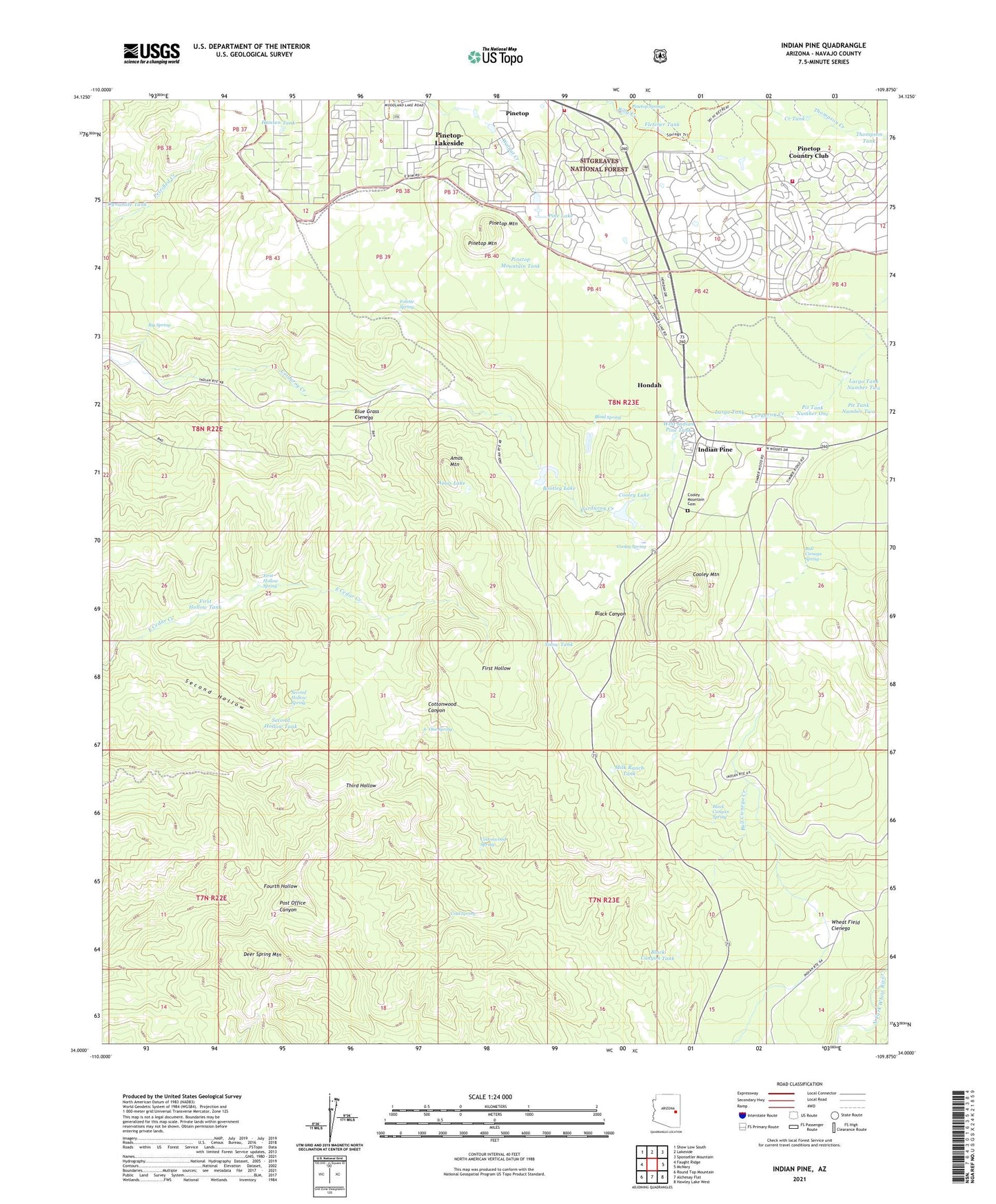
2021 topographic map quadrangle Indian Pine in the state of Arizona. Scale: 1:24000. Based on the newly updated USGS 7.5' US Topo map series, this map is in the following counties: Navajo. The map contains contour data, water features, and other items you are used to seeing on USGS maps, but also has updated roads and other features. This is the next generation of topographic maps. Printed on high-quality waterproof paper with UV fade-resistant inks.
Quads adjacent to this one:
West: Faught Ridge
Northwest: Show Low South
North: Lakeside
Northeast: Sponseller Mountain
East: McNary
Southeast: Hawley Lake West
South: Alchesay Flat
Southwest: Round Top Mountain
This map covers the same area as the classic USGS quad with code o34109a8.
Contains the following named places: A- One Spring, Amos Lake, Amos Mountain, Amos Ranch, Arizona Game and Fish Region One Office, Big Spring, Black Canyon Spring, Black Canyon Tank, Blind Spring, Blue Grass Cienega, Bootleg Dam, Bootleg Lake, Bootleg Lake Campground, Bull Cienega Creek, Bull Cienega Spring, Coal Spring, Community Presbyterian Church, Cooley Dam, Cooley Lake, Cooley Lake Campground, Cooley Mountain, Cooley Ranch, Cooley Spring, Cottonwood Spring, Creek Tank, Deer Spring Mountain, Dynamite Tank, First Hollow Spring, First Hollow Tank, Fletcher Tank, Folette Spring, Hansen Tank, Hondah Census Designated Place, Indian Pine, Largo Tank, Largo Tank Number Two, Milk Ranch Tank, Navajo County Sheriff's Office Pinetop, Penrod Cabin, Pettis Ranch, Pine Lake, Pinetop Country Club Census Designated Place, Pinetop Fire Department Station 11, Pinetop Fire Department Station 12, Pinetop Lakes Country Club, Pinetop Mountain, Pinetop Mountain Tank, Pinetop Springs, Pit Tank Number One, Pit Tank Number Two, Saint Mary of the Angels Catholic Community, Second Hollow, Second Hollow Spring, Second Hollow Tank, Snow Tank, Thompson Tank, West Indian Pine Tank, Wheat Field Cienega, White Mountain Apache Tribal Fire and Rescue Department Station 830 - Hon Dah, White Mountain Apache Tribe Hon - Dah Regional Wastewater Treatment Facility, White Mountain Country Club, ZIP Code: 85935