MyTopo
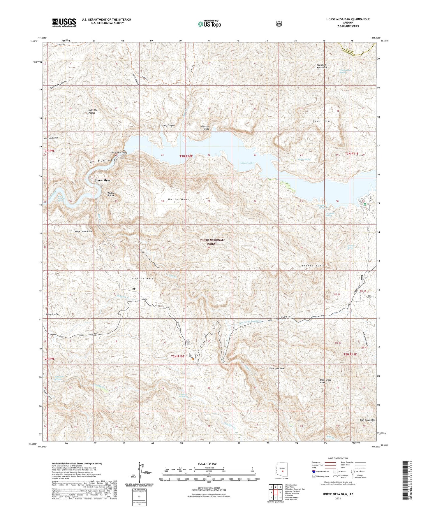
Horse Mesa Dam Arizona US Topo Map
Couldn't load pickup availability
Also explore the Horse Mesa Dam Forest Service Topo of this same quad for updated USFS data
2021 topographic map quadrangle Horse Mesa Dam in the state of Arizona. Scale: 1:24000. Based on the newly updated USGS 7.5' US Topo map series, this map is in the following counties: Maricopa, Gila. The map contains contour data, water features, and other items you are used to seeing on USGS maps, but also has updated roads and other features. This is the next generation of topographic maps. Printed on high-quality waterproof paper with UV fade-resistant inks.
Quads adjacent to this one:
West: Mormon Flat Dam
Northwest: Mine Mountain
North: Four Peaks
Northeast: Theodore Roosevelt Dam
East: Pinyon Mountain
Southeast: Iron Mountain
South: Weavers Needle
Southwest: Goldfield
This map covers the same area as the classic USGS quad with code o33111e3.
Contains the following named places: Adams Camp, Alder Creek, Apache Lake, Apache Lake Campground, Apache Lake Marina Recreation Site, Apache Lake Resort, Arizona Highway Maintenance Fish Creek Yard, Ash Creek, Black Cross Butte, Bronco Butte, Coronado Mesa, Coronado Summit, Cottonwoods Spring, Crabtree Spring, Crabtree Wash, Crabtree Wash Recreation Residences, Fish Creek, Fish Creek Canyon, Fish Creek Mountain, Fish Creek Peak, Fish Creek Vista, Goat Mountain, Hells Hole Spring, Horse Mesa, Horse Mesa Accommodation School, Horse Mesa Dam, Horse Mesa Dam Number Two Heliport, Horse Mesa Number One Heliport, Horse Pasture Spring, Indian Spring, Lewis and Pranty Creek, Long Canyon, Mescal Pit Spring, Mud Spring Canyon, O'Connell Spring, Painted Cliffs, Salt River Project Housing, Schells Stations, Three Bar Wildlife Area, Walls of Bronze