MyTopo
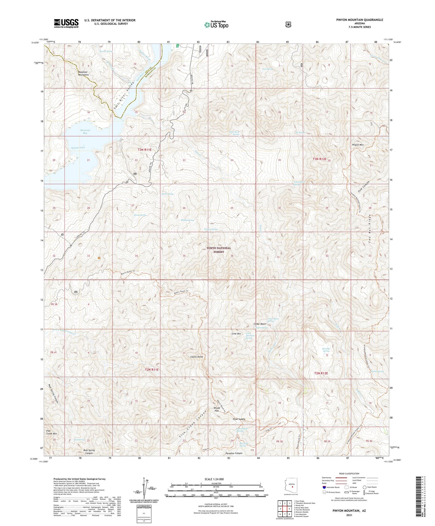
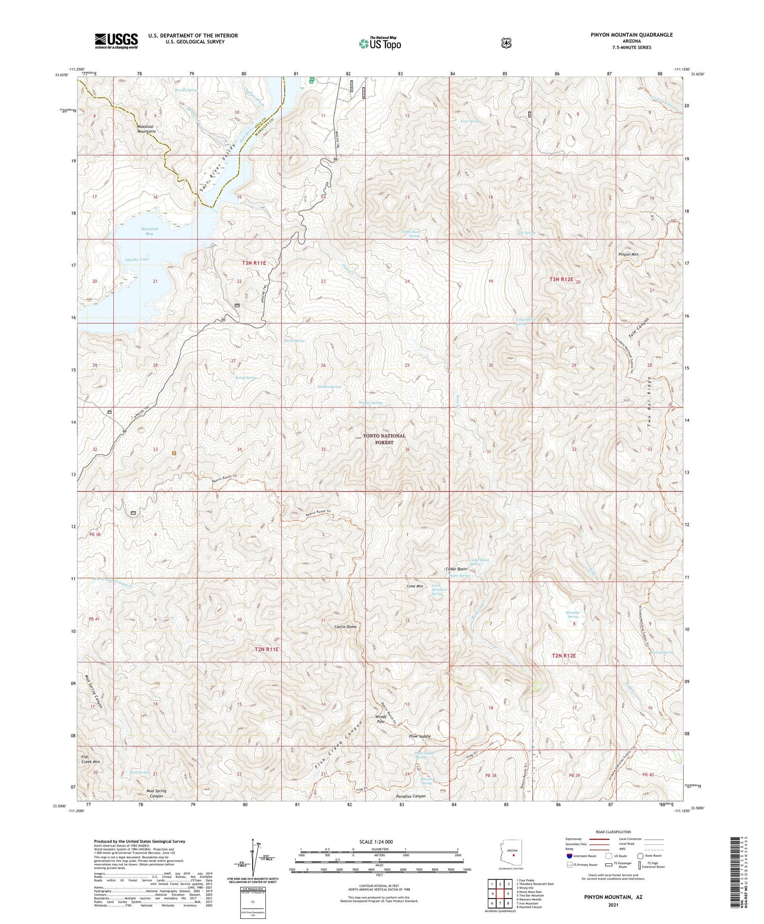
Pinyon Mountain Arizona US Topo Map
Couldn't load pickup availability
Also explore the Pinyon Mountain Forest Service Topo of this same quad for updated USFS data
2021 topographic map quadrangle Pinyon Mountain in the state of Arizona. Scale: 1:24000. Based on the newly updated USGS 7.5' US Topo map series, this map is in the following counties: Maricopa, Gila. The map contains contour data, water features, and other items you are used to seeing on USGS maps, but also has updated roads and other features. This is the next generation of topographic maps. Printed on high-quality waterproof paper with UV fade-resistant inks.
Quads adjacent to this one:
West: Horse Mesa Dam
Northwest: Four Peaks
North: Theodore Roosevelt Dam
Northeast: Windy Hill
East: Two Bar Mountain
Southeast: Haunted Canyon
South: Iron Mountain
Southwest: Weavers Needle
This map covers the same area as the classic USGS quad with code o33111e2.
Contains the following named places: Apache Trail, Bronco Creek, Bronco Spring, Burnt Corral Creek, Castle Dome, Cedar Basin, Cedar Basin Spring, Chukar Wash, Davis Spring, Davis Wash, Hidden Spring, Ike Spring, Klondike Spring, Lime Mountain, Lime Mountain Spring, Lion Spring, Maple Spring, Mazatzal Bay, Mud Spring, Muskhog Tank, Paradise Spring, Pine Creek, Pinyon Mountain, Plow Saddle, Plow Saddle Springs, Rainy Spring, Reavis Creek, Reavis Trailhead, Two Bar Ridge, Walnut Spring, Water Dog Recreational Site, White Rock Spring, Windy Pass, Winger Spring, Yellowjacket Spring, ZIP Code: 85545