MyTopo
Rocky Ridge SE Arizona US Topo Map
Couldn't load pickup availability
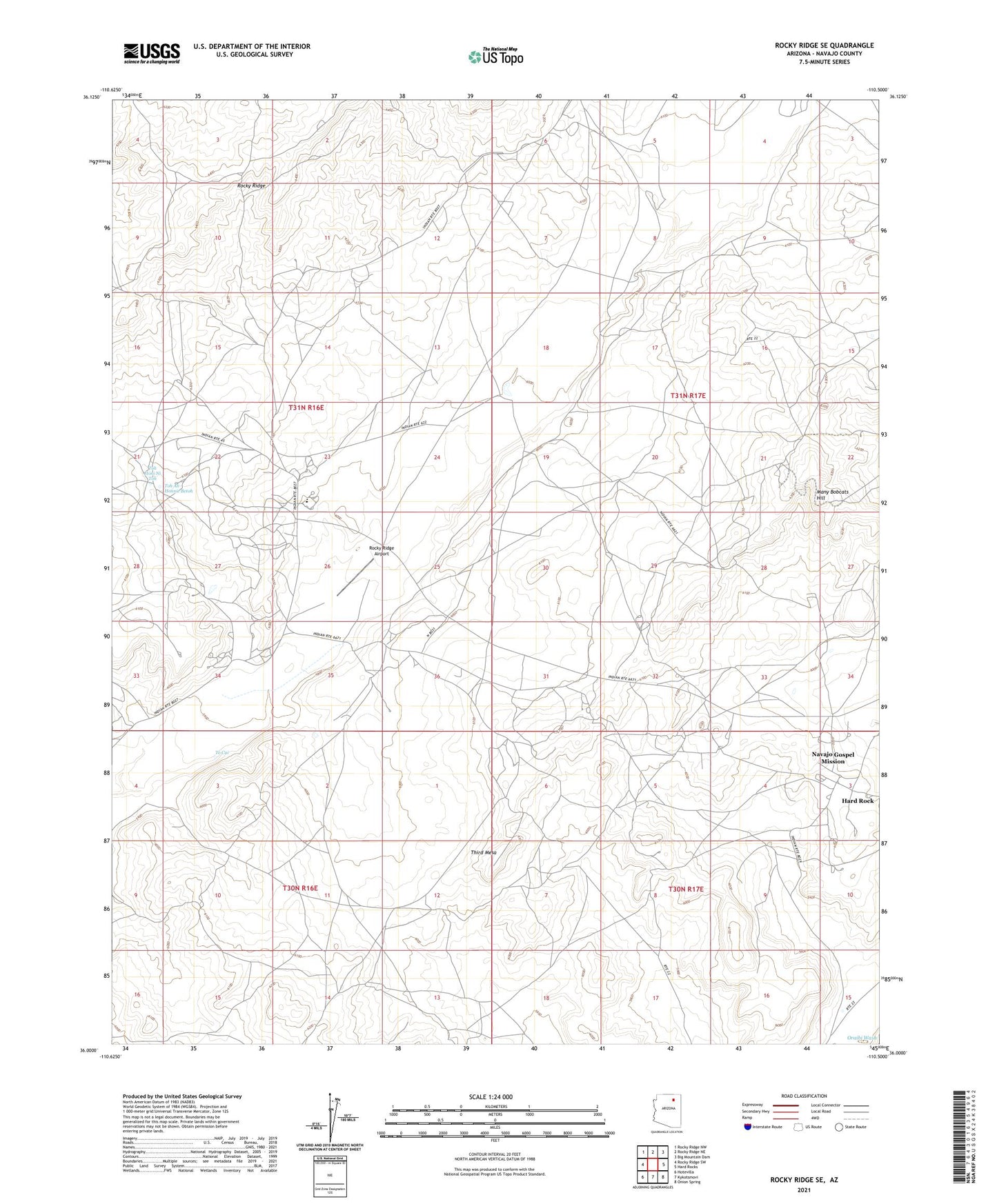
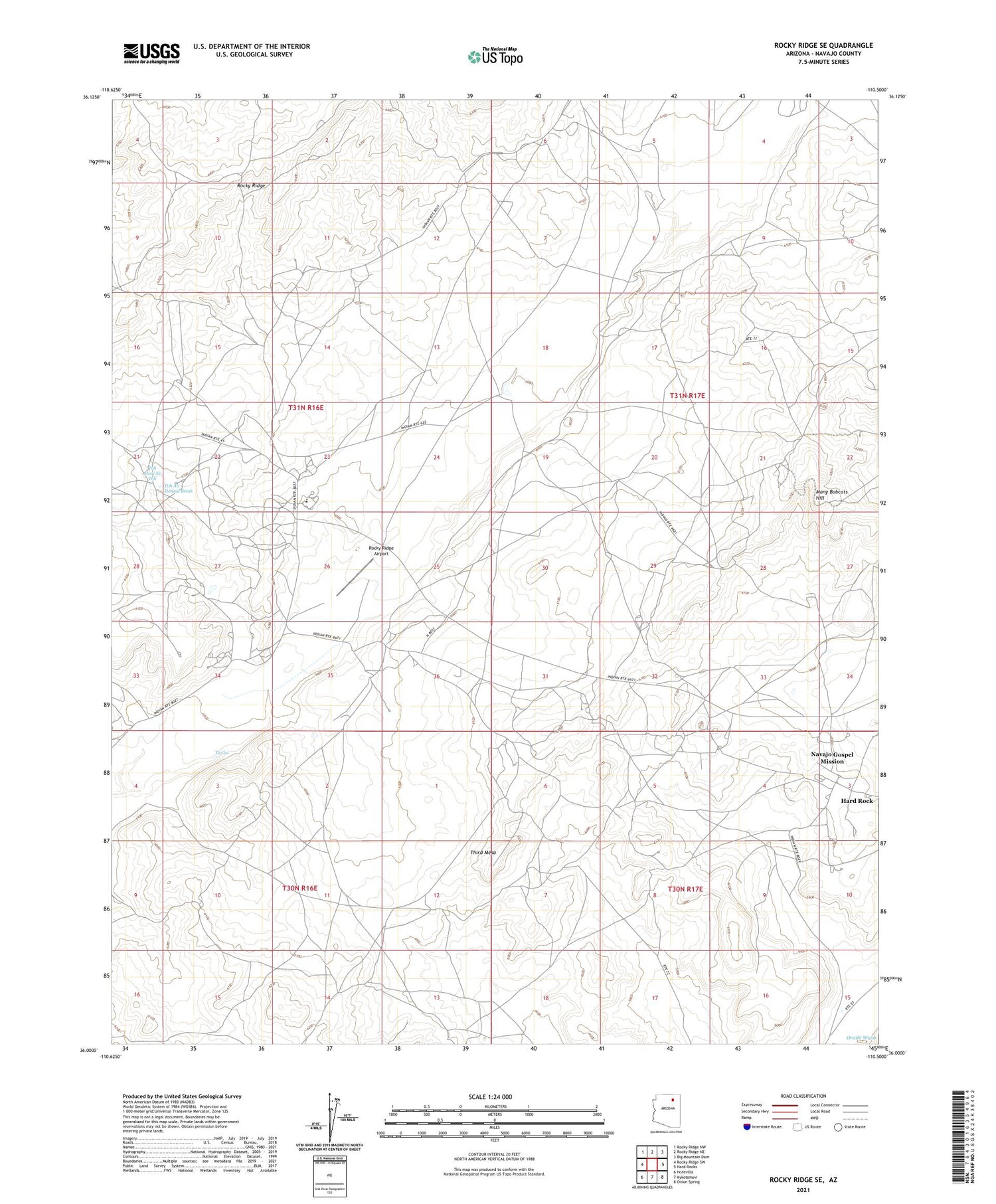
2021 topographic map quadrangle Rocky Ridge SE in the state of Arizona. Scale: 1:24000. Based on the newly updated USGS 7.5' US Topo map series, this map is in the following counties: Navajo. The map contains contour data, water features, and other items you are used to seeing on USGS maps, but also has updated roads and other features. This is the next generation of topographic maps. Printed on high-quality waterproof paper with UV fade-resistant inks.
Quads adjacent to this one:
West: Rocky Ridge SW
Northwest: Rocky Ridge NW
North: Rocky Ridge NE
Northeast: Big Mountain Dam
East: Hard Rocks
Southeast: Onion Spring
South: Kykotsmovi
Southwest: Hotevilla
This map covers the same area as the classic USGS quad with code o36110a5.
Contains the following named places: Dinnebito Trading Post, Hard Rock Census Designated Place, Many Bobcats Hill, Navajo Gospel Mission, Rocky Ridge, Rocky Ridge Airport, Rocky Ridge School, RU258, Third Mesa, To Cai, Toh Ah Honnie Betoh, Toh Honi Ni Toh, ZIP Code: 86039