MyTopo
Houck Arizona US Topo Map
Couldn't load pickup availability
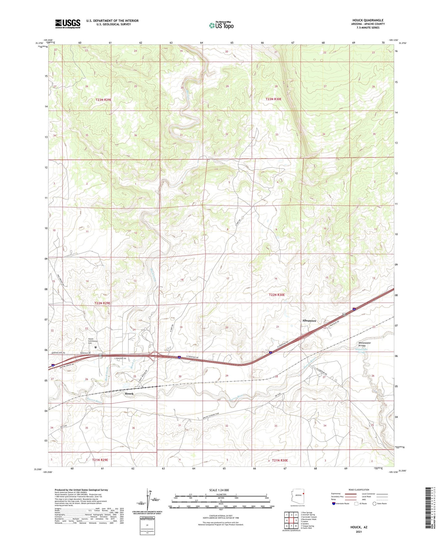
2021 topographic map quadrangle Houck in the state of Arizona. Scale: 1:24000. Based on the newly updated USGS 7.5' US Topo map series, this map is in the following counties: Apache. The map contains contour data, water features, and other items you are used to seeing on USGS maps, but also has updated roads and other features. This is the next generation of topographic maps. Printed on high-quality waterproof paper with UV fade-resistant inks.
Quads adjacent to this one:
West: Burntwater Wash
Northwest: Pine Springs
North: Uranium Spring
Northeast: Surrender Canyon
East: Lupton
Southeast: Chafin Well
South: Tolapai Spring
Southwest: Sanders
This map covers the same area as the classic USGS quad with code o35109c2.
Contains the following named places: Allentown, Big Arrow Trading Post, Black Creek, Good News Mission, Houck, Houck Census Designated Place, Houck Railroad Station, Navajo Community Center, Pine Springs Day School, Saint Anselm Mission, Spencers Well, Tegakwithan Mission, Whitewater Arroyo, ZIP Code: 86506