MyTopo
Surrender Canyon New Mexico US Topo Map
Couldn't load pickup availability
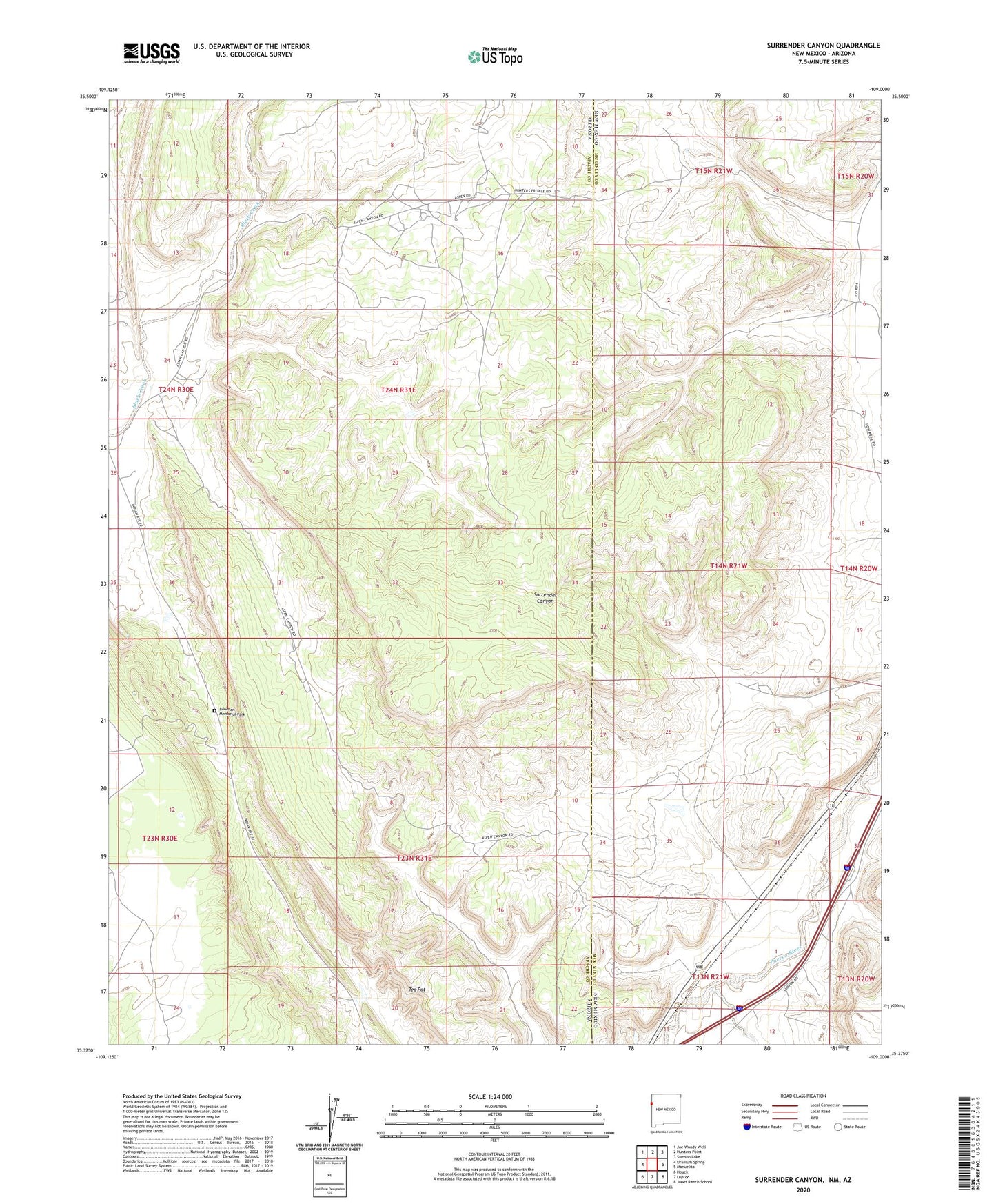
2023 topographic map quadrangle Surrender Canyon in the state of New Mexico. Scale: 1:24000. Based on the newly updated USGS 7.5' US Topo map series, this map is in the following counties: McKinley, Apache. The map contains contour data, water features, and other items you are used to seeing on USGS maps, but also has updated roads and other features. This is the next generation of topographic maps. Printed on high-quality waterproof paper with UV fade-resistant inks.
Quads adjacent to this one:
West: Uranium Spring
Northwest: Joe Woody Well
North: Hunters Point
Northeast: Samson Lake
East: Manuelito
Southeast: Jones Ranch School
South: Lupton
Southwest: Houck
This map covers the same area as the classic USGS quad with code o35109d1.
Contains the following named places: Bowman Memorial Park, Tea Pot