
MyTopo
Humphreys Peak Arizona US Topo Map
Couldn't load pickup availability
Also explore the Humphreys Peak Forest Service Topo of this same quad for updated USFS data
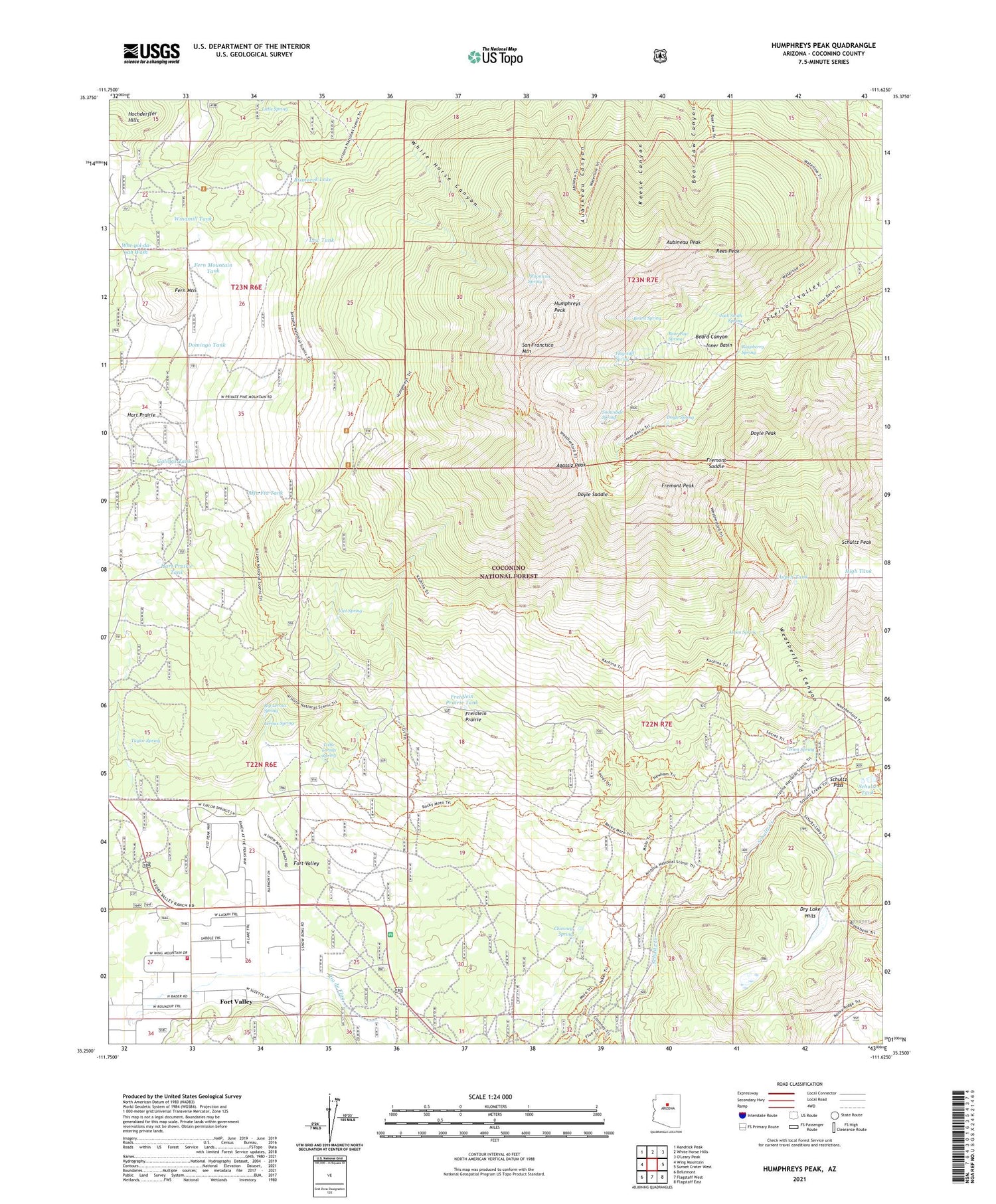
2021 topographic map quadrangle Humphreys Peak in the state of Arizona. Scale: 1:24000. Based on the newly updated USGS 7.5' US Topo map series, this map is in the following counties: Coconino. The map contains contour data, water features, and other items you are used to seeing on USGS maps, but also has updated roads and other features. This is the next generation of topographic maps. Printed on high-quality waterproof paper with UV fade-resistant inks.
Quads adjacent to this one:
West: Wing Mountain
Northwest: Kendrick Peak
North: White Horse Hills
East: Sunset Crater West
Southeast: Flagstaff East
South: Flagstaff West
Southwest: Bellemont
This map covers the same area as the classic USGS quad with code o35111c6.
Contains the following named places: Agassiz Peak, Alfa Fia Tank, Arizona Snow Bowl, Arizona Snow Bowl Campground, Aspen Spring, Aspen Tank, Aubineau Peak, Bear Paw Spring, Beard Canyon, Beard Spring, Big Leroux Spring, Bismarck Lake, Chimney Spring, Domingo Tank, Doyle Peak, Doyle Saddle, Doyle Spring, Fern Mountain, Fern Mountain Tank, Flagstaff Spring, Fort Valley, Fort Valley Census Designated Place, Fort Valley Experimental Forest, Fort Valley Experimental Forest Station, Freidlein Prairie, Freidlein Prairie Tank, Fremont Peak, Fremont Saddle, G. A. Pearson Natural Area, Galinas Tank, Hart Prairie, Hart Prairie Tank, High Tank, Hot Shot Headquarters, Humphreys Peak, Inner Basin, Jack Smith Spring, Kachina Peaks Wilderness, Leroux Spring, Lew Tank, Little Leroux Spring, Little Spring, Meadow Tank, Michelbach Ranch, Orion Spring, Philomena Spring, Raspberry Spring, Rees Peak, San Francisco Mountain, San Francisco Peaks Natural Area, Schultz Pass, Schultz Peak, Schultz Tank, Snowbowl Ski Area, Snowslide Spring, Summit Fire District Station 36, Taylor Spring, Viet Spring, Windmill Tank, ZIP Code: 86001


