MyTopo
Kendrick Peak Arizona US Topo Map
Couldn't load pickup availability
Also explore the Kendrick Peak Forest Service Topo of this same quad for updated USFS data
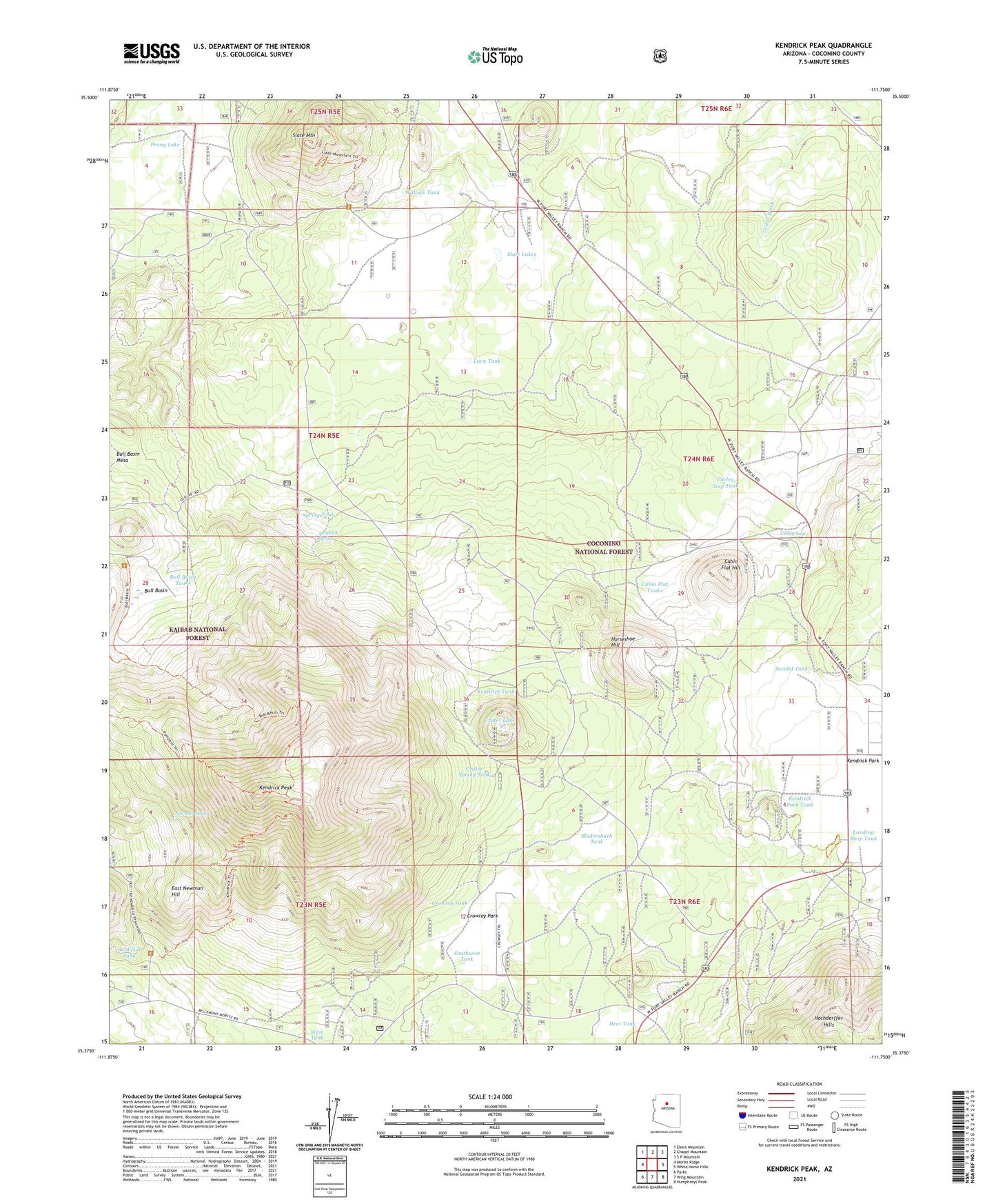
2021 topographic map quadrangle Kendrick Peak in the state of Arizona. Scale: 1:24000. Based on the newly updated USGS 7.5' US Topo map series, this map is in the following counties: Coconino. The map contains contour data, water features, and other items you are used to seeing on USGS maps, but also has updated roads and other features. This is the next generation of topographic maps. Printed on high-quality waterproof paper with UV fade-resistant inks.
Quads adjacent to this one:
West: Moritz Ridge
Northwest: Ebert Mountain
North: Chapel Mountain
Northeast: S P Mountain
East: White Horse Hills
Southeast: Humphreys Peak
South: Wing Mountain
Southwest: Parks
This map covers the same area as the classic USGS quad with code o35111d7.
Contains the following named places: Antelope Well, Bald Hill Tank, Bull Basin, Bull Basin Tanks, Cabin Flat Hill, Cabin Flat Tanks, Crater Lake, Crater Spring Tank, Crowley Park, Crowley Park Tank, Crowley Tank, Curley Seep, Curley Seep Tank, East Newman Hill, Hochderffer Hills, Horseshoe Hill, Kendrick Mountain Wilderness, Kendrick Park, Kendrick Park Picnic Ground, Kendrick Park Tank, Kendrick Peak, Kendrick Peak Trail, Kendrick Recreation Site, Kendrick Spring, Kendrick Tank, Landing Strip Tank, Lava Tank, Maverick Tank, Mudersbach, Mudersbach Tank, Mudersbach Well, Newman Spring, Osborn Well, Park Tank, Prong Lake, Secelid Tank, Slate Lakes, Slate Mountain, Slate Well, Southwest Tank, Spring Tank, Wallace Tank, West Tank