
MyTopo
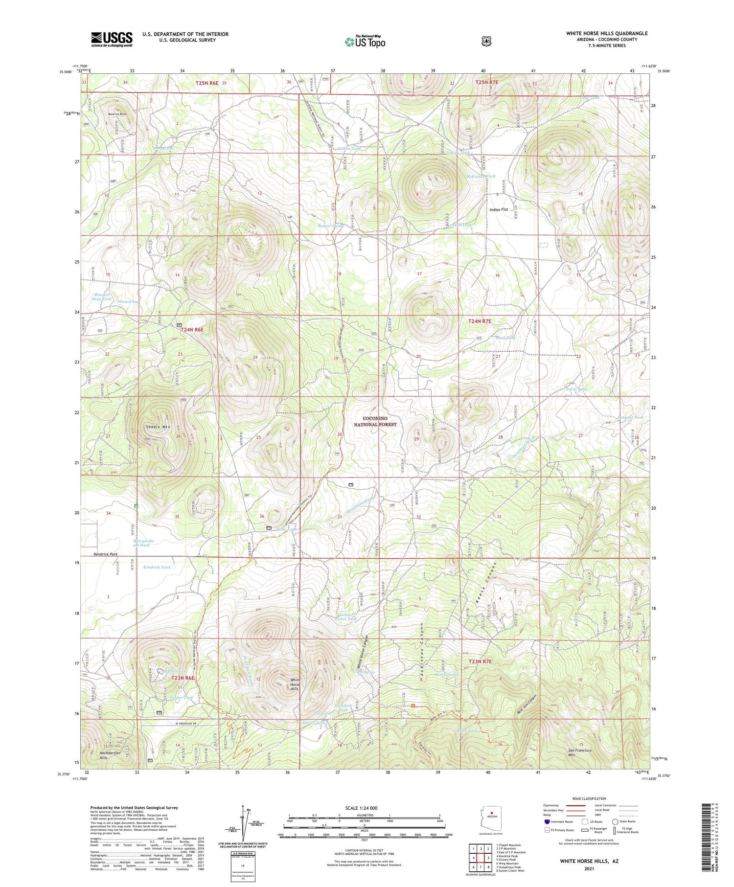
White Horse Hills Arizona US Topo Map
Couldn't load pickup availability
Also explore the White Horse Hills Forest Service Topo of this same quad for updated USFS data
2021 topographic map quadrangle White Horse Hills in the state of Arizona. Scale: 1:24000. Based on the newly updated USGS 7.5' US Topo map series, this map is in the following counties: Coconino. The map contains contour data, water features, and other items you are used to seeing on USGS maps, but also has updated roads and other features. This is the next generation of topographic maps. Printed on high-quality waterproof paper with UV fade-resistant inks.
Quads adjacent to this one:
West: Kendrick Peak
Northwest: Chapel Mountain
North: S P Mountain
Northeast: East of S P Mountain
Southeast: Sunset Crater West
South: Humphreys Peak
Southwest: Wing Mountain
This map covers the same area as the classic USGS quad with code o35111d6.
Contains the following named places: Aubineau Canyon, Badger Tank, Bear Jaw Canyon, Black Tank, Bonita Tank, Borrego Trick Tank, Deep Tank, Elizabeth Tank, Geyler Tank, Goat Tank, Hall Tank, Howard Seep, Howard Seep Tank, Indian Flat, Indian Tank, Kelly Tank, Kendrick Park Forest Service Station, Kendrick Tank, Lavin Tank, Lookout Tank, Maverick Butte, McKinney Tank, Pat Spring, Pat Tank, Pete Number One Tank, Potato Tank, Reese Canyon, Reese Tanks, Road Tank, Saddle Mountain, Saddle Trick Tank, Tub Number One, Tub Number Three, Tub Number Two, Walker Lake, White Horse Canyon, White Horse Hills, Yellow Jacket Tank


