MyTopo
Hunters Point Arizona US Topo Map
Couldn't load pickup availability
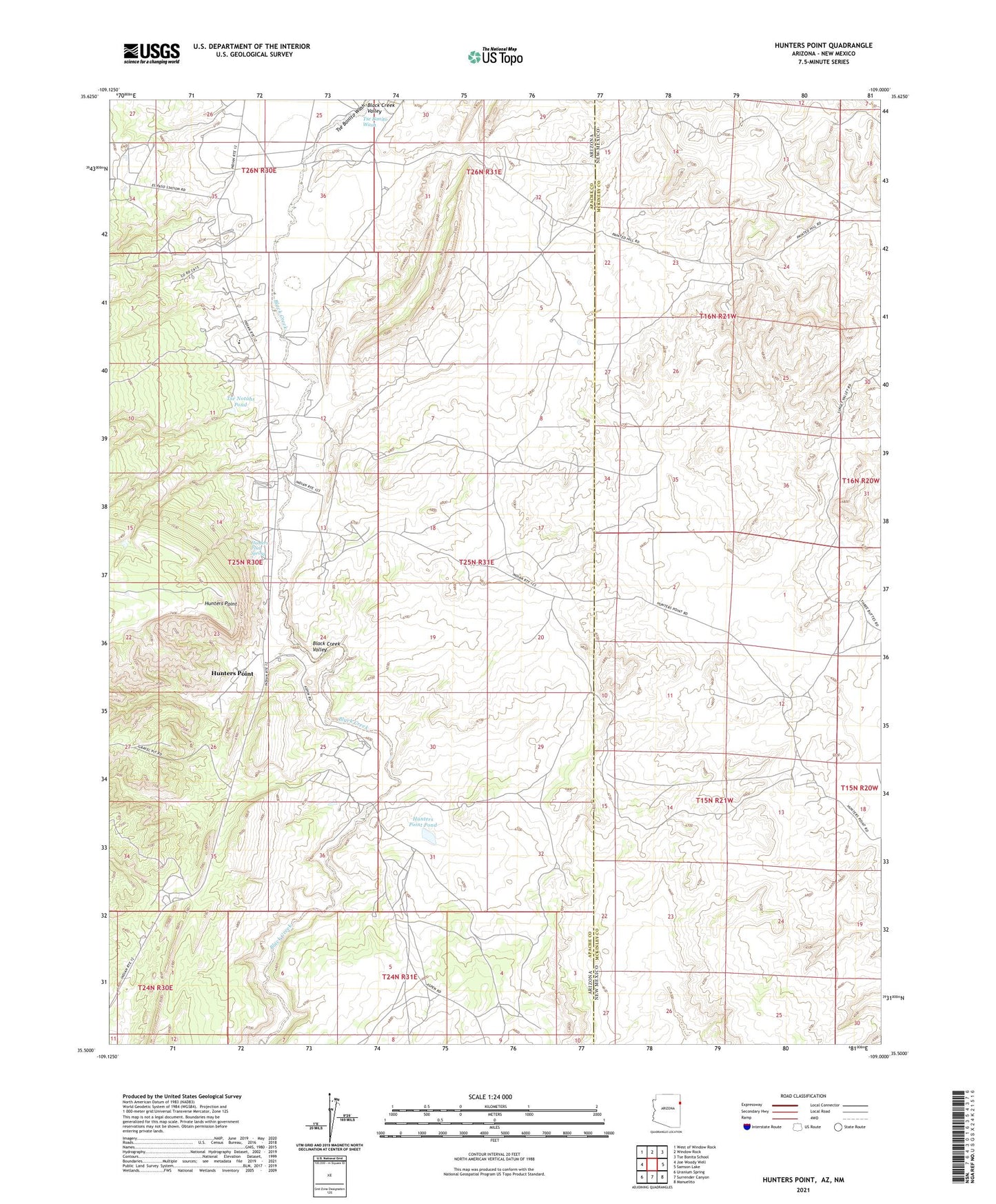
2021 topographic map quadrangle Hunters Point in the states of Arizona, New Mexico. Scale: 1:24000. Based on the newly updated USGS 7.5' US Topo map series, this map is in the following counties: Apache, McKinley. The map contains contour data, water features, and other items you are used to seeing on USGS maps, but also has updated roads and other features. This is the next generation of topographic maps. Printed on high-quality waterproof paper with UV fade-resistant inks.
Quads adjacent to this one:
West: Joe Woody Well
Northwest: West of Window Rock
North: Window Rock
Northeast: Tse Bonita School
East: Samson Lake
Southeast: Manuelito
South: Surrender Canyon
Southwest: Uranium Spring
Contains the following named places: Billie Notahs Well, Black Creek Valley, Hunters Point, Hunters Point Boarding School, Hunters Point Campground, Hunters Point Pond, Hunters Point Spring, Hunters Point Trading Post, John Nez Well, KWRK-FM (Window Rock), Navajo Mission, Peterson Well, Spencer Well, Tabaha Well, Tse Bonito Wash, Tse Notahs Pond, W R 5 Water Well, W R 7 Water Well, W R S Water Well, Window Rock Pumping Station