MyTopo
Tse Bonita School New Mexico US Topo Map
Couldn't load pickup availability
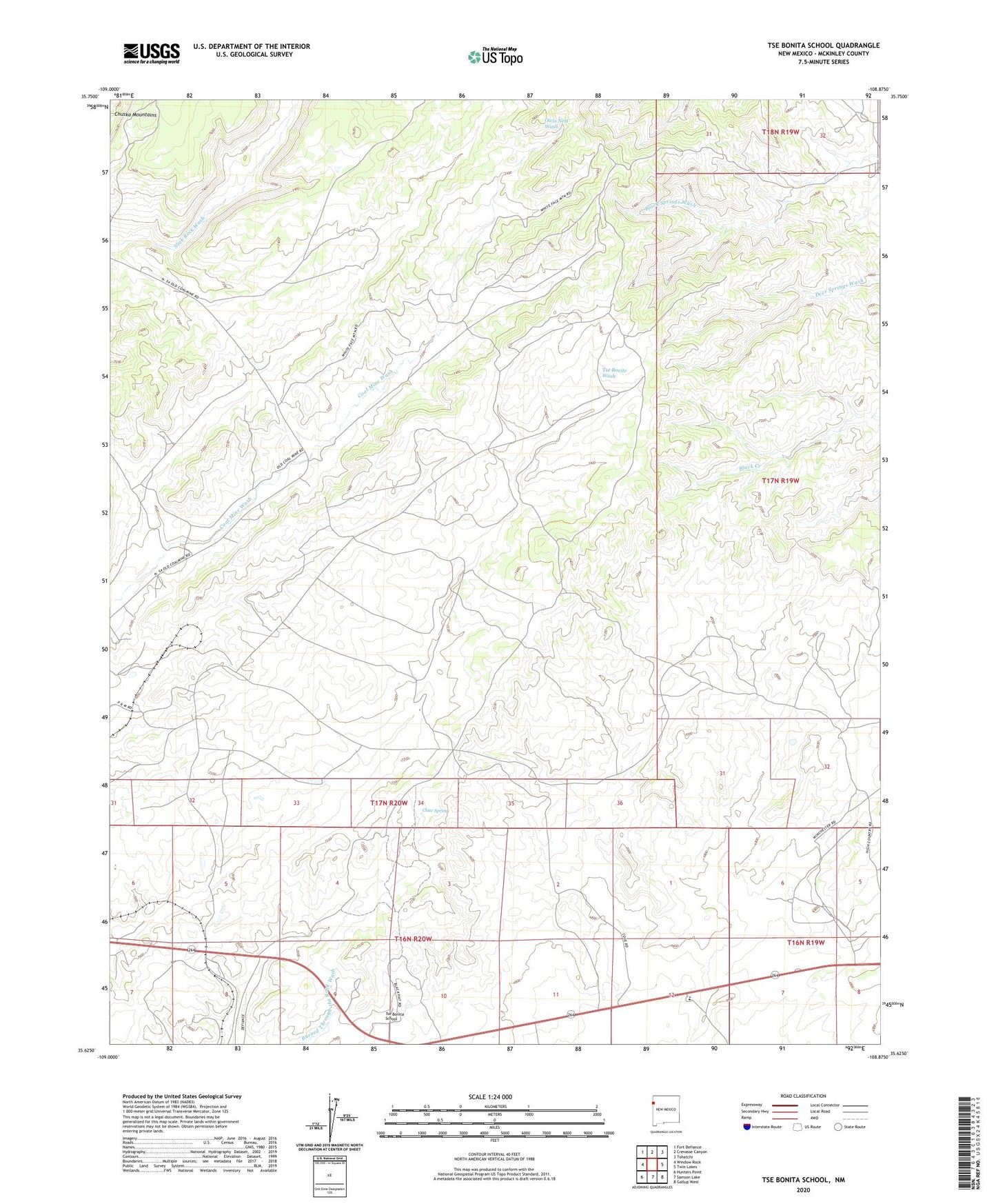
2023 topographic map quadrangle Tse Bonita School in the state of New Mexico. Scale: 1:24000. Based on the newly updated USGS 7.5' US Topo map series, this map is in the following counties: McKinley. The map contains contour data, water features, and other items you are used to seeing on USGS maps, but also has updated roads and other features. This is the next generation of topographic maps. Printed on high-quality waterproof paper with UV fade-resistant inks.
Quads adjacent to this one:
West: Window Rock
Northwest: Fort Defiance
North: Crevasse Canyon
Northeast: Tohatchi
East: Twin Lakes
Southeast: Gallup West
South: Samson Lake
Southwest: Hunters Point
This map covers the same area as the classic USGS quad with code o35108f8.
Contains the following named places: 18K-329 Water Well, 18T-591 Water Well, 86515, Black Hat, Black Hat Census Designated Place, Claw Spring, Gando Coal, McKinley Mine, Slick Rock, Tse Bonita School, Window Rock Coal Mine