
MyTopo
Indian Peak Arizona US Topo Map
Couldn't load pickup availability
Also explore the Indian Peak Forest Service Topo of this same quad for updated USFS data
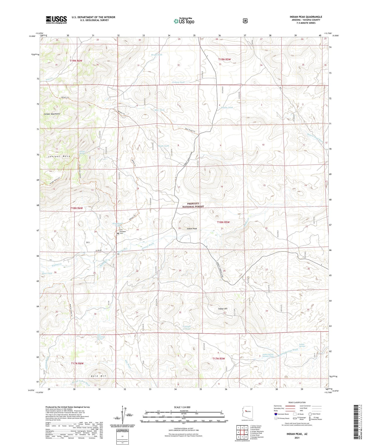
2021 topographic map quadrangle Indian Peak in the state of Arizona. Scale: 1:24000. Based on the newly updated USGS 7.5' US Topo map series, this map is in the following counties: Yavapai. The map contains contour data, water features, and other items you are used to seeing on USGS maps, but also has updated roads and other features. This is the next generation of topographic maps. Printed on high-quality waterproof paper with UV fade-resistant inks.
Quads adjacent to this one:
West: Juniper Mountains
Northwest: Turkey Canyon
North: Red Mountain
Northeast: South Butte
East: Limestone Peak
Southeast: Simmons
South: Seepage Mountain
Southwest: Camp Wood
This map covers the same area as the classic USGS quad with code o34112h7.
Contains the following named places: Apache Creek, Bald Mountain, Bald Mountain Spring, Brush Tank, Cement Tank, Chino Valley Ranger District, Chucks Tank, Cienega Ranch, Flood Dam Tank, Fritche Tank, Graver Wash, Hunt Tank, Indian Hill, Indian Peak, Indian Spring Number Three, Indian Springs, Juniper Spring, K Four Ranch, Section Twentyfive Tank, South Tank, Spur Tank, Taylor Ranch, Triangle U Ranch, Triangle U Tank, Trick Tank, Walnut Creek Ranger Station, Walnut Creek Work Center, Windshield Tank


