
MyTopo
South Butte Arizona US Topo Map
Couldn't load pickup availability
Also explore the South Butte Forest Service Topo of this same quad for updated USFS data
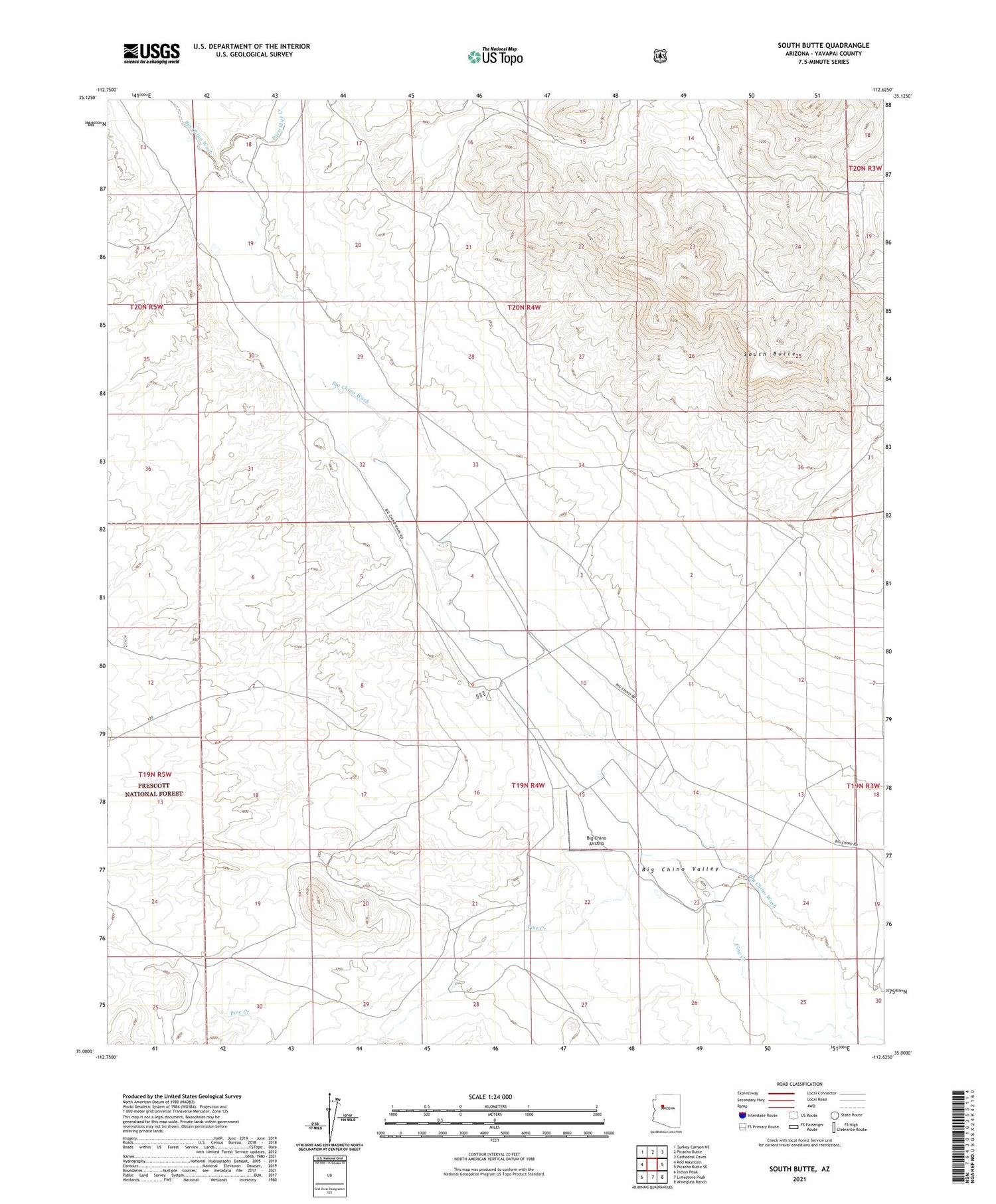
2021 topographic map quadrangle South Butte in the state of Arizona. Scale: 1:24000. Based on the newly updated USGS 7.5' US Topo map series, this map is in the following counties: Yavapai. The map contains contour data, water features, and other items you are used to seeing on USGS maps, but also has updated roads and other features. This is the next generation of topographic maps. Printed on high-quality waterproof paper with UV fade-resistant inks.
Quads adjacent to this one:
West: Red Mountain
Northwest: Turkey Canyon NE
North: Picacho Butte
Northeast: Cathedral Caves
East: Picacho Butte SE
Southeast: Wineglass Ranch
South: Limestone Peak
Southwest: Indian Peak
This map covers the same area as the classic USGS quad with code o35112a6.
Contains the following named places: Big Chino Airstrip, K 4 Farms, Partridge Creek, Pollocks Substation, South Butte


