MyTopo
Seepage Mountain Arizona US Topo Map
Couldn't load pickup availability
Also explore the Seepage Mountain Forest Service Topo of this same quad for updated USFS data
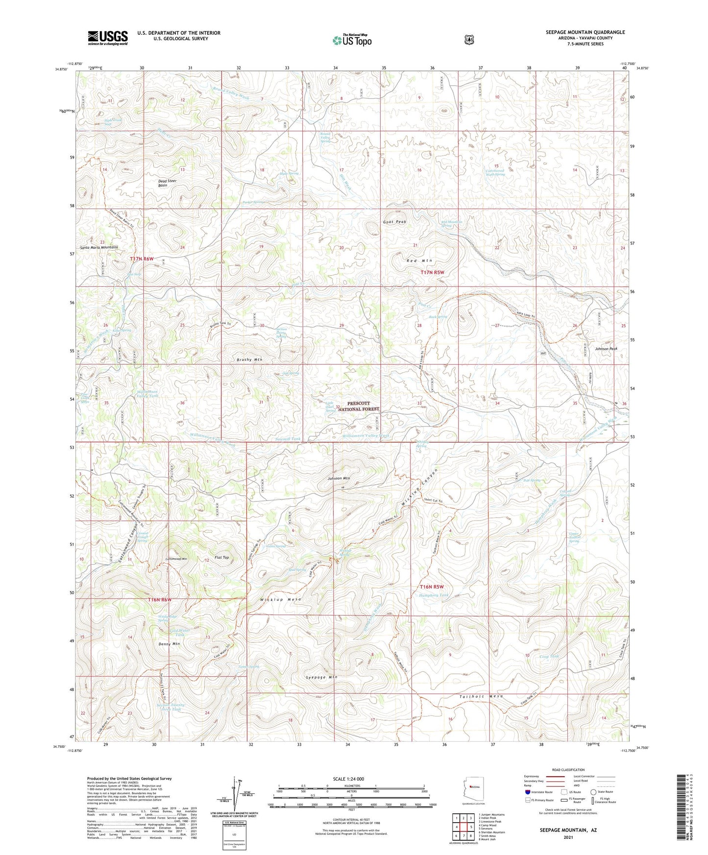
2021 topographic map quadrangle Seepage Mountain in the state of Arizona. Scale: 1:24000. Based on the newly updated USGS 7.5' US Topo map series, this map is in the following counties: Yavapai. The map contains contour data, water features, and other items you are used to seeing on USGS maps, but also has updated roads and other features. This is the next generation of topographic maps. Printed on high-quality waterproof paper with UV fade-resistant inks.
Quads adjacent to this one:
West: Camp Wood
Northwest: Juniper Mountains
North: Indian Peak
Northeast: Limestone Peak
East: Simmons
Southeast: Mount Josh
South: Smith Mesa
Southwest: Sheridan Mountain
This map covers the same area as the classic USGS quad with code o34112g7.
Contains the following named places: Brushy Mountain, Brushy Tank, Cabin Spring, Cement Trough Spring, Colcord Spring, Cold Water Tank, Coop Tank, Cottonwood Mountain, Cottonwood Wash Spring, Cross U Ranch, Dead Steer Basin, Denny Mountain, Flat Top, Goat Peak, Hitt Wash Well, Humphrey Tank, Hyde Creek, Hyde Creek Seep, Hyde Spring, Johnson Mountain, Johnson Peak, Kckel Spring, Little Pine Creek Well, Little Quail Spring, Mud Spring, North Tailholt Tank, Oak Spring, Parker Spring, Pine Creek Seeps, Pine Seep, Pole Spring, Prescott National Forest, Red Mountain, Red Mountain Spring, Rock Spring, Round Valley Spring, Round Valley Wash, Sawmill Tank, Section Thirty Spring, Section Twenty-three Tank, Seepage Mountain, Seepage Tank, South Tailholt Tank, Stringtown Wash, Tailholt Mesa, Tunnel Spring, Upper Tailholt Spring, West Sedona Elementary School, Whiskey Spring, Wickiup Canyon, Wickiup Mesa, Wickiup Pit Tank, Wickiup Spring, Williamson Valley Tank, Windy Ridge Spring