MyTopo
Kitt Peak Arizona US Topo Map
Couldn't load pickup availability
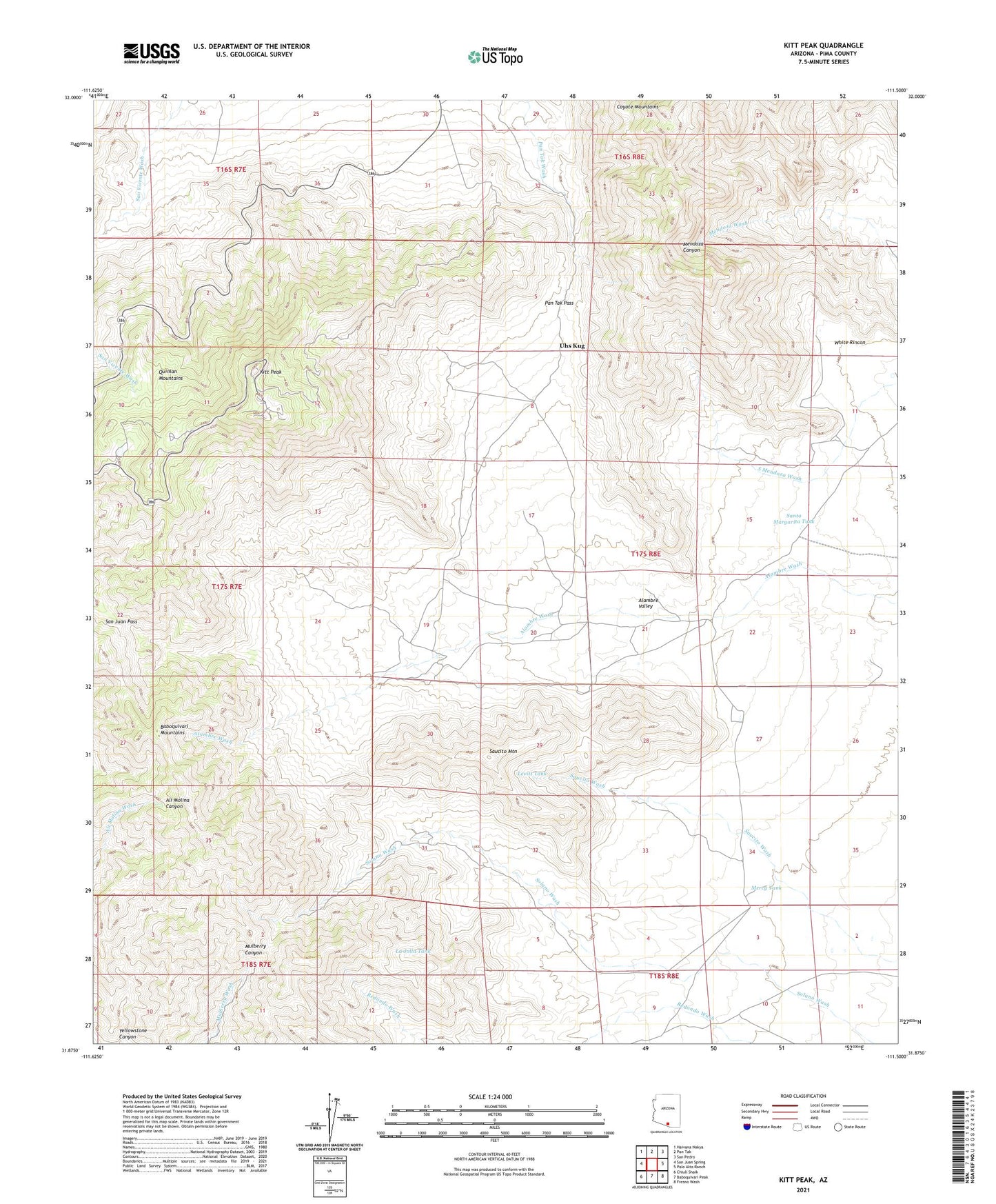
2021 topographic map quadrangle Kitt Peak in the state of Arizona. Scale: 1:24000. Based on the newly updated USGS 7.5' US Topo map series, this map is in the following counties: Pima. The map contains contour data, water features, and other items you are used to seeing on USGS maps, but also has updated roads and other features. This is the next generation of topographic maps. Printed on high-quality waterproof paper with UV fade-resistant inks.
Quads adjacent to this one:
West: San Juan Spring
Northwest: Haivana Nakya
North: Pan Tak
Northeast: San Pedro
East: Palo Alto Ranch
Southeast: Fresno Wash
South: Baboquivari Peak
Southwest: Chiuli Shaik
This map covers the same area as the classic USGS quad with code o31111h5.
Contains the following named places: Alambre Valley, Alambre Well, Coyote Mountains Wilderness, Hay Hook Ranch, Kitt Peak, Kitt Peak National Observatory, La Jolla Tank, Levitt Tank, Mayall Telescope, McMath Solar Telescope, Mercy Tank, Milagro Well, Pan Tak Pass, Pozito Well, Quinlan Mountains, Saint Jude Well, San Juan Pass, Santa Margarita Tank, Saucito Mountain, Schmidt Telescope, Solano Well, Steward Observatory, Uhs Kug, White Rincon, Yellowstone Canyon