MyTopo
Palo Alto Ranch Arizona US Topo Map
Couldn't load pickup availability
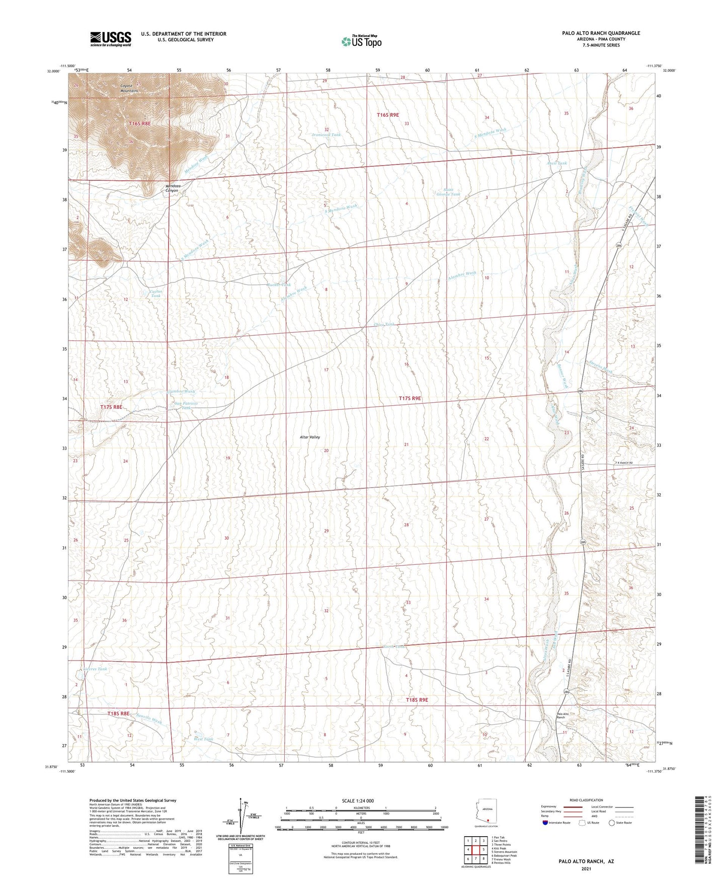
2021 topographic map quadrangle Palo Alto Ranch in the state of Arizona. Scale: 1:24000. Based on the newly updated USGS 7.5' US Topo map series, this map is in the following counties: Pima. The map contains contour data, water features, and other items you are used to seeing on USGS maps, but also has updated roads and other features. This is the next generation of topographic maps. Printed on high-quality waterproof paper with UV fade-resistant inks.
Quads adjacent to this one:
West: Kitt Peak
Northwest: Pan Tak
North: San Pedro
Northeast: Three Points
East: Stevens Mountain
Southeast: Penitas Hills
South: Fresno Wash
Southwest: Baboquivari Peak
This map covers the same area as the classic USGS quad with code o31111h4.
Contains the following named places: Alambre Wash, Altar Wash, Anvil Ranch, Anvil Tank, Ash Wash, Banner Wash, Cactus Tank, Chico Tank, Fresnal Wash, Fresno Wash, Ironwood Tank, Lievres Tank, Mendoza Canyon, North Tank, Palo Alto Ranch, Rucker Tank, Saint George Tank, San Patricio Tank, San Pedro Tank, Soldier Well, Stevens Wash, West Side Windmill, West Tank, Williams Well