MyTopo
Baboquivari Peak Arizona US Topo Map
Couldn't load pickup availability
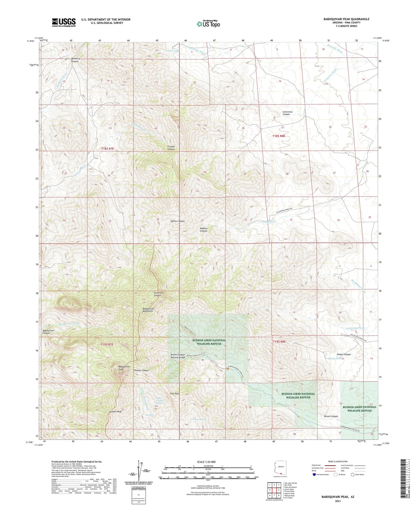
2021 topographic map quadrangle Baboquivari Peak in the state of Arizona. Scale: 1:24000. Based on the newly updated USGS 7.5' US Topo map series, this map is in the following counties: Pima. The map contains contour data, water features, and other items you are used to seeing on USGS maps, but also has updated roads and other features. This is the next generation of topographic maps. Printed on high-quality waterproof paper with UV fade-resistant inks.
Quads adjacent to this one:
West: Chiuli Shaik
Northwest: San Juan Spring
North: Kitt Peak
Northeast: Palo Alto Ranch
East: Fresno Wash
Southeast: Las Guijas
South: Mildred Peak
Southwest: Aguirre Peak
This map covers the same area as the classic USGS quad with code o31111g5.
Contains the following named places: Baboquivari Canyon, Baboquivari Mountains, Baboquivari Peak, Baboquivari Peak Wilderness, Broken Trough Spring, Brown Canyon, Brown Canyon Natural Bridge, Contreras Canyon, Diablo Canyon, Diablo Tank, Elkhorn Ranch, Itois Eyes, La Jolla Peak, Las Delicias Ranch, Max Seep, Mulberry Canyon, Nogales Canyon, Redondo Ranch, Redondo Wash, Sabino Canyon, Tinaja Spring, Virtud Tank