MyTopo
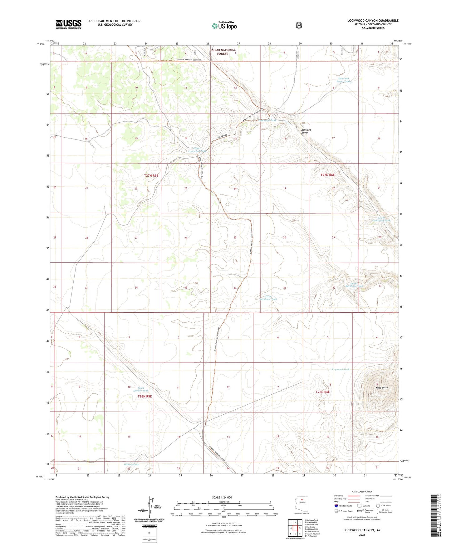
Lockwood Canyon Arizona US Topo Map
Couldn't load pickup availability
Also explore the Lockwood Canyon Forest Service Topo of this same quad for updated USFS data
2021 topographic map quadrangle Lockwood Canyon in the state of Arizona. Scale: 1:24000. Based on the newly updated USGS 7.5' US Topo map series, this map is in the following counties: Coconino. The map contains contour data, water features, and other items you are used to seeing on USGS maps, but also has updated roads and other features. This is the next generation of topographic maps. Printed on high-quality waterproof paper with UV fade-resistant inks.
Quads adjacent to this one:
West: Dog Knobs
Northwest: Harbison Tank
North: Peterson Flat
Northeast: Willows Camp
East: Additional Hill
Southeast: S P Mountain
South: Chapel Mountain
Southwest: Ebert Mountain
This map covers the same area as the classic USGS quad with code o35111f7.
Contains the following named places: Dent and Sayer Tank, Hibben Tank, Hidden Tank, Little Buckhorn Tank, Lockwood Tank, Lower Buckhorn Tank, Lower Lockwood Tank, Mesa Butte, Pearl Harbor Storage Tank, Pearl Harbor Tank, Raymond Tank, Upper Lockwood Tank