MyTopo
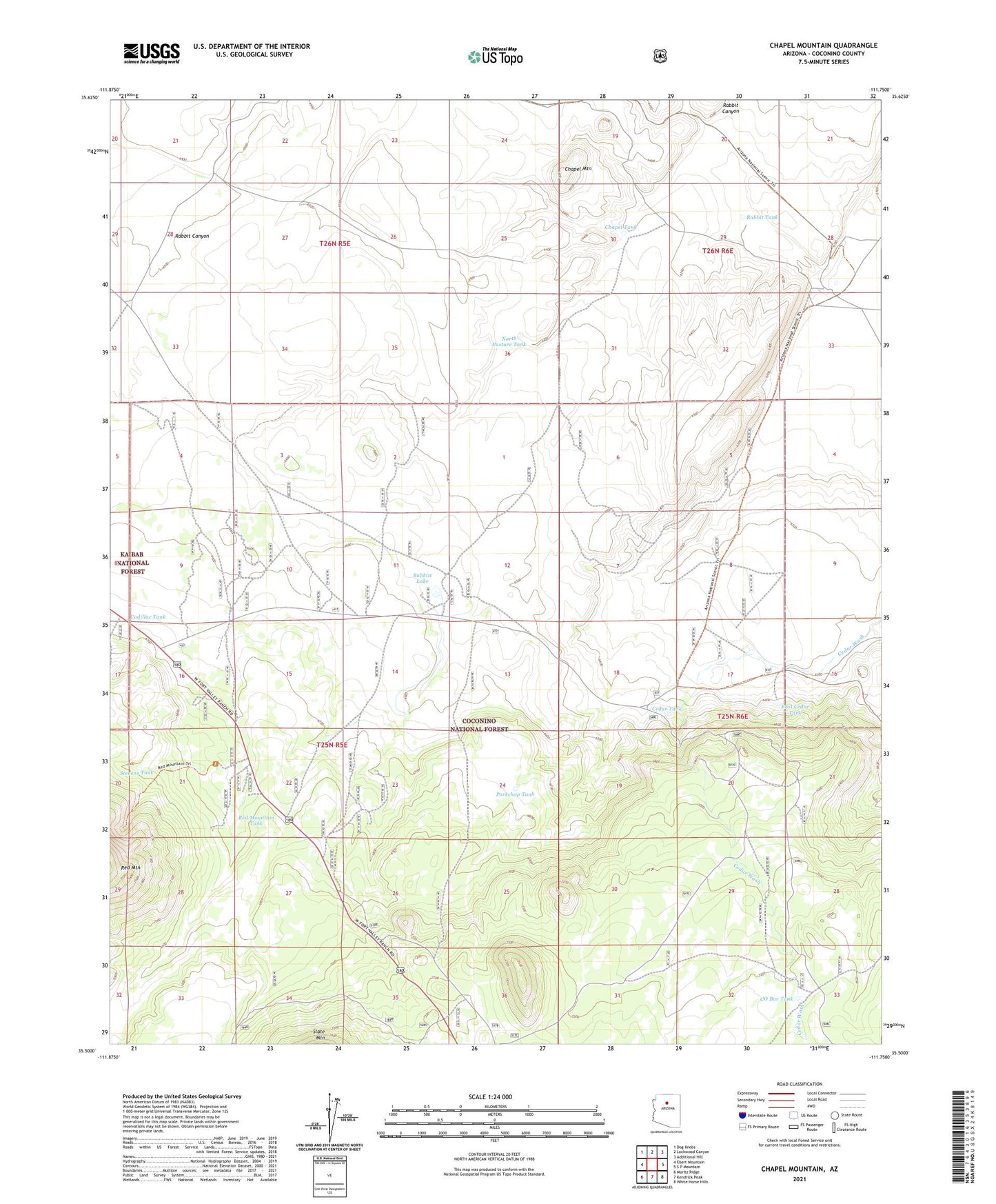
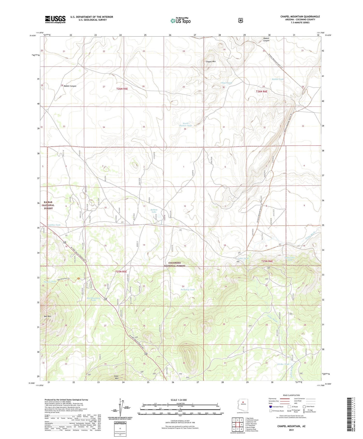
Chapel Mountain Arizona US Topo Map
Couldn't load pickup availability
Also explore the Chapel Mountain Forest Service Topo of this same quad for updated USFS data
2021 topographic map quadrangle Chapel Mountain in the state of Arizona. Scale: 1:24000. Based on the newly updated USGS 7.5' US Topo map series, this map is in the following counties: Coconino. The map contains contour data, water features, and other items you are used to seeing on USGS maps, but also has updated roads and other features. This is the next generation of topographic maps. Printed on high-quality waterproof paper with UV fade-resistant inks.
Quads adjacent to this one:
West: Ebert Mountain
Northwest: Dog Knobs
North: Lockwood Canyon
Northeast: Additional Hill
East: S P Mountain
Southeast: White Horse Hills
South: Kendrick Peak
Southwest: Moritz Ridge
This map covers the same area as the classic USGS quad with code o35111e7.
Contains the following named places: Babbitt Lake, Basin Well, Cadillac Tank, Cedar Ranch, Cedar Tank, Chapel Mountain, Chapel Tank, Cinder Tank, CO Bar Tank, Driftwood Tank, East Cedar Tank, Limestone Number Two Well, Limestone Well, North Pasture Tank, Porkchop Tank, Rabbit Canyon, Rabbit Tank, Red Mountain Tank, Slate Well, Stevens Tank, Tub Ranch