MyTopo
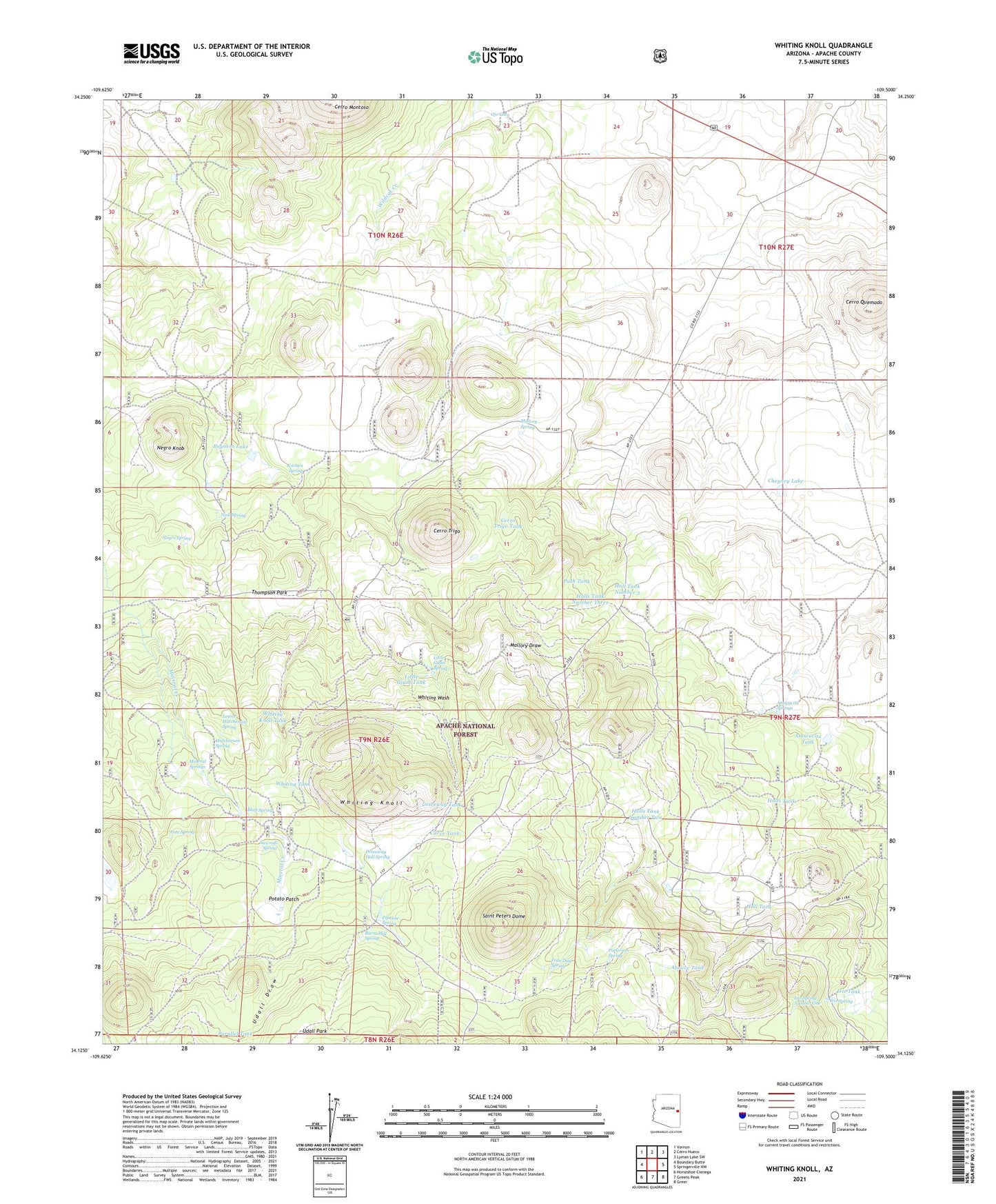
Whiting Knoll Arizona US Topo Map
Couldn't load pickup availability
Also explore the Whiting Knoll Forest Service Topo of this same quad for updated USFS data
2021 topographic map quadrangle Whiting Knoll in the state of Arizona. Scale: 1:24000. Based on the newly updated USGS 7.5' US Topo map series, this map is in the following counties: Apache. The map contains contour data, water features, and other items you are used to seeing on USGS maps, but also has updated roads and other features. This is the next generation of topographic maps. Printed on high-quality waterproof paper with UV fade-resistant inks.
Quads adjacent to this one:
West: Boundary Butte
Northwest: Vernon
North: Cerro Hueco
Northeast: Lyman Lake SW
East: Springerville NW
Southeast: Greer
South: Greens Peak
Southwest: Horseshoe Cienega
This map covers the same area as the classic USGS quad with code o34109b5.
Contains the following named places: Abouve Tank, Atascacita Springs, Atascacita Tank, Bluff Spring, Boynton Lake, Boynton Lake Dam, Burnt Mill Spring, Cerro Quemado, Cerro Trigo, Cerro Trigo Tank, Cheyney Lake, Crossbred Tank, Curve Tank, Driveway Hall Spring, Driveway Tank, Fran Day Spring, Hall Tank, Hall Tank Number 3, Halls Ranch, Halls Tank, Halls Tank Number One, Halls Tank Number Three, Halls Tank Number Two, Hutcherson Spring, Iris Spring, Iris Spring Number One, Iris Tank, Kitchen Spring, Little Giant Spring, Little Giant Tank, Little Halls Tank, Lower Hutcherson Spring, Mallory Spring, Mineral Springs, Neal Spring, Negro Knob, Negro Spring, Ojo Gato, Parallel Tank, Pate Spring, Patterson Spring, Pipeline Spring, Pipeline tank, Potato Patch, Powerline Tank, Push Tank, Red Cabin, Saint Peters Dome, Sawmill Spring, Thompson Park, Thompson Park Tank, Udall Draw, Whiting Homestead, Whiting Knoll, Whiting Knoll Tank, Whiting Tank