MyTopo
Maverick Arizona US Topo Map
Couldn't load pickup availability
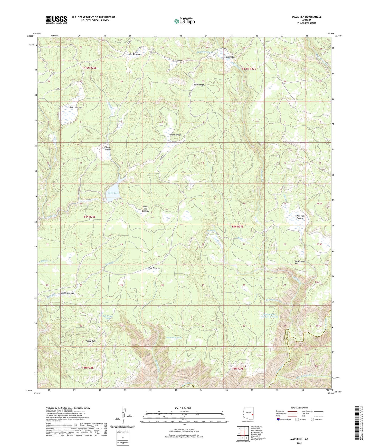
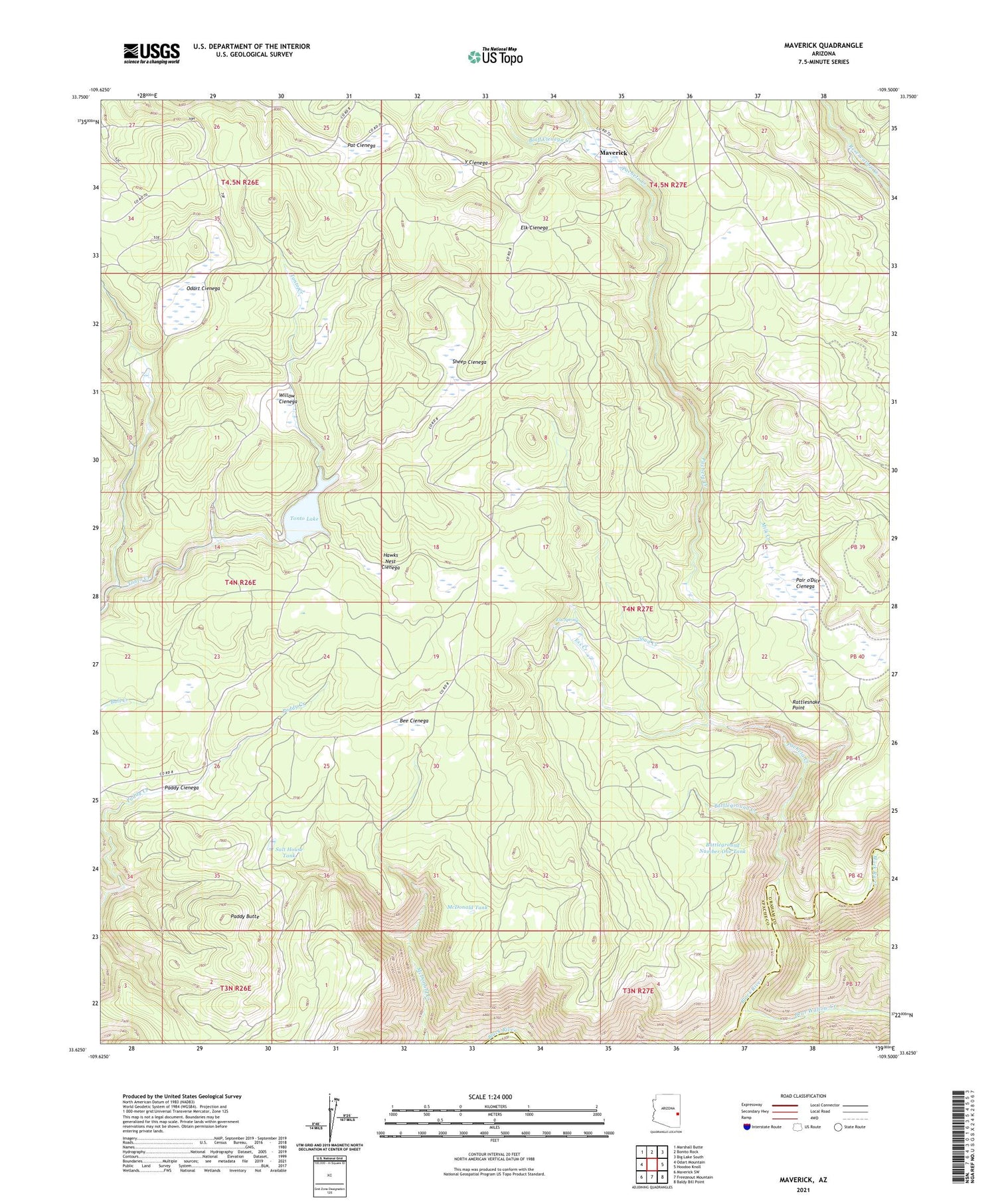
2021 topographic map quadrangle Maverick in the state of Arizona. Scale: 1:24000. Based on the newly updated USGS 7.5' US Topo map series, this map is in the following counties: Apache, Graham. The map contains contour data, water features, and other items you are used to seeing on USGS maps, but also has updated roads and other features. This is the next generation of topographic maps. Printed on high-quality waterproof paper with UV fade-resistant inks.
Quads adjacent to this one:
West: Odart Mountain
Northwest: Marshall Butte
North: Bonito Rock
Northeast: Big Lake South
East: Hoodoo Knoll
Southeast: Baldy Bill Point
South: Freezeout Mountain
Southwest: Maverick SW
This map covers the same area as the classic USGS quad with code o33109f5.
Contains the following named places: Battleground Creek, Battleground Number One Tank, Bear Creek, Bear Wallow Creek, Bee Cienega, Bluff Cienega Creek, Elk Cienega, Ess Creek, Ess Spring, Hawks Nest Cienega, Maverick, McDonald Tank, Milk Creek, Odart Cienega, Odart Ranch, Pacheta Creek, Paddy Butte, Paddy Cienega, Pair o'Dice Cienega, Pair o'Dice Ranch, Pat Cienega, Rattlesnake Point, Salt House Tank, Sheep Cienega, Spud Creek, Tonto Dam, Tonto Lake, Willow Cienega, Y Cienega