
MyTopo
Freezeout Mountain Arizona US Topo Map
Couldn't load pickup availability
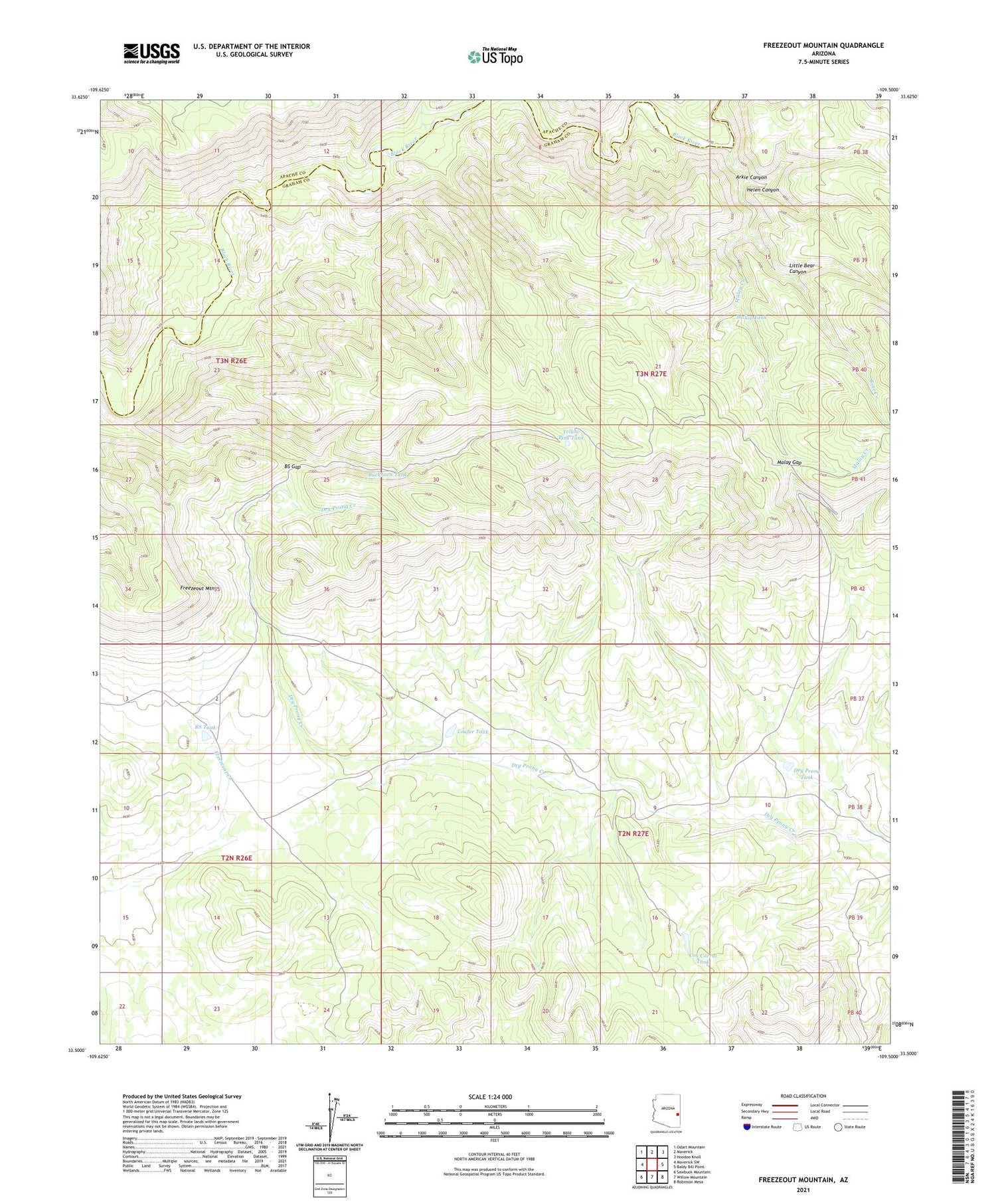
2021 topographic map quadrangle Freezeout Mountain in the state of Arizona. Scale: 1:24000. Based on the newly updated USGS 7.5' US Topo map series, this map is in the following counties: Graham, Apache. The map contains contour data, water features, and other items you are used to seeing on USGS maps, but also has updated roads and other features. This is the next generation of topographic maps. Printed on high-quality waterproof paper with UV fade-resistant inks.
Quads adjacent to this one:
West: Maverick SW
Northwest: Odart Mountain
North: Maverick
Northeast: Hoodoo Knoll
East: Baldy Bill Point
Southeast: Robinson Mesa
South: Willow Mountain
Southwest: Sawbuck Mountain
This map covers the same area as the classic USGS quad with code o33109e5.
Contains the following named places: Arkie Canyon, BS Gap, BS Tank, Buckhorn Tank, Cox Corral Tank, Dry Prong Dam, Dry Prong Tank, Freezeout Mountain, Helen Canyon, Little Bear Canyon, Loafer Dam, Loafer Tank, Malay Creek, Malay Gap, Malay Tank, McDonald Creek, Rose Creek, Yellow Pine Tank


