MyTopo
Maverick SW Arizona US Topo Map
Couldn't load pickup availability
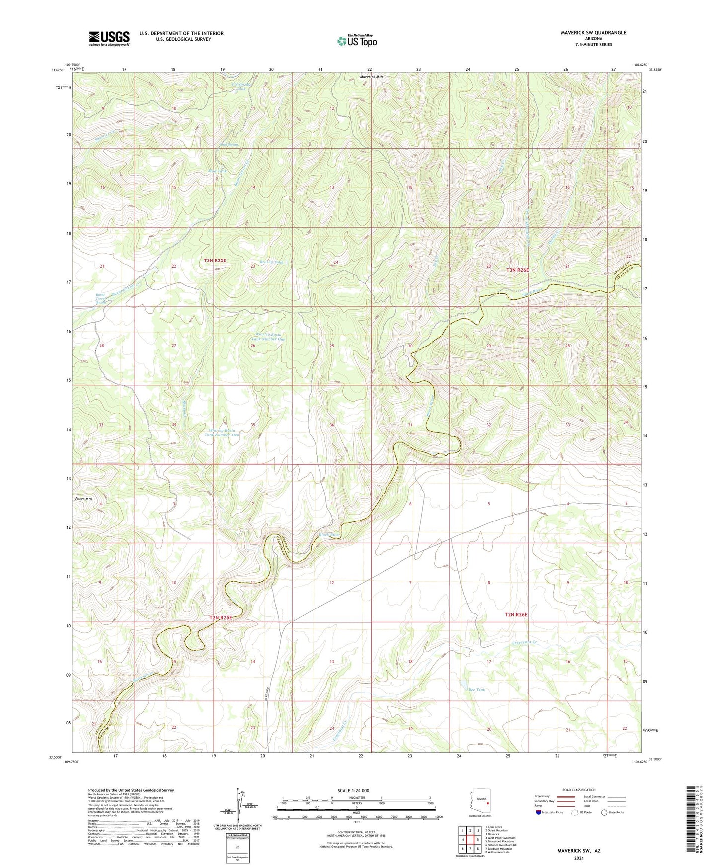
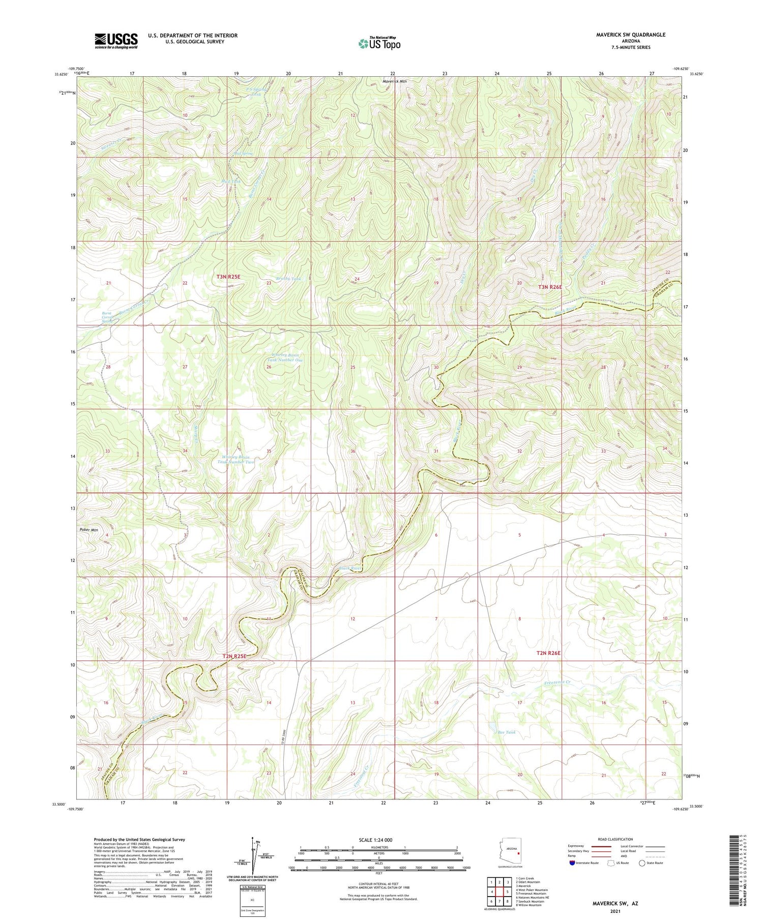
2021 topographic map quadrangle Maverick SW in the state of Arizona. Scale: 1:24000. Based on the newly updated USGS 7.5' US Topo map series, this map is in the following counties: Apache, Graham. The map contains contour data, water features, and other items you are used to seeing on USGS maps, but also has updated roads and other features. This is the next generation of topographic maps. Printed on high-quality waterproof paper with UV fade-resistant inks.
Quads adjacent to this one:
West: West Poker Mountain
Northwest: Corn Creek
North: Odart Mountain
Northeast: Maverick
East: Freezeout Mountain
Southeast: Willow Mountain
South: Sawbuck Mountain
Southwest: Natanes Mountains NE
This map covers the same area as the classic USGS quad with code o33109e6.
Contains the following named places: Bee Dam, Bee Tank, Brushy Tank, Burnt Corral Spring, Dry Creek, Mud Spring, Mud Tank, P S Spring Tank, Paddy Creek, Sharp Creek, Ten of Diamonds Creek, Ten of Diamonds Ranch, Whirley Basin Tank Number One, Whirley Basin Tank Number Two