MyTopo
Miller Tank Arizona US Topo Map
Couldn't load pickup availability
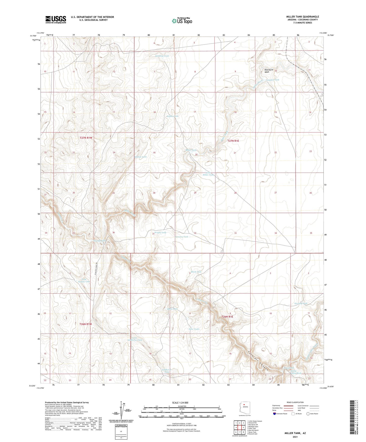
2021 topographic map quadrangle Miller Tank in the state of Arizona. Scale: 1:24000. Based on the newly updated USGS 7.5' US Topo map series, this map is in the following counties: Coconino. The map contains contour data, water features, and other items you are used to seeing on USGS maps, but also has updated roads and other features. This is the next generation of topographic maps. Printed on high-quality waterproof paper with UV fade-resistant inks.
Quads adjacent to this one:
West: Markham Dam
Northwest: Little Harpo Canyon
North: Howard Hill
Northeast: Red Butte SW
East: Valle Tank
Southeast: Howard Lake
South: Mixon Tank
Southwest: Red Hill Ranch
This map covers the same area as the classic USGS quad with code o35112f3.
Contains the following named places: Babbitt Tank, Black Tank, Dorothy Tank, Hibbin Tank, Islands Tank, January Tank, Little Miller Tank, Little Wildhorse Tank, Lumpkin Tank, Miller Tank, Miller Wash, Red Horse Wash, Spring Valley Wash, Tank Number One, Trail Tank, Twin Tanks, Wedding Tank, Wildhorse Tank, Wright Tank