MyTopo
Mixon Tank Arizona US Topo Map
Couldn't load pickup availability
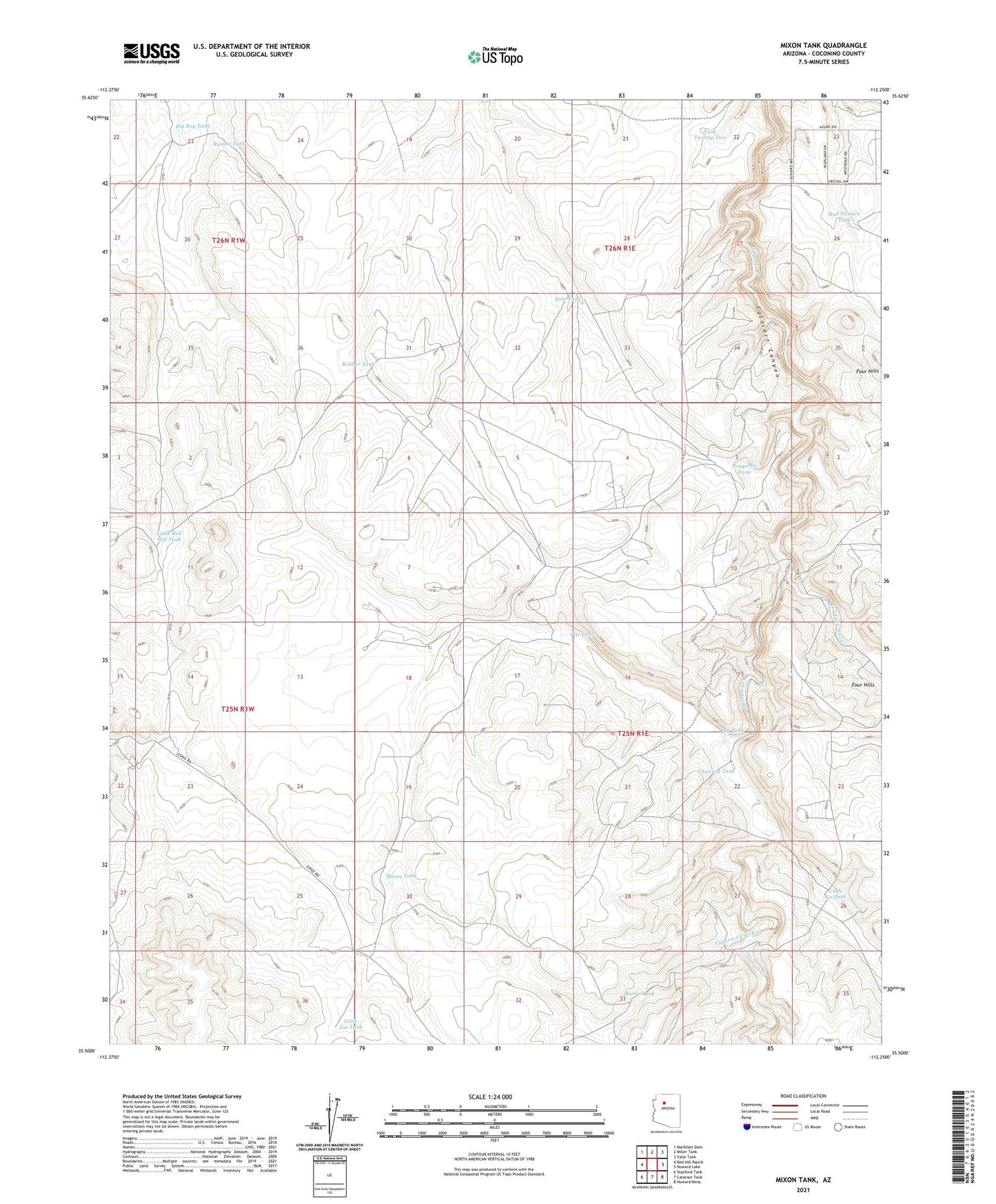
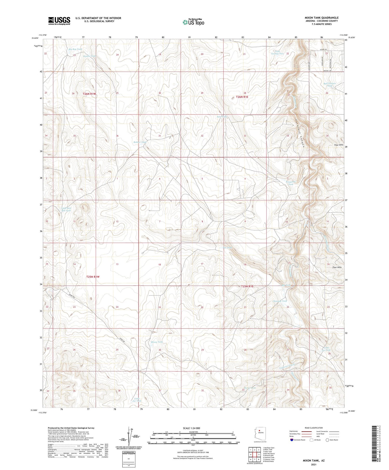
2021 topographic map quadrangle Mixon Tank in the state of Arizona. Scale: 1:24000. Based on the newly updated USGS 7.5' US Topo map series, this map is in the following counties: Coconino. The map contains contour data, water features, and other items you are used to seeing on USGS maps, but also has updated roads and other features. This is the next generation of topographic maps. Printed on high-quality waterproof paper with UV fade-resistant inks.
Quads adjacent to this one:
West: Red Hill Ranch
Northwest: Markham Dam
North: Miller Tank
Northeast: Valle Tank
East: Howard Lake
Southeast: Howard Mesa
South: Cataract Tank
Southwest: Stanford Tank
This map covers the same area as the classic USGS quad with code o35112e3.
Contains the following named places: Big Boy Tank, Big Tank, Bull Pasture Tank, Burro Tank, Chimney Tank, Little Joe Tank, Little Lo Tank, Little Red Hill Tank, Mixon Tank, New Tank, Pitt Tank, Pouquette Tank, Rambo Tank, Red Lake Wash, Robber Tank, Tank Twenty-Two