MyTopo
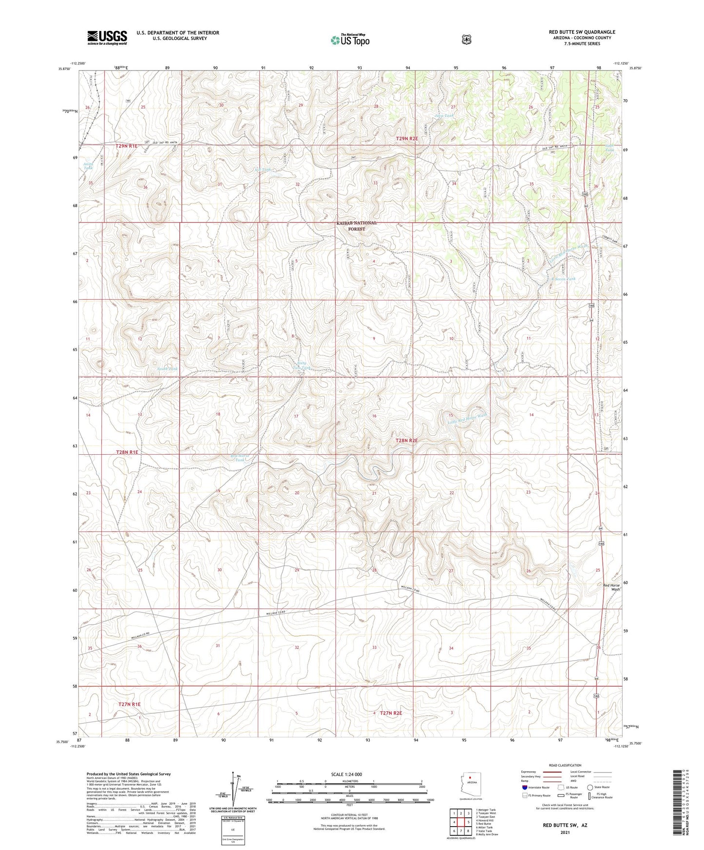
Red Butte SW Arizona US Topo Map
Couldn't load pickup availability
Also explore the Red Butte SW Forest Service Topo of this same quad for updated USFS data
2021 topographic map quadrangle Red Butte SW in the state of Arizona. Scale: 1:24000. Based on the newly updated USGS 7.5' US Topo map series, this map is in the following counties: Coconino. The map contains contour data, water features, and other items you are used to seeing on USGS maps, but also has updated roads and other features. This is the next generation of topographic maps. Printed on high-quality waterproof paper with UV fade-resistant inks.
Quads adjacent to this one:
West: Howard Hill
Northwest: Metzger Tank
North: Tusayan West
Northeast: Tusayan East
East: Red Butte
Southeast: Molly Ann Draw
South: Valle Tank
Southwest: Miller Tank
This map covers the same area as the classic USGS quad with code o35112g2.
Contains the following named places: Anita Station, Anita Tank, Copper Queen Mine, Java Tank, Little Red Horse Wash, R Seven Tank, Red Horse Tank, Sage Tank, Sixty Two Tank, South Tank, South Trick Tank, X B Tank