MyTopo
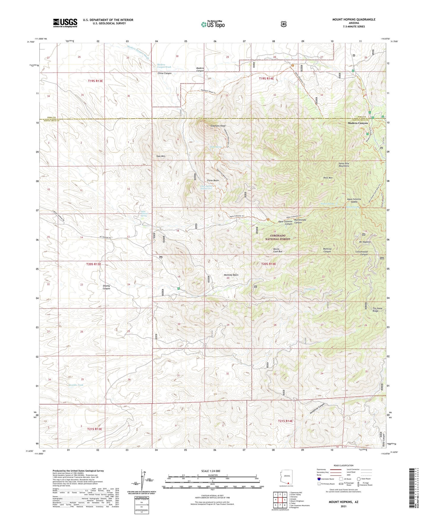
Mount Hopkins Arizona US Topo Map
Couldn't load pickup availability
Also explore the Mount Hopkins Forest Service Topo of this same quad for updated USFS data
2021 topographic map quadrangle Mount Hopkins in the state of Arizona. Scale: 1:24000. Based on the newly updated USGS 7.5' US Topo map series, this map is in the following counties: Santa Cruz, Pima. The map contains contour data, water features, and other items you are used to seeing on USGS maps, but also has updated roads and other features. This is the next generation of topographic maps. Printed on high-quality waterproof paper with UV fade-resistant inks.
Quads adjacent to this one:
West: Amado
Northwest: Esperanza Mill
North: Green Valley
Northeast: Helvetia
East: Mount Wrightson
Southeast: Patagonia
South: San Cayetano Mountains
Southwest: Tubac
This map covers the same area as the classic USGS quad with code o31110f8.
Contains the following named places: Agua Caliente Saddle, Agua Caliente Spring, Bergier Tank, Bog Springs Campground, Bull Springs Mine, Chino Basin, Chino Canyon, Chino Spring, Chino Spring Number Two, Compadre Mine, Devils Cash Box, Elephant Head, Eureka Mine, Glove Mine, Helvetia Mine, Hermits Home Mine, Iron Spring, Josephine Saddle Madera Trail Number 134, KMSB-TV (Nogales), KZAZ-TV (Nogales), Leroy Mine, Madera Administrative Site, Madera Canyon, Madora Picnic Area, Montosa Basin, Montosa Mine, Mount Hopkins, Ocotillo Tank, Pete Mountain, Proctor Ranch, Quantrell Mine, Rattlesnake Canyon, Santa Rita Lodge, Smithsonian Astrophysical Observatory, Tia Juana Ridge, Treasure Vault Mine, Vault Mine Trail One Hundred Forty, Walnut Spring, Yoas Mountain, ZIP Code: 85646