MyTopo
Amado Arizona US Topo Map
Couldn't load pickup availability
Also explore the Amado Forest Service Topo of this same quad for updated USFS data
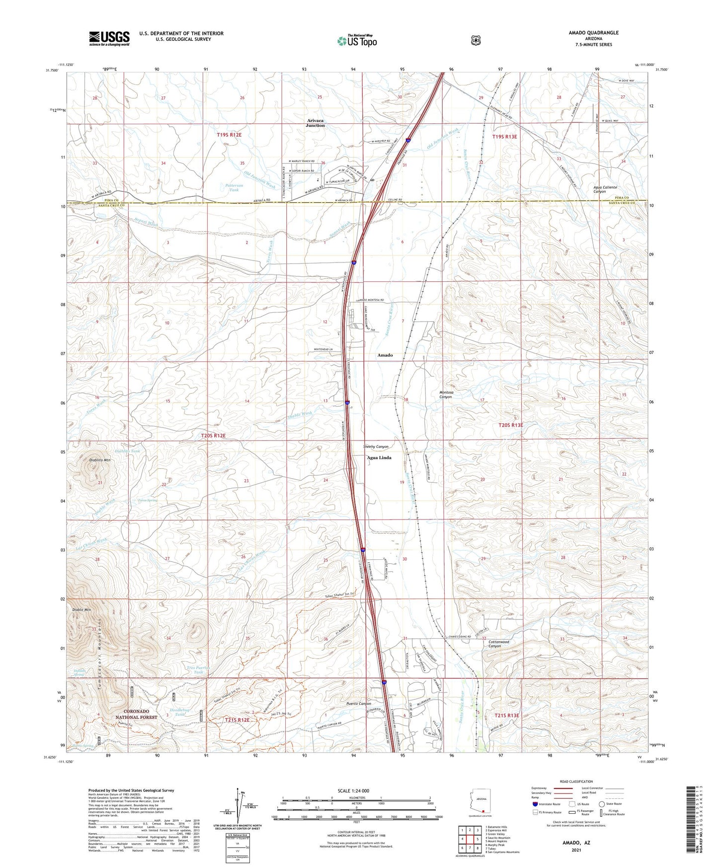
2021 topographic map quadrangle Amado in the state of Arizona. Scale: 1:24000. Based on the newly updated USGS 7.5' US Topo map series, this map is in the following counties: Santa Cruz, Pima. The map contains contour data, water features, and other items you are used to seeing on USGS maps, but also has updated roads and other features. This is the next generation of topographic maps. Printed on high-quality waterproof paper with UV fade-resistant inks.
Quads adjacent to this one:
West: Saucito Mountain
Northwest: Batamote Hills
North: Esperanza Mill
Northeast: Green Valley
East: Mount Hopkins
Southeast: San Cayetano Mountains
South: Tubac
Southwest: Murphy Peak
This map covers the same area as the classic USGS quad with code o31111f1.
Contains the following named places: Agua Linda, Amado, Amado Census Designated Place, Amado Post Office, Arivaca Junction, Arivaca Junction Census Designated Place, Chaves, Cottonwood Canyon, De Anza Trails Recreational Vehicle Resort, Diablito Mountain, Diablito Spring, Diablito Tank, Diablo Mountain, Diablo Wash, Diablo Well, Doodlebug Tank, Las Chivas Wash, Lupe Well, Montosa Canyon, New Well, Old Junction Wash, Otero Land Grant, P M Ranch, Patterson Tank, Pina Sopori Ranch, Puerto Canyon, Puerto Spring, Rex Ranch, Rex Well, Sheehy Canyon, Sopori Elementary School, Sopori Ranch, Sopori Wash, Sotos Crossing, Toros Spring, Toros Wash, Tres Puertas Tank, Tres Puertas Well, Tubac Golf Resort