MyTopo
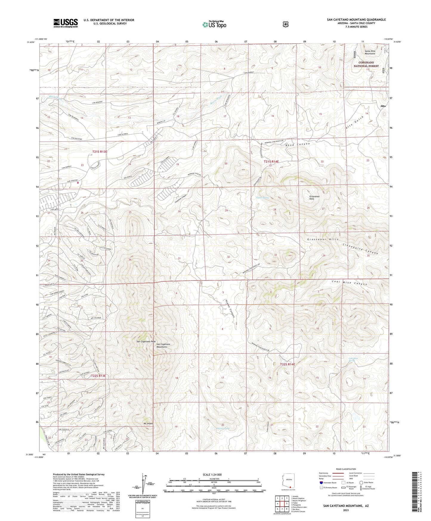
San Cayetano Mountains Arizona US Topo Map
Couldn't load pickup availability
Also explore the San Cayetano Mountains Forest Service Topo of this same quad for updated USFS data
2021 topographic map quadrangle San Cayetano Mountains in the state of Arizona. Scale: 1:24000. Based on the newly updated USGS 7.5' US Topo map series, this map is in the following counties: Santa Cruz. The map contains contour data, water features, and other items you are used to seeing on USGS maps, but also has updated roads and other features. This is the next generation of topographic maps. Printed on high-quality waterproof paper with UV fade-resistant inks.
Quads adjacent to this one:
West: Tubac
Northwest: Amado
North: Mount Hopkins
Northeast: Mount Wrightson
East: Patagonia
Southeast: Cumero Canyon
South: Rio Rico
Southwest: Pena Blanca Lake
This map covers the same area as the classic USGS quad with code o31110e8.
Contains the following named places: Alamo Canyon, Alto, Alto Gulch, Bergier Ranch, Bond Canyon, Chivas Tank, Coal Mine Canyon, Coal Mine Spring, Finleys, Grosvenor Hills, Hacienda del Santa Rita, Josephine Canyon Trail Number 133, Luis Maria Baca Grant, Mount Shibell, Rio Rico Northeast Census Designated Place, Salero Ranch, San Cayetano Mountains, San Cayetano Peak, Sheuy Well, Tejano Spring, Tubutana Mine