MyTopo
Oak Creek Ranch Arizona US Topo Map
Couldn't load pickup availability
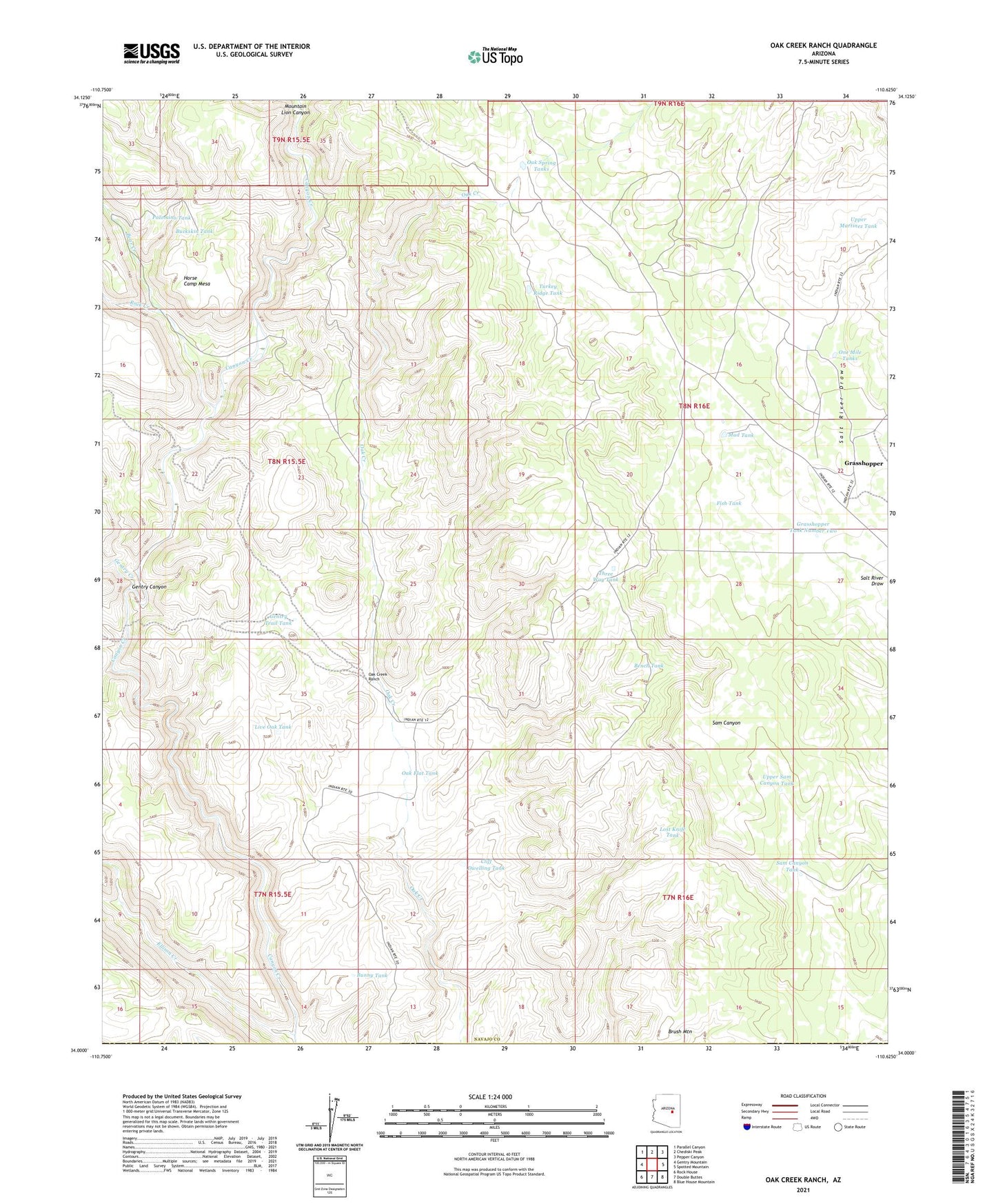
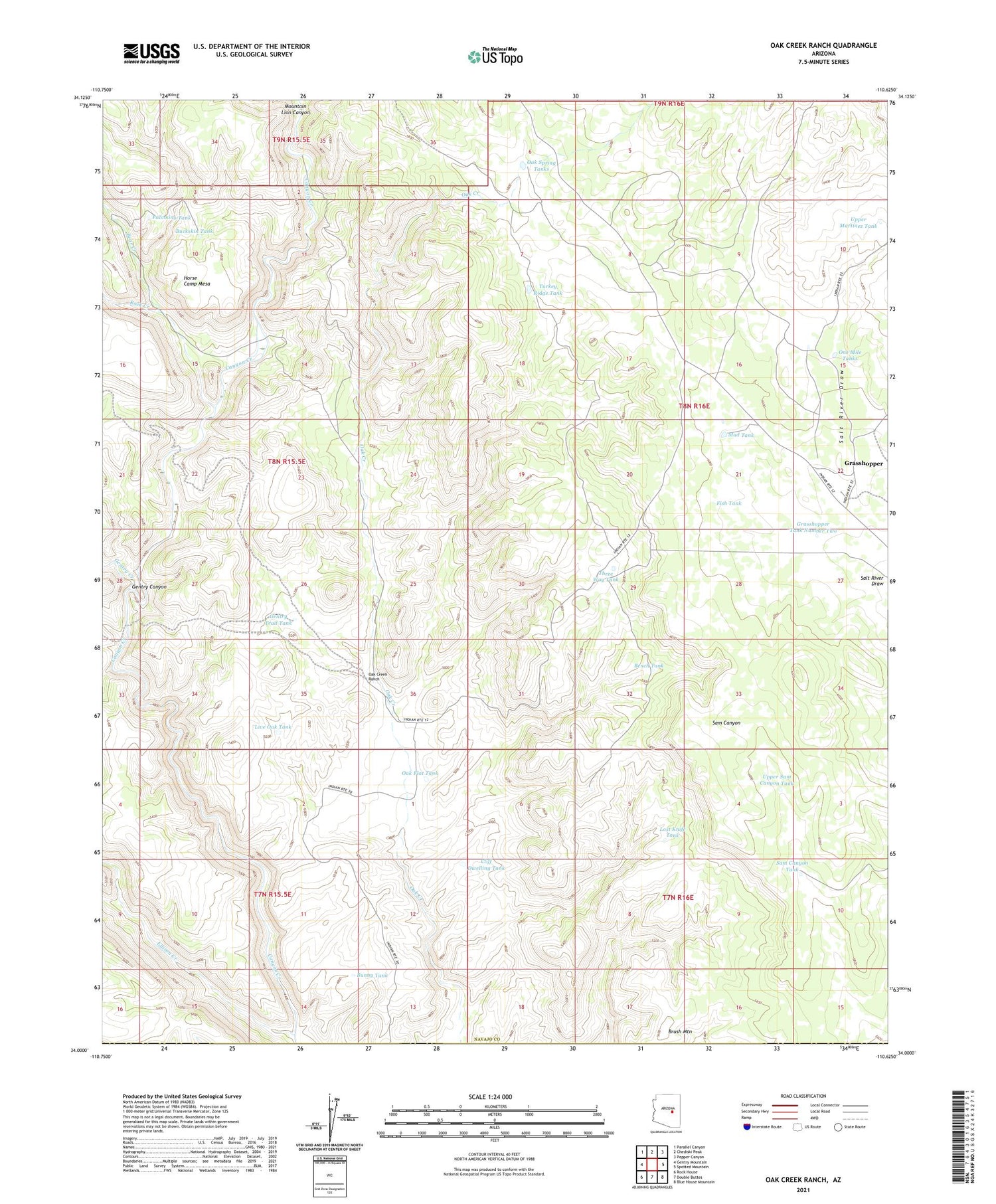
2021 topographic map quadrangle Oak Creek Ranch in the state of Arizona. Scale: 1:24000. Based on the newly updated USGS 7.5' US Topo map series, this map is in the following counties: Navajo, Gila. The map contains contour data, water features, and other items you are used to seeing on USGS maps, but also has updated roads and other features. This is the next generation of topographic maps. Printed on high-quality waterproof paper with UV fade-resistant inks.
Quads adjacent to this one:
West: Gentry Mountain
Northwest: Parallel Canyon
North: Chediski Peak
Northeast: Pepper Canyon
East: Spotted Mountain
Southeast: Blue House Mountain
South: Double Buttes
Southwest: Rock House
This map covers the same area as the classic USGS quad with code o34110a6.
Contains the following named places: Bear Creek, Bench Tank, Brush Mountain, Buckskin Tank, Bunny Tank, Cliff Dwelling Tank, Ellison Creek, Fish Tank, Gentry Canyon, Gentry Trail Tank, Grasshopper, Grasshopper Tank Number Two, Horse Camp Mesa, Live Oak Tank, Lost Knife Tank, Mountain Lion Canyon, Mud Tank, Oak Creek Ranch, Oak Flat Tank, Oak Spring Tanks, One Mile Tanks, Palomino Tank, Rock Creek, Sam Canyon Tank, Three Way Tank, Turkey Ridge Tank, Upper Martinez Tank, Upper Sam Canyon Tank, Whiskey Trail