
MyTopo
Blue House Mountain Arizona US Topo Map
Couldn't load pickup availability
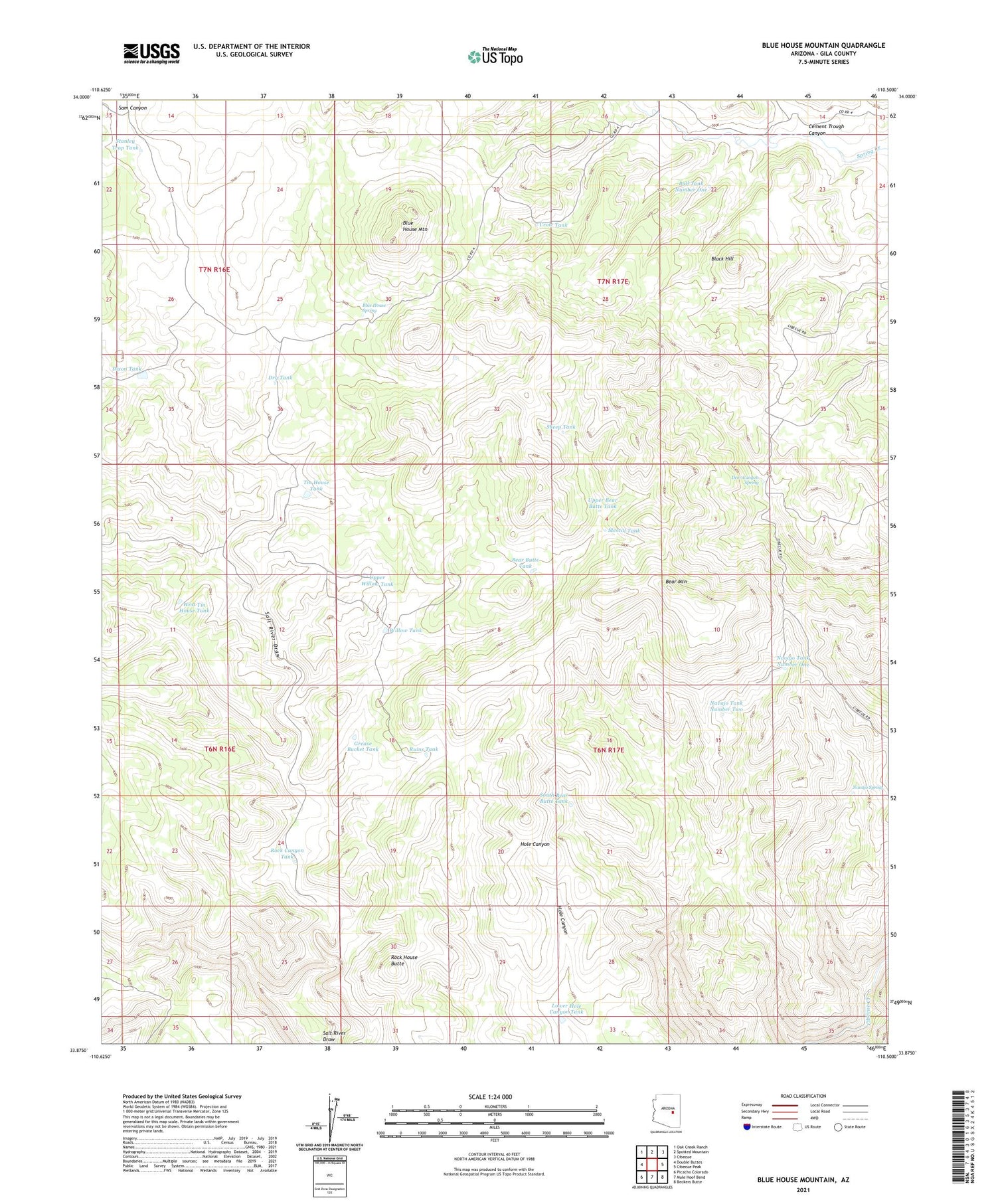
2021 topographic map quadrangle Blue House Mountain in the state of Arizona. Scale: 1:24000. Based on the newly updated USGS 7.5' US Topo map series, this map is in the following counties: Gila. The map contains contour data, water features, and other items you are used to seeing on USGS maps, but also has updated roads and other features. This is the next generation of topographic maps. Printed on high-quality waterproof paper with UV fade-resistant inks.
Quads adjacent to this one:
West: Double Buttes
Northwest: Oak Creek Ranch
North: Spotted Mountain
Northeast: Cibecue
East: Cibecue Peak
Southeast: Beckers Butte
South: Mule Hoof Bend
Southwest: Picacho Colorado
This map covers the same area as the classic USGS quad with code o33110h5.
Contains the following named places: Bear Butte Tank, Bear Mountain, Black Hill, Blue House Mountain, Blue House Spring, Brown Cabin Tank, Bull Tank Number One, Cement Trough Canyon, Checker Tank, Crow Tank, Deer Canyon Spring, Dixon Tank, Dry Tank, Grease Bucket Tank, Hole Canyon Tank, Lower Hole Canyon Tank, Mescal Tank, Navajo Spring, Navajo Tank Number One, Navajo Tank Number Two, Rock Canyon Tank, Rock House Butte, Rock House Tank, Ruins Tank, Sam Canyon, Sheep Tank, South Bear Butte Tank, Stanley Trap Tank, Tin House Tank, Upper Bear Butte Tank, Upper Willow Tank, West Tin House Tank, Willow Tank


