MyTopo
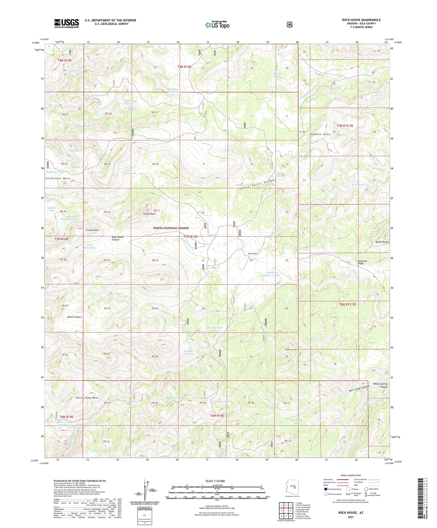
Rock House Arizona US Topo Map
Couldn't load pickup availability
Also explore the Rock House Forest Service Topo of this same quad for updated USFS data
2021 topographic map quadrangle Rock House in the state of Arizona. Scale: 1:24000. Based on the newly updated USGS 7.5' US Topo map series, this map is in the following counties: Gila. The map contains contour data, water features, and other items you are used to seeing on USGS maps, but also has updated roads and other features. This is the next generation of topographic maps. Printed on high-quality waterproof paper with UV fade-resistant inks.
Quads adjacent to this one:
West: McFadden Peak
Northwest: Young
North: Gentry Mountain
Northeast: Oak Creek Ranch
East: Double Buttes
Southeast: Picacho Colorado
South: Sombrero Peak
Southwest: Aztec Peak
This map covers the same area as the classic USGS quad with code o33110h7.
Contains the following named places: Asbestos Spring, Asbestos Tank, Brush Top Tank, Brushy Top Mountain, Campbell Creek, Castle Butte Tank, Castle Peak, Copper Fork Tank, Cross Tank, Dead Cow Spring, Devils Playground Tank, Double Buttes, Dry Bone Tank, Duett Branch Tank, Duett Tank, Gunsight Butte, Hobble Mesa, Horse Camp, Horse Camp Mesa, Horse Camp Mesa Tank, Horse Camp Windmill, Horse Canyon Tank, House Spring, Ironside Hill Tank, Juniper Tank, Lacey Forks Canyon, Lone Pine Tank, Middle Pasture Tank, Middle Spring, Middle Tank, Middle Trap Spring, Middleton Mesa Spring, Mineral Tank, Pendleton Mesa, Rock House, Rodgers Tank, Sidehill Tank, Skid Tank, Well Camp Canyon, Well Camp Tank