MyTopo
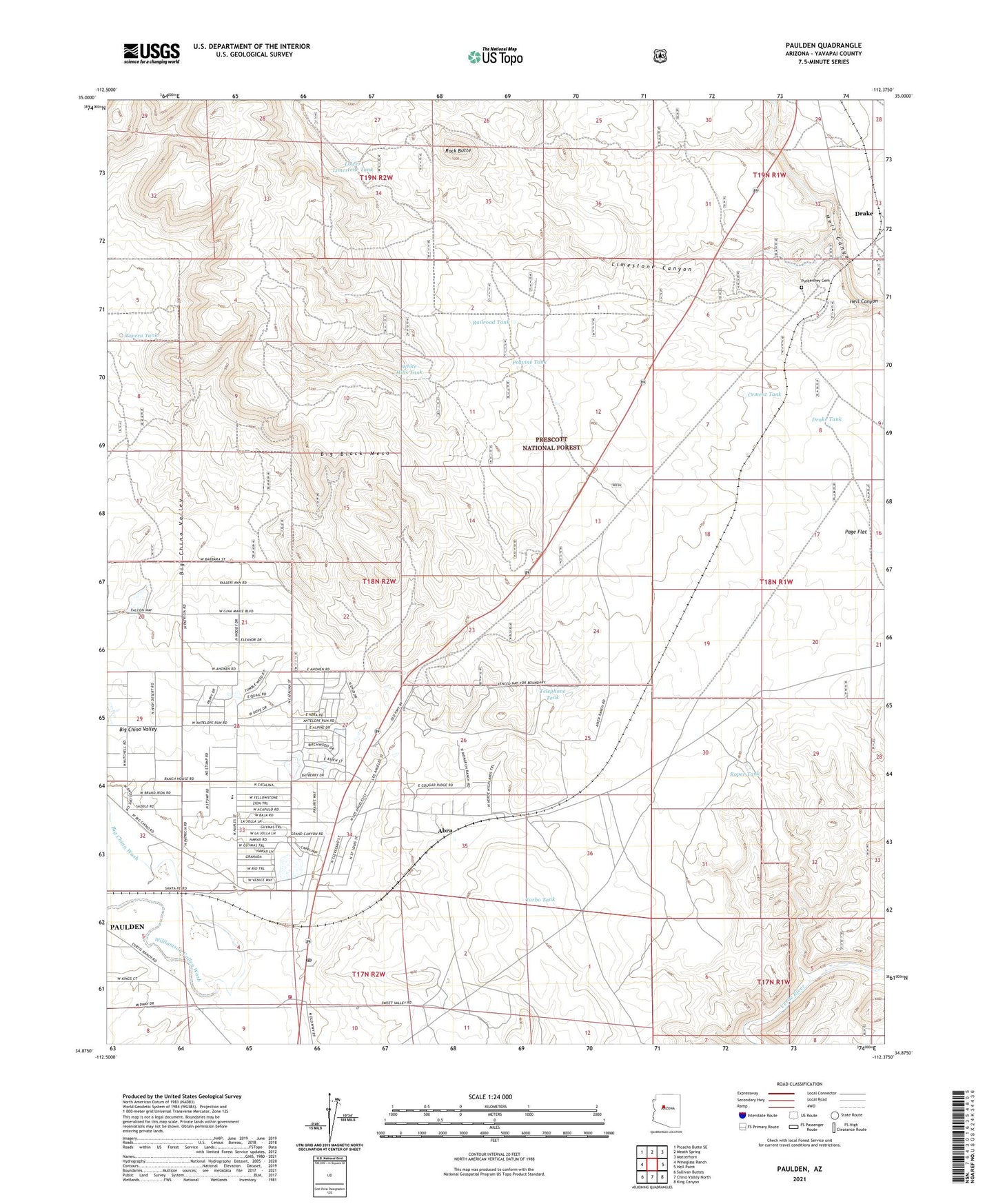
Paulden Arizona US Topo Map
Couldn't load pickup availability
Also explore the Paulden Forest Service Topo of this same quad for updated USFS data
2021 topographic map quadrangle Paulden in the state of Arizona. Scale: 1:24000. Based on the newly updated USGS 7.5' US Topo map series, this map is in the following counties: Yavapai. The map contains contour data, water features, and other items you are used to seeing on USGS maps, but also has updated roads and other features. This is the next generation of topographic maps. Printed on high-quality waterproof paper with UV fade-resistant inks.
Quads adjacent to this one:
West: Wineglass Ranch
Northwest: Picacho Butte SE
North: Meath Spring
Northeast: Matterhorn
East: Hell Point
Southeast: King Canyon
South: Chino Valley North
Southwest: Sullivan Buttes
This map covers the same area as the classic USGS quad with code o34112h4.
Contains the following named places: Abra, Abra Railroad Station, Big Chino Valley, Big Chino Wash, Cement Tank, Chino Valley Fire District Station 63, Drake, Drake Railroad Station, Drake Tank, Hells Well, Limestone Canyon, Lower Limestone Tank, Paulden, Paulden Census Designated Place, Paulden Community School, Paulden Post Office, Peavine Tank, Puntenney Cemetery, Railroad Tank, Rock Butte, Roper Tank, Telephone Tank, Tovera Tank, Tract 38, Tract 39, Trick Tank, White Hills Tank, Williamson Valley Wash, Yarbo Tank