MyTopo
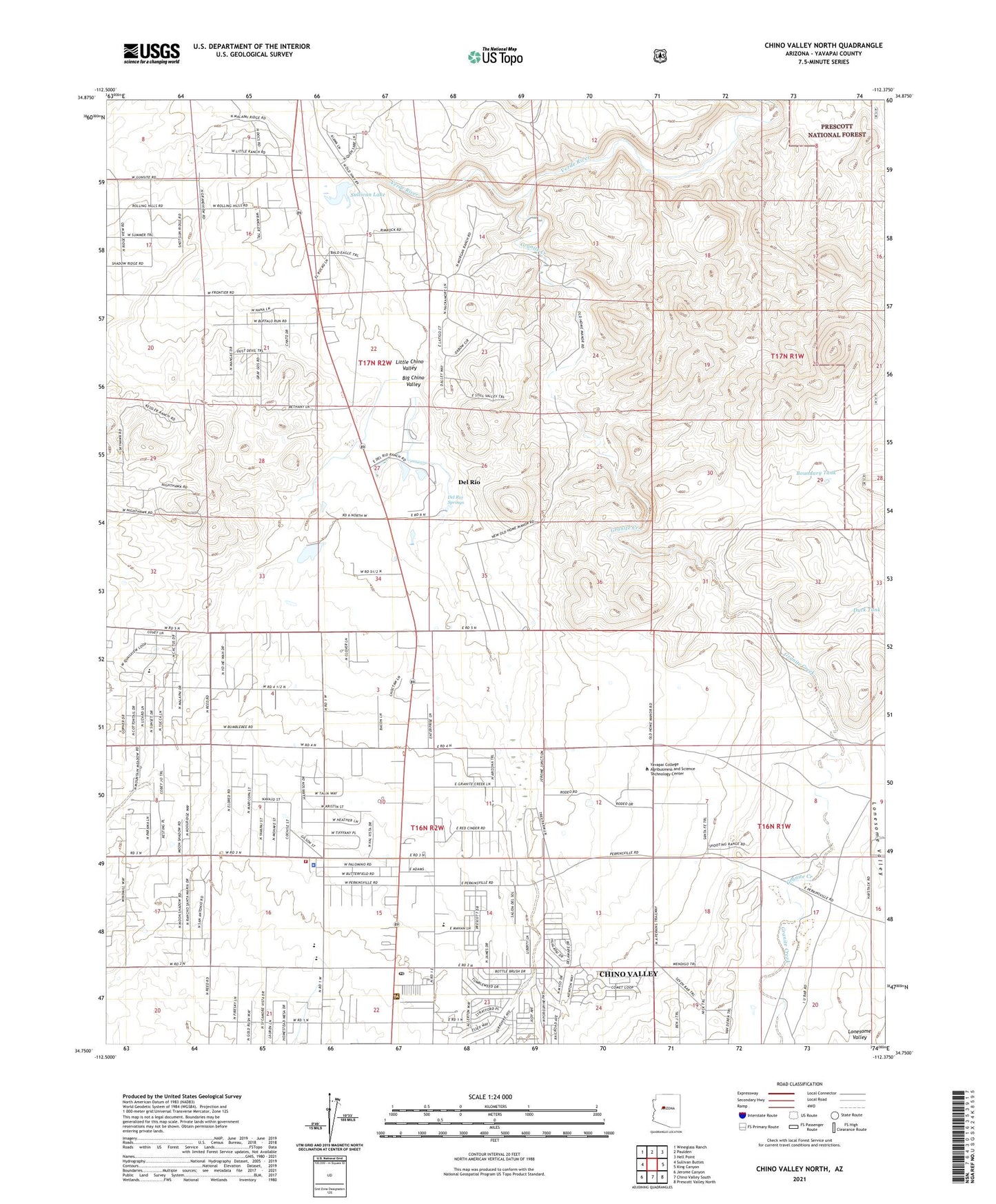
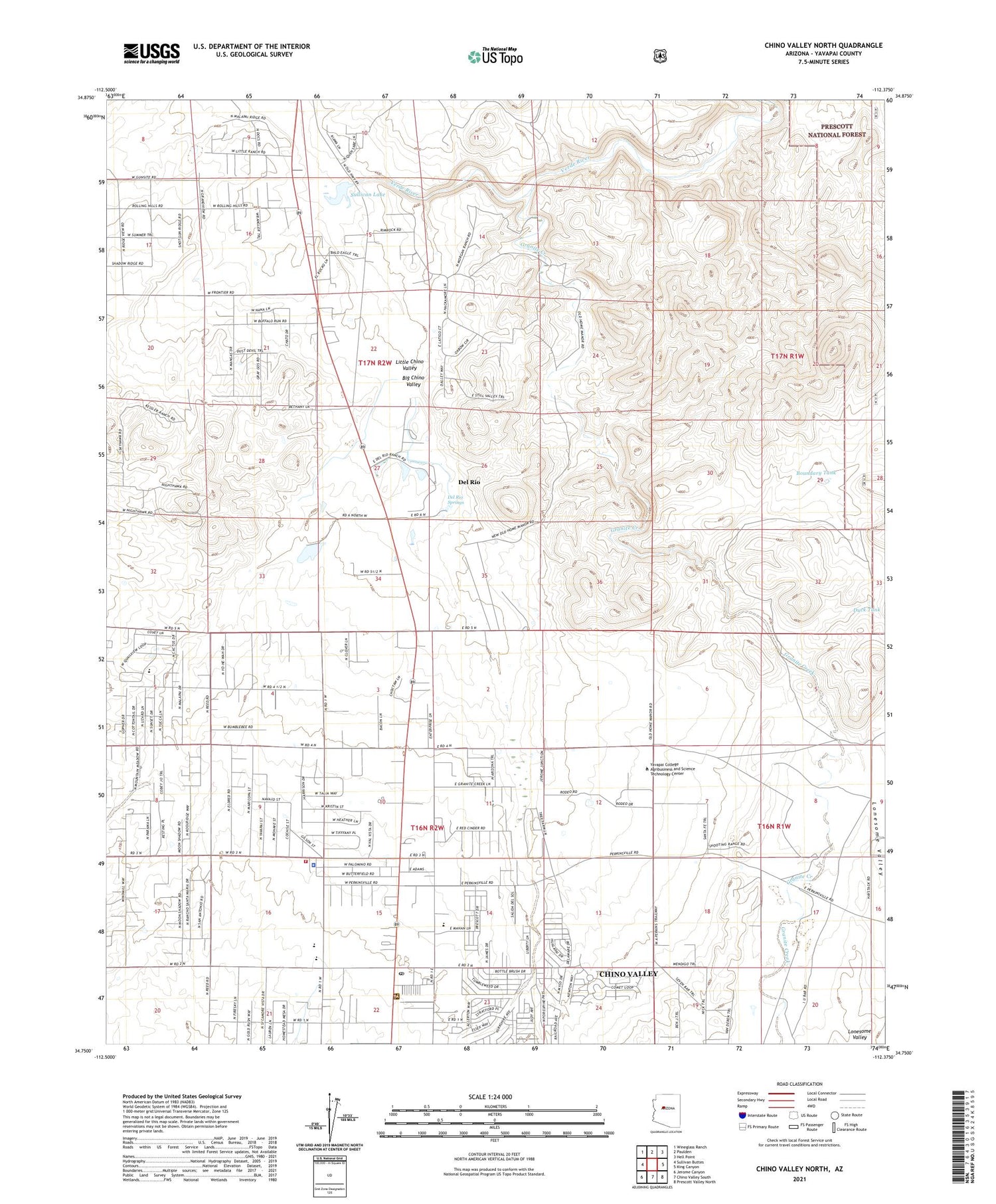
Chino Valley North Arizona US Topo Map
Couldn't load pickup availability
Also explore the Chino Valley North Forest Service Topo of this same quad for updated USFS data
2021 topographic map quadrangle Chino Valley North in the state of Arizona. Scale: 1:24000. Based on the newly updated USGS 7.5' US Topo map series, this map is in the following counties: Yavapai. The map contains contour data, water features, and other items you are used to seeing on USGS maps, but also has updated roads and other features. This is the next generation of topographic maps. Printed on high-quality waterproof paper with UV fade-resistant inks.
Quads adjacent to this one:
West: Sullivan Buttes
Northwest: Wineglass Ranch
North: Paulden
Northeast: Hell Point
East: King Canyon
Southeast: Prescott Valley North
South: Chino Valley South
Southwest: Jerome Canyon
This map covers the same area as the classic USGS quad with code o34112g4.
Contains the following named places: Arizona Highway Maintenance Chino Valley Yard, Bible Baptist Church, Boundary Tank, Chino Valley, Chino Valley Community Church, Chino Valley District Ranger Office, Chino Valley Fire District Station 61, Chino Valley Police Department, Chino Valley Post Office, Chino Valley Public Library, Chino Valley Word of Life Assembly of God, Copper Railroad Station, Country West Mobile Home Park, Del Rio, Del Rio Dam, Del Rio Elementary School, Del Rio Railroad Station, Del Rio Ranch, Del Rio Springs, Duck Tank, Excel Education Centers - Chino Valley, First Southern Baptist Church of Chino Valley, Granite Creek, Heritage Middle School, Hope Evangelical Lutheran Church, Kingdom Hall of Jehovahs Witnesses, Little Chino Valley, Lonesome Valley, Mingus Springs Charter School, Morgan Ranch and Headquarters, Puro Railroad Station, Roadrunner Mobile Home Park, Saint Catherine Laboure Catholic, Sullivan Dam, Sullivan Lake, Territorial Early Childhood Center School, Town of Chino Valley, Yavapai College Agribusiness and Science Technology Center, ZIP Code: 86323